Tanworth-in-Arden / Tanewrtha / Tanworth
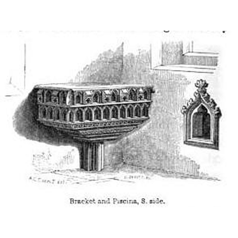
Image copyright © [in the public domain]
PD
Results: 3 records
view of church interior - detail
Copyright Statement: Image copyright © [in the public domain]
Image Source: engraving in Notices of the churches of Warwickshire (vol. 2, 1858)
Copyright Instructions: PD
view of church interior - detail
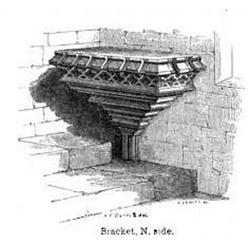
Copyright Statement: Image copyright © [in the public domain]
Image Source: engraving in Notices of the churches of Warwickshire (vol. 2, 1858)
Copyright Instructions: PD
view of church interior - plan
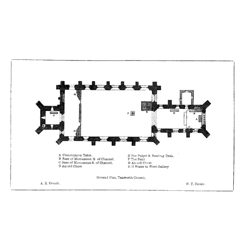
Scene Description: showing the font in the nave, towards the east end
Copyright Statement: Image copyright © [in the public domain]
Image Source: illustration in Notices of the churches of Warwickshire (vol. 2, 1858)
Copyright Instructions: PD
INFORMATION
Font ID: 19590TAN
Object Type: Baptismal Font1
Font Century and Period/Style: 12th century, Late Norman
Church / Chapel Name: Parish Church of St. Mary Magdalene
Church Patron Saint(s): St. Mary Magdalene
Church Address: Tom Hill, Tanworth-in-Arden, West Midlands, B94 5AL -- Tel.: +44 1564 742565
Site Location: Warwickshire, West Midlands, England, United Kingdom
Directions to Site: Located 7 km NW of Henley-in-Arden, 18 km S of Birmingham
Ecclesiastic Region: Diocese of Birmingham [formerly in the Diocese of Worcester]
Historical Region: Hundred of Kington
Additional Comments: disappeared font? (the one from the early-12thC church here -- was the late-18thC one removed in the 19thC? [cf. FontNotes])
Font Notes:
Click to view
We found no entry for Tanworth-in-Arden in the Domeday survey. Notices of the churches of Warwickshire (vol. 2, 1858) reports: "The Church was originally a Chapel attached to Brailes, and was conveyed as such by Roger de Newburgh Earl of Warwick to the Canons of Kenilworth : it is stiled Capella de Tanewrtha in the confirmation of that grant [...] by Simon Bishop of Worcester, temp. Hen. I. [i.e., 1100-1135] The Church, which is dedicated to St. Mary Magdalen, is a large parochial edifice [...] has been, originally, a fine structure of the Decorated style throughout. It is now, however, mutilated and defaced to an extent which can hardly be credited, and these sad disfigurements appear to have been committed at no distant period. [...] The ancient stone font has been removed, and a substitute found in a shallow stone vase on a baluster stem, placed in the eastern (!) part of the nave." English Heritage [Listing NGR: SP1134870511] (1967) reports a "C18 font with large baluster." The Victoria County History (Warwick, vol. 5, 1949) notes: "The chapel at Tanworth [...] had become an independent parish church by 1202 [...] A period of about half a century, from the late 13th century to c. 1330–40, covers the whole of the architectural details of the building, apart from the modern work. [...] The font is modern, but there is a disused late-18th-century font nearby."
Credit and Acknowledgements: We are grateful to Aidan McRae Thomson, of Warwickshire Churches [http://warwickshirechurches.weebly.com], for his photographs of this church
COORDINATES
UTM: 30U 579382 5798657
Latitude & Longitude (Decimal): 52.332473, -1.835008
Latitude & Longitude (DMS): 52° 19′ 56.9″ N, 1° 50′ 6.03″ W
REFERENCES
- Victoria County History [online], University of London, 1993-. URL: https://www.british-history.ac.uk.
- Warwickshire Natural History and Archaeological Society. Architectural Committee, Notices of the churches of Warwickshire, Rivington, London; [etc.]: Henry T. Cooke, 1847-, vol. 2: 1-9