Bentley / Bentley in Chapel Farm
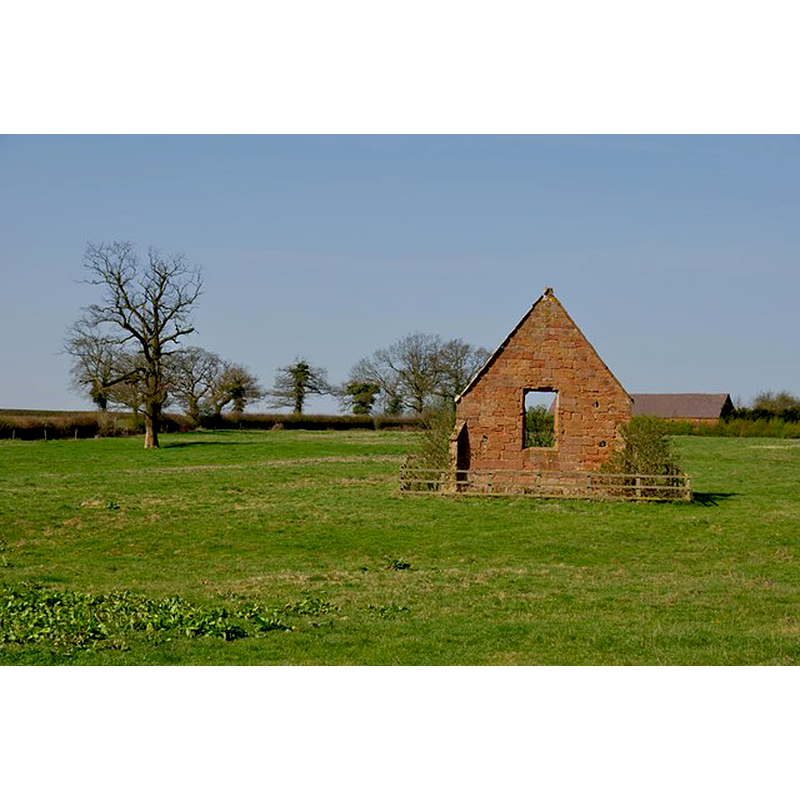
Image copyright © Mick Malpass, 2012
CC-BY-SA-2.0
Results: 1 records
view of church exterior
Scene Description: Source caption: "This one wall is all that is left standing of this old Chapel."
Copyright Statement: Image copyright © Mick Malpass, 2012
Image Source: digital photograph taken 1 April 2012 by Mick Malpass [www.geograph.org.uk/photo/2880420] [accessed 15 December 2014]
Copyright Instructions: CC-BY-SA-2.0
INFORMATION
Font ID: 19575BEN
Object Type: Baptismal Font1?
Font Century and Period/Style: 13th - 14th century, Medieval
Church / Chapel Name: Chapel of the Holy Trintiy [in ruins]
Church Patron Saint(s): The Holy Trinity
Church Address: Coleshill Road, Bentley, Warwickshire CV9 2JS
Site Location: Warwickshire, West Midlands, England, United Kingdom
Directions to Site: The ruin if located off the B4116, at Chapel Farm, near to Birchley Heath
Additional Comments: disappeared font? (was there ever a font in it? the chapel had regular service, but we were not able to find out if baptisms were administered here)
Font Notes:
Click to view
The Victoria County History (Warwick, vol. 4, 1947) notes: "The chapel of Bentley is presumed to have been originally in the patronage of the lords of Shustoke [...] and by 1250 enjoyed an annuity of 4 marks from the heirs of Roger de Camvile [...] The chapel or chantry was appropriated to Maxstoke and in 1483 there is evidence of an appointment of a priest, to perform divine service there on Sundays and double festivals only, and for the rest of the time, at least 3 days a week, at the altar of St. Catherine in Maxstoke priory, but always, apparently, for the souls of the founder and benefactors of the chantry. [...] Immediately before the Dissolution the priory of Maxstoke was paying 4 marks to a priest for celebrating once a week in the chapel of Bentley. [...] This corresponds to the original endowment, and also to the annual farm of tithes of corn from Bentley [...] the ruined chapel of the Holy Trinity, which was already 'decayed' in 1589, [...] and was but a 'carcasse' when Dugdale wrote (c. 1640). [...] Only the east wall and a little of the north and south walls are standing, the remainder being entirely cleared away and grassed over."
COORDINATES
UTM: 30U 595309 5822881
Latitude & Longitude (Decimal): 52.547655, -1.594421
Latitude & Longitude (DMS): 52° 32′ 51.56″ N, 1° 35′ 39.92″ W