Seckington / Secandune / Sechintone / Secintone
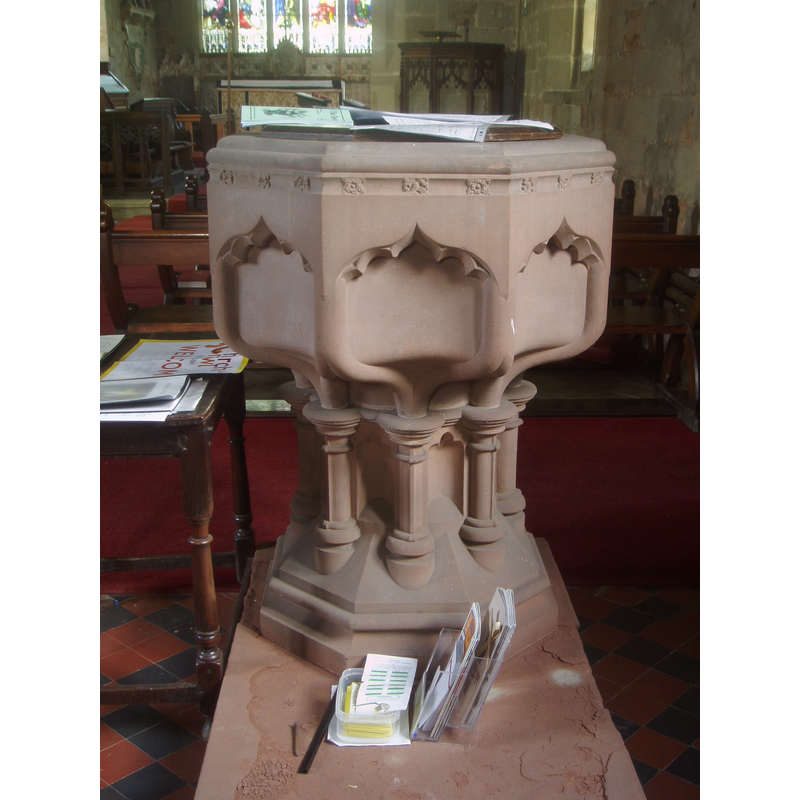
Image copyright © Aidan McRae Thomson, 2013
Standing permission
Results: 4 records
view of font and cover
Scene Description: the modern font
Copyright Statement: Image copyright © Aidan McRae Thomson, 2013
Image Source: digital photograph taken 27 April 2013 by Aidan McRae Thomson [www.flickr.com/photos/amthomson/10086982814/] [accessed 11 December 2014]
Copyright Instructions: Standing permission
view of church exterior - south view - detail
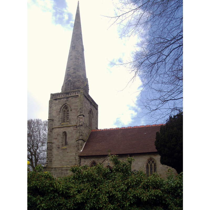
Copyright Statement: Image copyright © Aidan McRae Thomson, 2013
Image Source: digital photograph taken 27 April 2013 by Aidan McRae Thomson [www.flickr.com/photos/amthomson/10095542536/] [accessed 11 December 2014]
Copyright Instructions: Standing permission
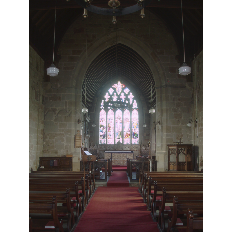
view of church interior - nave - looking west
![the top of the modern font is visible at the far [west] end, left [south] side](/static-50478a99ec6f36a15d6234548c59f63da52304e5/compressed/1150125008_compressed.png)
Scene Description: the top of the modern font is visible at the far [west] end, left [south] side
Copyright Statement: Image copyright © Aidan McRae Thomson, 2013
Image Source: digital photograph taken 27 April 2013 by Aidan McRae Thomson [www.flickr.com/photos/amthomson/10081278306/] [accessed 11 December 2014]
Copyright Instructions: Standing permission
view of church interior - nave - looking east
Copyright Statement: Image copyright © Aidan McRae Thomson, 2013
Image Source: digital photograph taken 27 April 2013 by Aidan McRae Thomson [www.flickr.com/photos/amthomson/10087046115/] [accessed 11 December 2014]
Copyright Instructions: Standing permission
INFORMATION
Font ID: 19567SEC
Object Type: Baptismal Font1?
Font Century and Period/Style: 13th century, Early English
Church / Chapel Name: Parish Church of All Saints
Church Patron Saint(s): All Saints
Church Address: Church Lane, Seckington, Warwickshire, B79 0LD
Site Location: Warwickshire, West Midlands, England, United Kingdom
Directions to Site: Located 6 km NE of Tamworth, in N Warwickshire, by the county border with Staffordshire
Ecclesiastic Region: Diocese of Birmingham
Historical Region: Hundred of Coleshill -- Hundred of Hemlingford
Additional Comments: disappeared font? (the one from the ca. 1205 church here)
Font Notes:
Click to view
There are two entries for Seckington [variant spelling] in the Domesday survey [http://domesdaymap.co.uk/place/SK2607/seckington/] [accessed 11 December 2014], but neither mentions cleric or church in it. The Victoria County History (Warwick, vol. 4, 1947) notes: "In 1205 William de Camville and Aubrey his wife brought an assize of last presentation against Simon de Berkeston for this church, [...] and probably established their claim, as, except when the manor was in the hands of the overlords owing to the minority of the heir, the advowson of the church rested with the lord of the manor [...] The chancel is probably of late-13th-century origin [...] The font is modern." English Heritage [Listing NGR: SK2601807417] (1953} reports a "Late C19 octagonal font" in this church.
Credit and Acknowledgements: We are grateful to Aidan McRae Thomson, of Warwickshire Churches [http://warwickshirechurches.weebly.com], for his photographs of this church and modern font
COORDINATES
UTM: 30U 593530 5835758
Latitude & Longitude (Decimal): 52.663698, -1.617005
Latitude & Longitude (DMS): 52° 39′ 49.31″ N, 1° 37′ 1.22″ W
REFERENCES
- Victoria County History [online], University of London, 1993-. URL: https://www.british-history.ac.uk.