Hartshill nr. Nuneaton / Ardreshille
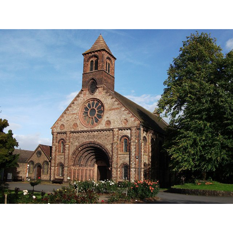
Image copyright © John Brightley, 2010
CC-BY-SA-2.0
Results: 1 records
view of church exterior - southwest view
Scene Description: Source caption: "Church of the Holy Trinity, Hartshill. Grade II listed. From listing description: 1841-1848 by T.L. Walker. Hartshill granite rubble with red brick, blue brick and sandstone dressings. Plain-tile roof has stone-coped gable parapets. Nave and shallow apsidal chancel. Neo-Norman style. The interior was redecorated in 1939 and 1948 by N.F.Cachemaille-Day."
Copyright Statement: Image copyright © John Brightley, 2010
Image Source: digital photograph taken 20 September 2010 by John Brightley [www.geograph.org.uk/photo/2077027] [accessed 9 December 2014]
Copyright Instructions: CC-BY-SA-2.0
INFORMATION
Font ID: 19556HAR
Object Type: Baptismal Font1
Font Century and Period/Style: 19th century (mid?), Victorian
Church / Chapel Name: Parish Church of the Holy Trinity
Font Location in Church: Inside the church
Church Patron Saint(s): The Holy Trinity
Church Notes: formerly a chapelry of Mancetter
Church Address: Church Road / Church Close, Hartshill, Warwickshire, CV10 0LY
Site Location: Warwickshire, West Midlands, England, United Kingdom
Directions to Site: Located 5 km NW of Nuneaton, and practically a suburb of it now
Ecclesiastic Region: Diocese of Coventry
Historical Region: Hundred of Coleshill [in Domesday] -- Hundred of Hemlingford
Font Notes:
Click to view
There is an entry for Hartshill [variant spelling] in the Domesday survey [http://domesdaymap.co.uk/place/SP3293/hartshill/] [accessed 9 December 2014], but it mentions neither cleric nor church in it. The Victoria County History (Warwick, vol. 4, 1947) notes: "The modern church of the Holy Trinity south-east of the castle is built of stone with brick dressings, and has an apsidal chancel. The west doorway and window are of the 12th-century style." English Heritage [Listing NGR: SP3271693940] (1988) reports a "Stone octagonal Gothic style font" in this mid-19th century church. [NB: we have not found any evidence of an earlier church here].
COORDINATES
UTM: 30U 600373 5822112
REFERENCES
- Victoria County History [online], University of London, 1993-. URL: https://www.british-history.ac.uk.