Church Knowle / Chenolle / Cnolle / Glole
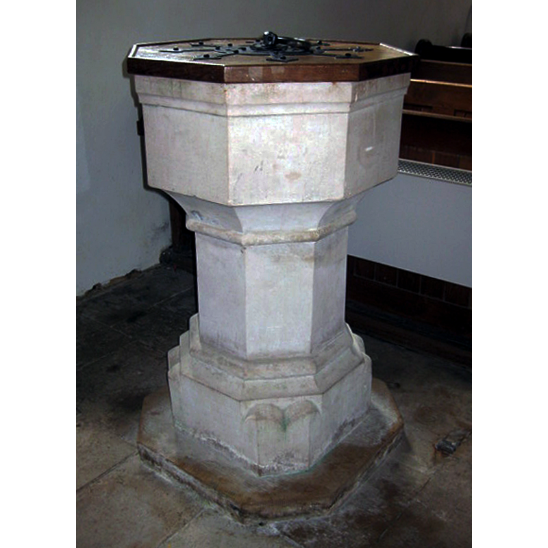
Image copyright © Brentorboxer, 2010
No known copyright restriction – Fair Dealing
Results: 4 records
view of font and cover
Scene Description: the modern font in this church [cf. FontNotes]
Copyright Statement: Image copyright © Brentorboxer, 2010
Image Source: digital photograph 15 October 2010 by Brentorboxer [www.waymarking.com/waymarks/WM9Y8J_Font_St_Peters_Church_Church_Knowle_Dorset_UK] [accessed 5 December 2014]
Copyright Instructions: No known copyright restriction – Fair Dealing
view of church exterior - southwest end
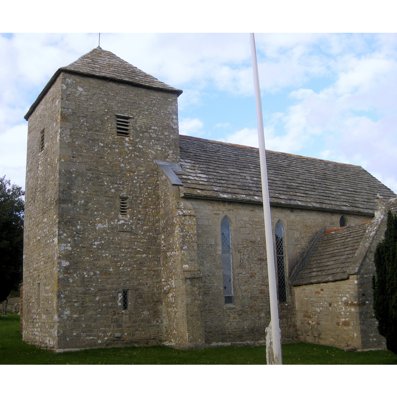
Copyright Statement: Image copyright © Huligan0, 2010
Image Source: digital photograph taken 7 April 2010 by Huligan0 [http://commons.wikimedia.org/wiki/File:2010-04-07-Church_Knowle,_St_Peter's_Church.jpg] [accessed 5 December 2010]
Copyright Instructions: CC-BY-SA-3.0
view of church exterior - south view
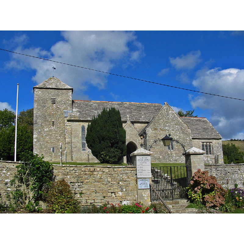
Copyright Statement: Image copyright © Clive Perrin, 2005
Image Source: digital photograph taken 9 October 2005 by Clive Perrin [www.geograph.org.uk/photo/102059] [accessed 5 December 2014]
Copyright Instructions: CC-BY-SA-3.0
view of church interior - nave - looking east
![the upper half of the font and its cover are visible in the foreground, right side [west end of the nave, south side]](/static-50478a99ec6f36a15d6234548c59f63da52304e5/compressed/1141206015_compressed.png)
Scene Description: the upper half of the font and its cover are visible in the foreground, right side [west end of the nave, south side]
Copyright Statement: Image copyright © Huligan0, 2010
Image Source: digital photograph taken 7 April 2010 by Huligan0 [http://commons.wikimedia.org/wiki/File:2010-04-07-Church_Knowle,_St_Peter's_Church.jpg] [accessed 5 December 2010]
Copyright Instructions: CC-BY-SA-3.0
INFORMATION
Font ID: 19551KNO
Object Type: Baptismal Font1
Font Century and Period/Style: 11th century, Pre-Conquest? / Norman
Church / Chapel Name: Parish Church of St. Peter
Font Location in Church: Inside the church, at the W end of the nave , S side
Church Patron Saint(s): St. Peter
Church Address: Church Knowle, Dorset BH20 5NF
Site Location: Dorset, South West, England, United Kingdom
Directions to Site: Located on the Isle of Purbeck, 2 km W of Corfe Castle
Ecclesiastic Region: Diocese of Salisbury
Historical Region: Hundred of Hasler [Domesday]
Additional Comments: disappeared font? (the one from the Domesday-time church here)
Font Notes:
Click to view
There are four entries for [Church] Knowle [variant spelling] in the Domesday survey [http://domesdaymap.co.uk/place/SY9481/church-knowle/] [accessed 5 December 2014], of which only the one in the lordship of Roger de Beaumont mentions a priest, but not a church in it, though there probably was one there. English Heritage [Listing NGR: SY9407881938] (1959) reports the church of "C13 origin", but mentions no font in it. The present font, of overall octagonal shape, with an octagonal-to-square lower base and a wooden cover, appears modern.
COORDINATES
UTM: 30U 564619 5609831
Latitude & Longitude (Decimal): 50.636761, -2.086205
Latitude & Longitude (DMS): 50° 38′ 12.34″ N, 2° 5′ 10.34″ W