Bickenhill / Bichehelle
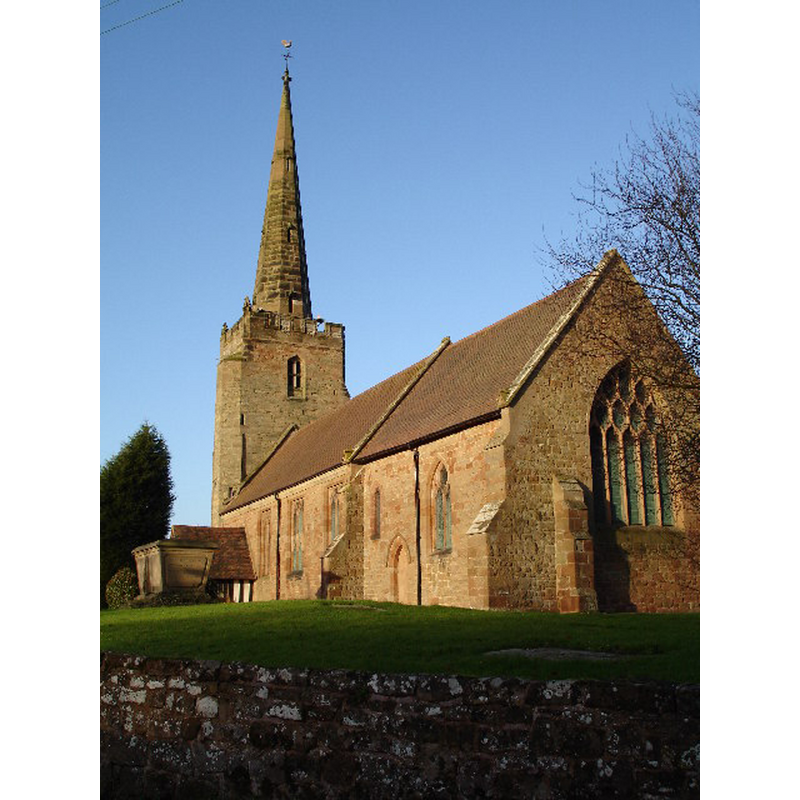
Image copyright © Peter Lloyd, 2005
CC-BY-SA-2.0
Results: 5 records
view of church exterior - southeast view
Scene Description: Source caption: "Parish Church of Saint Peter, Bickenhill in the Birmingham Diocese. This beautiful old parish church lies in the tiny village of Bickenhill. Unfortunately it is located very close to Birmingham International Airport and is threatened by the potential future airport expansion plans."
Copyright Statement: Image copyright © Peter Lloyd, 2005
Image Source: digital photograph taken 12 December 2005 py Peter Lloyd [www.geograph.org.uk/photo/90351] [accessed 1 December 2014]
Copyright Instructions: CC-BY-SA-2.0
design element - motifs - quatrefoil - in a circle - in a square - 8


angel - demi-figure - holding shield - blank - 8
design element - motifs - panel - trefoiled - 8
design element - architectural - buttress - 8
INFORMATION
Font ID: 19546BIC
Object Type: Baptismal Font1
Font Century and Period/Style: 15th century (late?), Perpendicular
Workshop/Group/Artisan: heraldic font
Church / Chapel Name: Parish Church of St. Peter
Font Location in Church: Inside the church
Church Patron Saint(s): St. Peter
Church Address: Church Lane, Bickenhill, Solihull B92 0DN
Site Location: Warwickshire, West Midlands, England, United Kingdom
Directions to Site: Located between Coleshill (N) and Hampton-in-Arden (S)
Ecclesiastic Region: Diocese of Birmingham
Historical Region: Hundred of Coleshill [in Domesday] -- Hundred of Hemlingford
Additional Comments: disappeared font? (the one from the ca. 1140 church here)
Font Notes:
Click to view
There are two entries for Bickenhill [variant spelling] in the Domesday survey [http://domesdaymap.co.uk/place/XX0000/bickenhill-and-middle-bickenhill/] [accessed 1 December 2014], neither of which mentions cleric or church in it. The Victoria County History (Warwick, vol. 4, 1947) notes: "The church had a 12th-century nave, with a north aisle of which the arcade of c. 1140 remains in place. The chancel was added or rebuilt about 1300 [...] In 1887 a very drastic restoration was carried out, the whole of the south walls of the chancel and nave being rebuilt; the only structural features that were re-used were the priests' doorway and the inner archway of the 12th century south doorway. [...] The font, late-15th-century, is octagonal, the bowl being panelled with quatrefoiled circles in squares, the tapering lower part carved with demi-angels holding shields. The stem has trefoiled panels and panelled buttresses at the angles."
COORDINATES
UTM: 30U 586376 5810755
Latitude & Longitude (Decimal): 52.44016, -1.729277
Latitude & Longitude (DMS): 52° 26′ 24.58″ N, 1° 43′ 45.4″ W
MEDIUM AND MEASUREMENTS
Material: stone
Font Shape: octagonal, mounted
Basin Interior Shape: round
Basin Exterior Shape: octagonal
REFERENCES
- Victoria County History [online], University of London, 1993-. URL: https://www.british-history.ac.uk.