Wixford / Witelavesfors
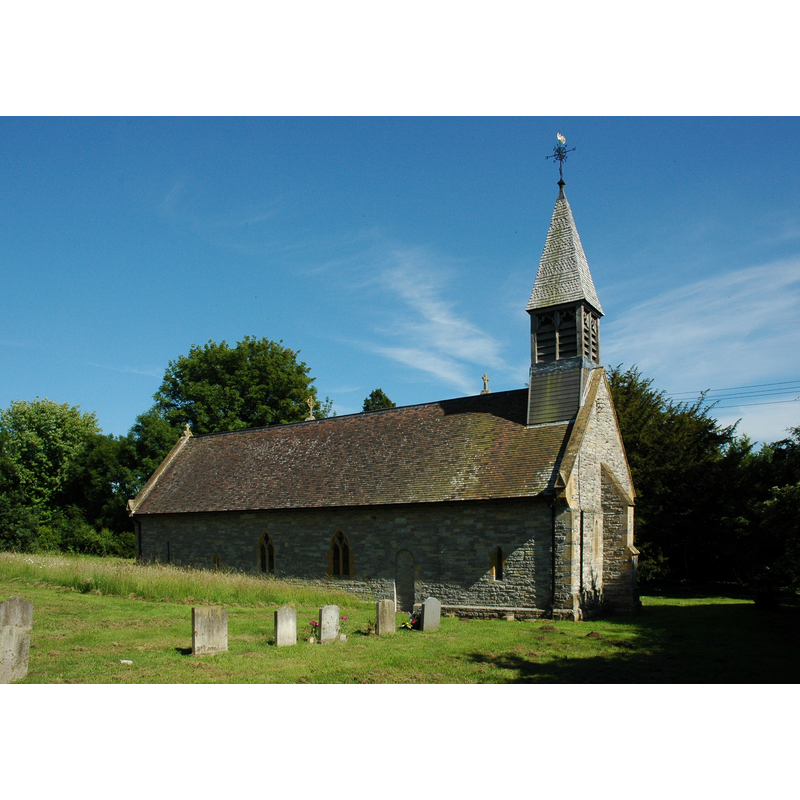
Image copyright © Philip Halling, 2010
CC-BY-SA-2.0
Results: 2 records
view of church exterior - north view
Copyright Statement: Image copyright © Philip Halling, 2010
Image Source: digital photograph taken 20 June 2010 by Philip Halling [www.geograph.org.uk/photo/1930369] [accessed 27 November 2014]
Copyright Instructions: CC-BY-SA-2.0
view of church exterior - south view
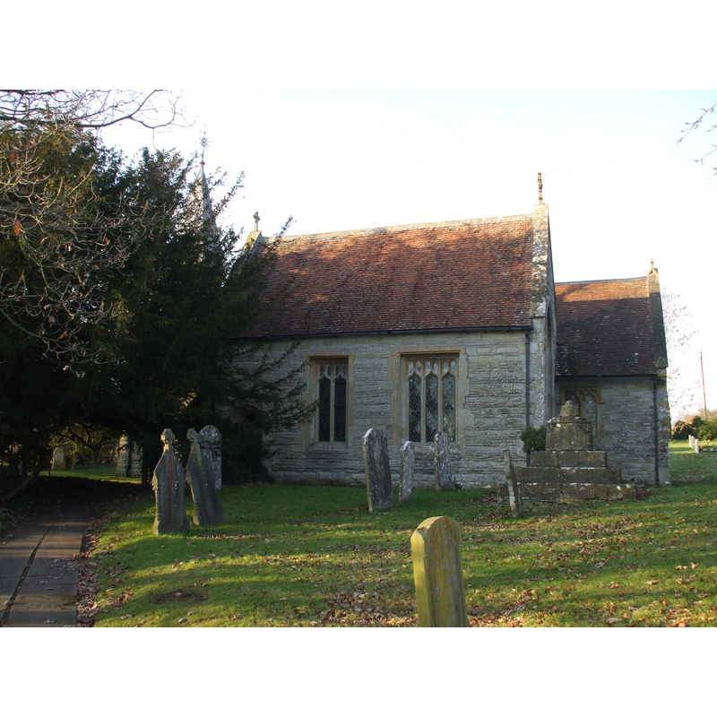
Scene Description: the west end practically hidden behing the trees
Copyright Statement: Image copyright © [in the public domain]
Image Source: digital photograph taken 30 January 2011 by Argrogan [http://commons.wikimedia.org/wiki/File:Wixford_(3).JPG] [accessed 27 November 2014]
Copyright Instructions: Released by its author into the public domain
INFORMATION
Font ID: 19537WIX
Object Type: Baptismal Font1
Font Century and Period/Style: 15th century, Perpendicular
Church / Chapel Name: Parish Church of St. Milburga
Font Location in Church: Reported in a S chapel in 1945
Church Patron Saint(s): St. Milburga [aka Milburh, Milburgha]
Church Address: Wixford, Warwickshire B49 6DD
Site Location: Warwickshire, West Midlands, England, United Kingdom
Directions to Site: Located across the Hay Brook valley, 3 km S of Alcester, SW of Warwick
Ecclesiastic Region: Diocese of Coventry
Historical Region: Hundred of Ferncombe [in Domesday times] -- Hundred of Barlichway
Additional Comments: disused font (the one in the south chapel [cf. FontNotes]) -- disappeared font? (the one from the original 11th-12thC chapel here [cf. FontNotes])
Font Notes:
Click to view
There is an entry for Wixford [variant spelling] in the Domesday survey [http://domesdaymap.co.uk/place/SP0954/wixford/] [accessed 27 November 2014], but it mentions neither cleric nor church in it. The Victoria County History (Warwick, vol. 3, 1945) notes: "Domesday makes no mention of a priest at Wixford, though the dedication of the church to the Saxon saint St. Milburg seems to be evidence of its antiquity; [...] but it may have been in 1086, as certainly it was later, a chapel of Salford. Henry I gave it with the mother church to Kenilworth Priory, whose rights therein were contested by the monks of Evesham as lords of the manor. An agreement was finally made, and confirmed by Roger, Bishop of Worcester (1163–79) [...] Modern restoration has rather obscured its history, but probably the nave is the original 12thcentury building and the chancel is a 13th-century lengthening of the plan; it is possible, from the positions of the 12th-century doorways, that the nave was lengthened also at the west end in the 13th century. [...] The church was restored in 1881 [...] The font is modern, but in the south chapel is a plain disused font, perhaps of the 15th century, with an eight-sided bowl, a cylindrical stem, and square base with a chamfered plinth." English Heritage [Listing NGR: SP0900054940] (1967) reports: "Nave has C19 font".
COORDINATES
UTM: 30U 577259 5782925
Latitude & Longitude (Decimal): 52.19137, -1.86976
Latitude & Longitude (DMS): 52° 11′ 28.93″ N, 1° 52′ 11.14″ W
MEDIUM AND MEASUREMENTS
Material: stone
Font Shape: octagonal, mounted
Basin Interior Shape: round
Basin Exterior Shape: octagonal
REFERENCES
- Victoria County History [online], University of London, 1993-. URL: https://www.british-history.ac.uk.