Weethley / Wilelei
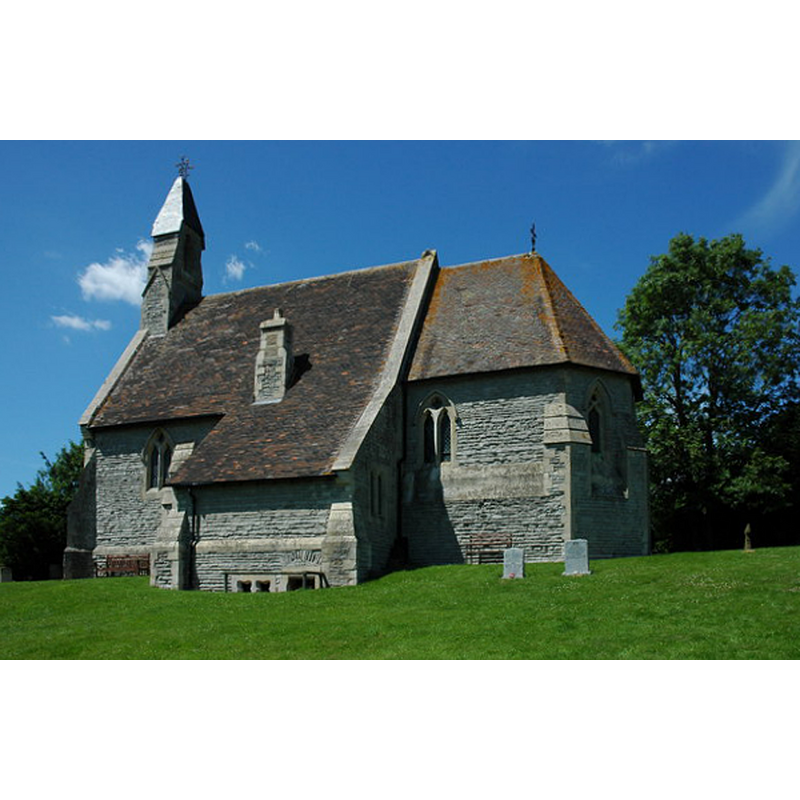
Image copyright © Philip Halling, 2010
CC-BY-SA-2.0
Results: 2 records
view of church exterior - south view
Scene Description: Source caption: "Weethley church is dedicated to St James. It was built in 1857-8 by E. Haycock of Shrewsbury. The church is situated on high ground in a prominent position and enjoys good views to the south towards the Cotswold Hills."
Copyright Statement: Image copyright © Philip Halling, 2010
Image Source: digital photograph taken 20 June 2010 by Philip Halling [www.geograph.org.uk/photo/1927718] [accessed 27 November 2014]
Copyright Instructions: CC-BY-SA-2.0
view of church exterior in context
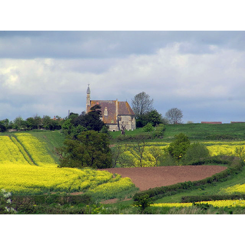
Copyright Statement: Image copyright © Richard Dunn, 2005
Image Source: digital photograph taken 5 May 2005 by Richard Dunn [www.geograph.org.uk/photo/7922] [accessed 27 November 2014]
Copyright Instructions: CC-BY-SA-2.0
INFORMATION
Font ID: 19536WEE
Object Type: Baptismal Font1?
Font Century and Period/Style: 12th century, Late Norman
Church / Chapel Name: Parish Church of St. James [originally a chapel-of-ease to Kinwarton]
Church Patron Saint(s): St. James
Church Address: Weethley, Warwickshire B49 5NA
Site Location: Warwickshire, West Midlands, England, United Kingdom
Directions to Site: Located off the B4088 [Evesham Rd.], near Dunnington, 5 km SW of Alcester
Ecclesiastic Region: Diocese of Coventry
Historical Region: Hundred of Ferncombe [in Domesday times] -- Hundred of Barlichway
Additional Comments: disappeared font? (the one of the original 12thC chapel here [cf. FontNotes])
Font Notes:
Click to view
There is an entry for Weethley [variant spelling] in the Domesday survey [http://domesdaymap.co.uk/place/SP0555/weethley/] [accessed 27 November 2014], but it mentions neither cleric nor church in it. The Victoria County History (Warwick, vol. 3, 1945) notes: "The chapel of Weethley, which was attached to the church of Kinwarton, [...] was held by Ralph of Kinwarton, and given by him to the abbey of Evesham towards the close of the 12th century. [...] The church of ST. JAMES was built in 1857–8 of lias stone in the 13thcentury style and consists of an apsidal chancel, nave with bell-turret, north porch, and south vestry. It replaced an ancient building, restored in 1839, [...] which was no doubt that described c. 1640: 'The chappell is buylded all of tymber, being halftymbered both the chancell and the church. It standeth on a pretty high hill; southwards and westwards it hath a great discent and a very fyne prospect. There is both buriall and christning here. . . . There are no armes nor monuments.'" [the quote is footnoted: "Hamper's notes to Dugdale (B.M.), quoting Sir Simon Archer's MS."]. English Heritage [Listing NGR: SP0551555319] (1984) reports a "big octagonal font on 4 half-hipped gablets". It is presumably the font introduced in the mid-19th century re-building of this church. [NB: we have no information of the font of the original 12th-century (?) chapel here].
COORDINATES
UTM: 30U 573782 5783387
Latitude & Longitude (Decimal): 52.195999, -1.920513
Latitude & Longitude (DMS): 52° 11′ 45.59″ N, 1° 55′ 13.85″ W
REFERENCES
- Victoria County History [online], University of London, 1993-. URL: https://www.british-history.ac.uk.