Loxley / Locksley / Lochesham / Locheslei
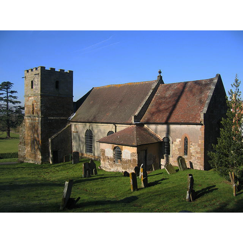
Image copyright © David Stowell, 2006
CC-BY-SA-2.0
Results: 3 records
view of church exterior - southeast view
Scene Description: Source caption: "Loxley Church. The history of this church dates back to the 8th century when the site was given to the church by Offa, King of Mercia. Some of the original Saxon stonework remains in the north wall, however the present church was consecrated in 1286. Most of the church, apart from the tower was rebuilt in the 18th century; the tower alone remaining unaltered. Note the unusual stonework in walls of the small vestry".
Copyright Statement: Image copyright © David Stowell, 2006
Image Source: digital photograph taken 10 February 2006 by David Stowell [www.geograph.org.uk/photo/120061] [accessed 24 November 2014]
Copyright Instructions: CC-BY-SA-2.0
view of church exterior in context
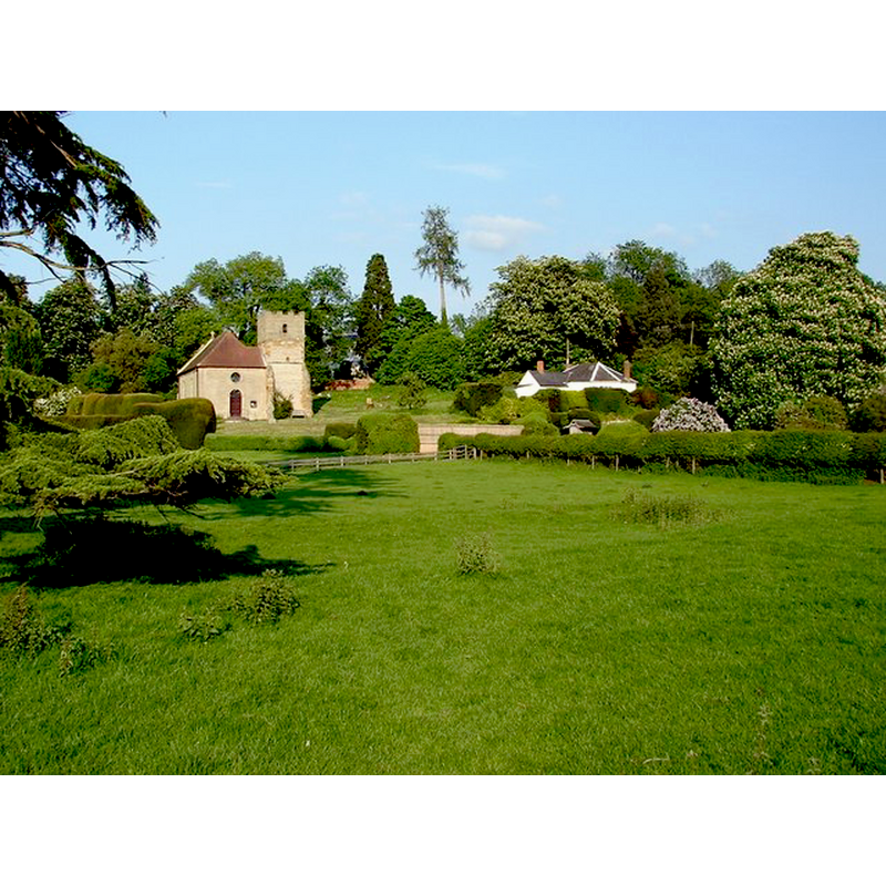
Scene Description: Source caption: "Loxley Church on the Hill. View from the public footpath near Loxley Hall."
Copyright Statement: Image copyright © Ian Patterson, 2008
Image Source: digital photograph taken 14 May 2008 by Ian Patterson [www.geograph.org.uk/photo/801801] [accessed 24 November 2014]
Copyright Instructions: CC-BY-SA-2.0
view of church interior - nave - looking west
![the present font, ca. 1800, is partially visible behind the left [south] bank of benches; the arch on the left [south] wall is the opening to the old [13thC?] tower](/static-50478a99ec6f36a15d6234548c59f63da52304e5/compressed/1141212014_compressed.png)
Scene Description: the present font, ca. 1800, is partially visible behind the left [south] bank of benches; the arch on the left [south] wall is the opening to the old [13thC?] tower
Copyright Statement: Image copyright © Ian Patterson, 2008
Image Source: digital photograph taken 14 May 2008 by Ian Patterson [www.geograph.org.uk/photo/801856] [accessed 24 November 2014]
Copyright Instructions: CC-BY-SA-2.0
INFORMATION
Font ID: 19532LOX
Object Type: Baptismal Font1?
Font Century and Period/Style: 11th century, Pre-Conquest? / Norman
Church / Chapel Name: Parish Church of St. Nicholas
Church Patron Saint(s): St. Nicholas of Myra
Church Address: Stratford Road, Loxley, Warwickshire CV35 9JP
Site Location: Warwickshire, West Midlands, England, United Kingdom
Directions to Site: Located 5 km from Stratford-upon-Avon
Ecclesiastic Region: Diocese of Coventry
Historical Region: Hundred of Pathlow [in Domesday] -- Hundred of Barlichway
Additional Comments: disappeared font? (the one from the Domesday-time church here?
Font Notes:
Click to view
There are three entries [variant spelling] for this Loxley in the Domesday survey [http://domesdaymap.co.uk/place/SP2552/loxley/] [accessed 24 November 2014], one of which, in the tenancy of the Count of Meulan in 1086, reports a priest but does not mention a church in it, though there probably was one there. The Victoria County History (Warwick, vol. 3, 1945) notes: "There was a priest on the Count of Meulan's holding in 1086. [...] Robert FitzOdo made a grant of the advowson of the church to the Priory of Stone in Staffordshire. [...] The parish church [...] is a small building consisting of a chancel, nave, and a south-west tower, with a vestry south of the chancel. The tower is medieval, probably a part of the church dedicated by Godfrey Giffard, Bishop of Worcester, in 1286 [...] The remainder of the church was rebuilt about the middle of the 18th century"; there is no mention of a font in the VCH entry. There is no mention of a font either in the English Heritage entry for this church [Listing NGR: SP2585453052] (1967). The present font is noted in Warwickshire Churches [http://warwickshirechurches.weebly.com/loxley---st-nicholas.html] [accessed 24 November 2014: "The slender font nearby looks c1800 and is undecorated"; the font is shown as octagonal all over, the basin plain except for a thin moulding on the chamfered underbowl, with two thin mouldings at top and bottom of the otherwise plain pedestal base, the lower base splaing out.
COORDINATES
UTM: 30U 594083 5781357
Latitude & Longitude (Decimal): 52.17466, -1.624141
Latitude & Longitude (DMS): 52° 10′ 28.78″ N, 1° 37′ 26.91″ W
REFERENCES
- Victoria County History [online], University of London, 1993-. URL: https://www.british-history.ac.uk.