Haselor / Haseloue / Haselove
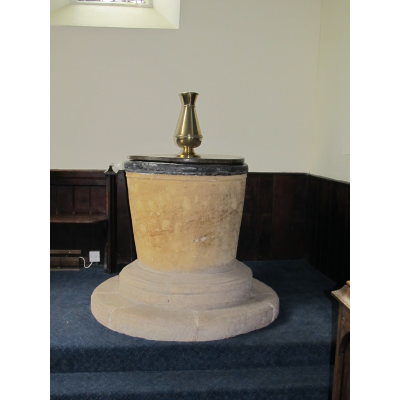
Image copyright © Dobbin's Churches, 2014
No known copyright restriction – Fair Dealing
Results: 4 records
view of font and cover
Copyright Statement: Image copyright © Dobbin's Churches, 2014
Image Source: digital photograph 26 May 2014 in Dobbin's Churches [http://dobbinschurches.blogspot.ca/] [accessed 21 November 2014]
Copyright Instructions: No known copyright restriction – Fair Dealing
view of font and cover
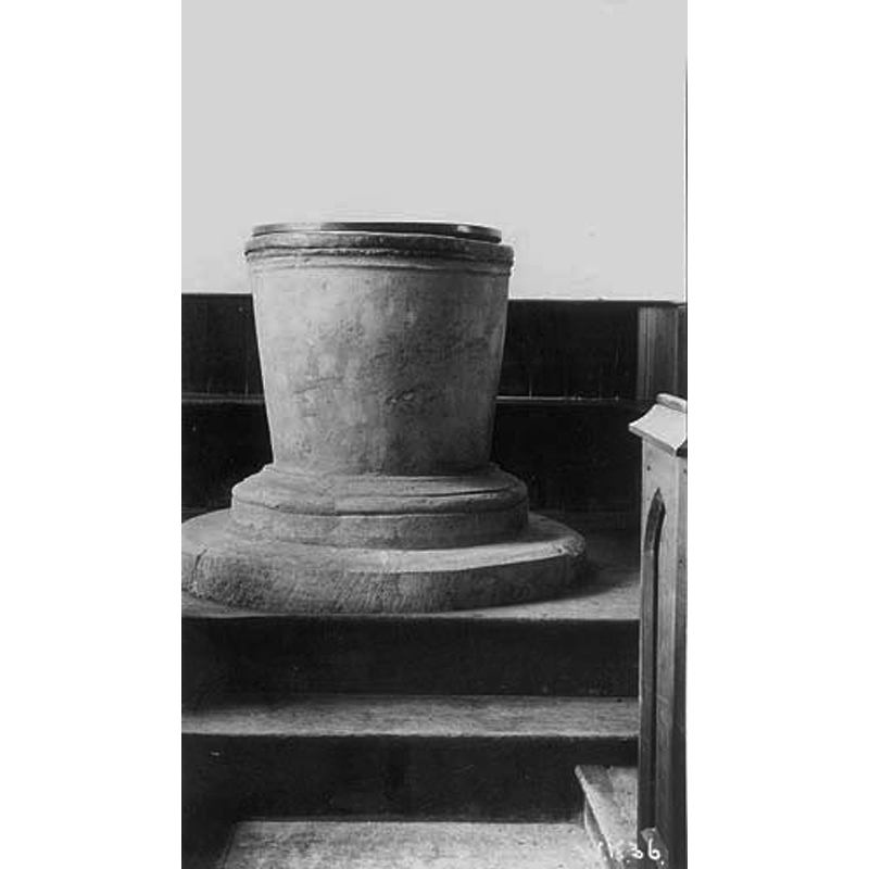
Copyright Statement: Image copyright © Libraries Heritage and Trading Standards, Warwickshire County Council, 2014
Image Source: B&W photograph of 1938 in the Libraries Heritage and Trading Standards, Warwickshire County Council collections [www.search.windowsonwarwickshire.org.uk/content/images/3/11/Resource/8273-0.jpg] [accessed 21 November 2014]
Copyright Instructions: Reproduced as permitted for "educational or personal non-commercial use"
view of church exterior - southwest view
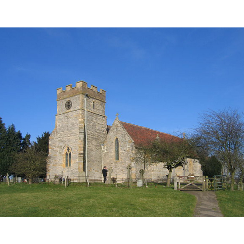
Copyright Statement: Image copyright © David Stowell, 2006
Image Source: digital photograph taken 18 February 2006 by David Stowell [www.geograph.org.uk/photo/124915] [accesssed 21 November 2014]
Copyright Instructions: CC-BY-SA-2.0
view of church exterior in context - south view
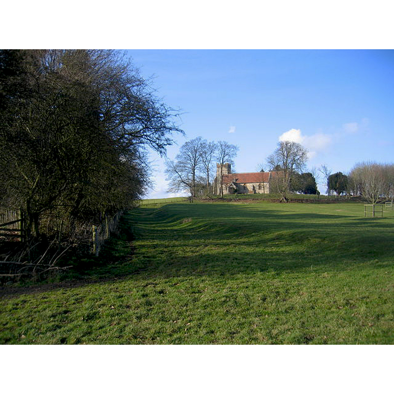
Copyright Statement: Image copyright © David Stowell, 2006
Image Source: digital photograph taken 18 February 2006 by David Stowell [www.geograph.org.uk/photo/124899] [accesssed 21 November 2014]
Copyright Instructions: CC-BY-SA-2.0
INFORMATION
Font ID: 19528HAS
Object Type: Baptismal Font1
Font Century and Period/Style: 12th century (early?), Late Norman
Church / Chapel Name: Parish Church of St. Mary and All Saints
Font Location in Church: Inside the church, in the aisle
Church Patron Saint(s): St. Mary the Virgin & All Saints
Church Address: Haselor, Warwickshire B49 6LU
Site Location: Warwickshire, West Midlands, England, United Kingdom
Directions to Site: Located between Alcester and Stratford, SW of the Alne river
Ecclesiastic Region: Diocese of Coventry
Historical Region: Hundred of Ferncombe [in Domesday times] -- Hundred of Barlichway
Font Notes:
Click to view
There is an entry for Haselor [variant spelling] in the Domesday survey [http://domesdaymap.co.uk/place/SP1257/haselor/] [accessed 21 November 2014], but it mentions neither cleric not church in it. The Victoria County History (Warwick, vol. 3, 1945) notes: "The church was founded by Henry I [1100-1135] [...] The parish church [...] is apparently of 12thcentury origin and had a west tower [...] The font is of tapering, round, flower-pot shape with a moulded top edge partly covered by the lead from the bowl, and has a moulded base and chamfered step: it is probably of the late 12th century."
COORDINATES
UTM: 30U 580517 5785971
Latitude & Longitude (Decimal): 52.218277, -1.821379
Latitude & Longitude (DMS): 52° 13′ 5.8″ N, 1° 49′ 16.96″ W
MEDIUM AND MEASUREMENTS
Material: stone
Font Shape: bucket-shaped, mounted
Basin Interior Shape: round
Basin Exterior Shape: round
Drainage Notes: lead lining
LID INFORMATION
Material: wood, oak?
Apparatus: no
Notes: round, falt and plain; appears modern
REFERENCES
- Victoria County History [online], University of London, 1993-. URL: https://www.british-history.ac.uk.