Budbrooke / Budebroc
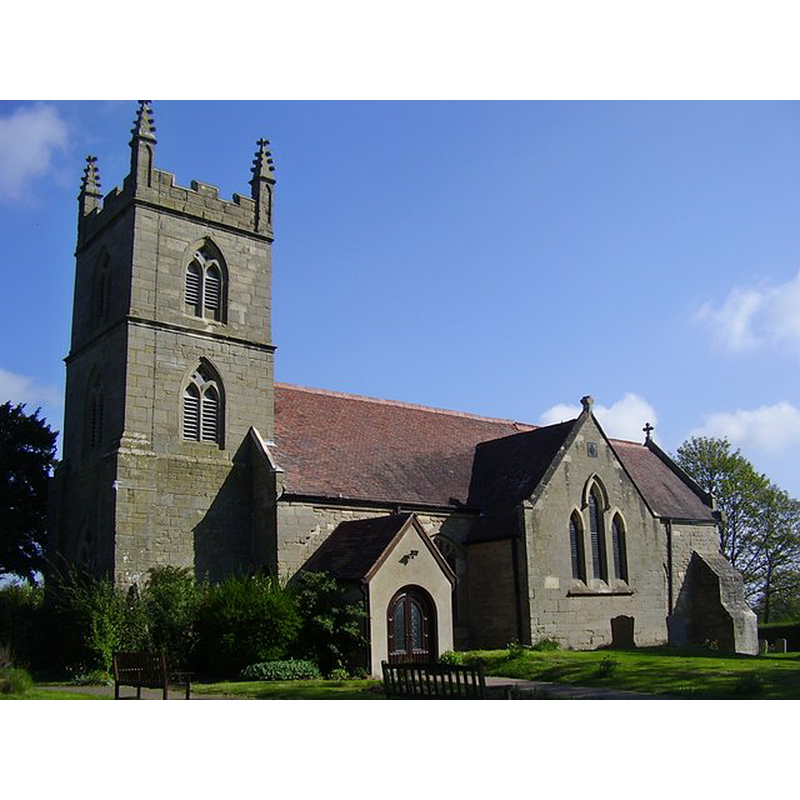
Image copyright © Ian Rob, 2011
CC-BY-SA-2.0
Results: 3 records
view of church exterior - south view
Scene Description: Source caption: "Budbrooke Church. Saint Michael's dating from the 12th century but was largely rebuilt in the 19th century."
Copyright Statement: Image copyright © Ian Rob, 2011
Image Source: digital photograph taken 16 April 2011 by Ian Rob [www.geograph.org.uk/photo/2360432] [accessed 20 November 2014]
Copyright Instructions: CC-BY-SA-2.0
view of church exterior - southeast view
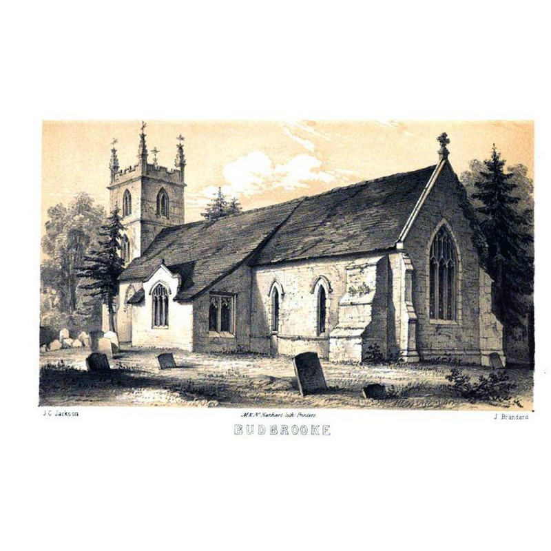
Scene Description: ca. 1847
Copyright Statement: Image copyright © [in the public domain]
Image Source: engraving by J. Brandard of a J.G. Jackson drawing in Notices of the Churches of Warwickshire (vol. 1, 1847)
Copyright Instructions: PD
view of church interior - plan

Scene Description: ca. 1847
Copyright Statement: Image copyright © [in the public domain]
Image Source: engraving in Notices of the Churches of Warwickshire (vol. 1, 1847)
Copyright Instructions: PD
INFORMATION
Font ID: 19522BUD
Object Type: Baptismal Font1?
Font Century and Period/Style: 12th century (early?), Late Norman
Church / Chapel Name: Parish Church of St. Michael
Church Patron Saint(s): St. Michael
Church Address: Budbrooke, Warwickshire CV35 8QL
Site Location: Warwickshire, West Midlands, England, United Kingdom
Directions to Site: Located off (W) the A46, 2 km W of Warwick, and now part of its suburbs
Ecclesiastic Region: Diocese of Coventry
Historical Region: Hundred of Ferncombe [in Domesday times] -- Hundred of Barlichway
Additional Comments: disappeared font? (the one from the 12thC church here)
Font Notes:
Click to view
There is an entry for Budbrooke [variant spelling] in the Domesday survey [http://domesdaymap.co.uk/place/SP2565/budbrooke/] [accessed 20 November 2014], but it mentons neither cleric nor church in it. Notices of the Churches of Warwickshire (vol. 1, 1847) notes: "A small octagonal-shaped font till lately was painted in imitation of veined marble! the paint has since been judiciously removed by the present Vicar." The Victoria County History (Warwick, vol. 3, 1945) notes: "Roger, Earl of Warwick, gave the church to the canons of the Collegiate Church of St. Mary, Warwick, at the time of their foundation in 1122–3 [...] Evidence of the 12th century is provided by the north doorway of the nave, and probably some of the masonry of the same wall is coeval with it. [...] The font and other furniture are modern."
COORDINATES
UTM: 30U 593911 5793857
Latitude & Longitude (Decimal): 52.287037, -1.623191
Latitude & Longitude (DMS): 52° 17′ 13.33″ N, 1° 37′ 23.49″ W
REFERENCES
- Victoria County History [online], University of London, 1993-. URL: https://www.british-history.ac.uk.
- Warwickshire Natural History and Archaeological Society. Architectural Committee, Notices of the churches of Warwickshire, Rivington, London; [etc.]: Henry T. Cooke, 1847-, vol. 1: 108