Billesley / Billeslei
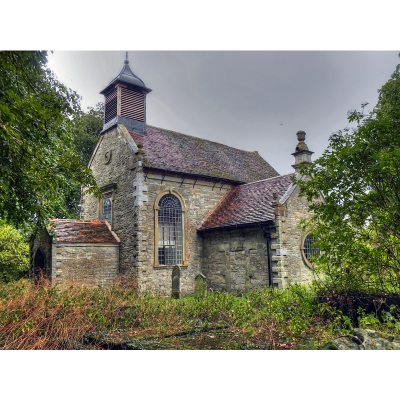
Image copyright © David Dixon, 2011
CC-BY-SA-2.0
Results: 2 records
view of church exterior - southwest view
Scene Description: Source caption: "Billesley All Saints' Church. There is a record of a Christian church here as early as the 11th century and the present building shows some evidence of 12th century work in the north wall. [...] The present church was built in 1692. It has been designated by English Heritage as a Grade I listed building [...] and is under the care of the Churches Conservation Trust."
Copyright Statement: Image copyright © David Dixon, 2011
Image Source: digital photograph taken 6 August 2011 by David Dixon [www.geograph.org.uk/photo/2547950] [accessed 19 November 2014]
Copyright Instructions: CC-BY-SA-2.0
symbol - cross
![a later re-cut? [cf. FontNotes]](/static-50478a99ec6f36a15d6234548c59f63da52304e5/others/image_not_available.jpg)
Scene Description: a later re-cut? [cf. FontNotes]
![a later re-cut? [cf. FontNotes]](/static-50478a99ec6f36a15d6234548c59f63da52304e5/bsi-testing-site/others/image_not_available.jpg)
INFORMATION
Font ID: 19521BIL
Object Type: Baptismal Font1
Font Date: ca. 1692?
Font Century and Period/Style: 17th century(late?) [re-cut?], Carline [altered]
Church / Chapel Name: Parish Church of All Saints [redundant]
Font Location in Church: Inside the church
Church Patron Saint(s): All Saints
Church Address: Billesley, Warwickshire B49 6NF
Site Location: Warwickshire, West Midlands, England, United Kingdom
Directions to Site: Located off the A46, between Alcester and Stratford-upon-Avon
Ecclesiastic Region: Diocese of Coventry
Historical Region: Hundred of Ferncombe [in Domesday times] -- Hundred of Barlichway
Additional Comments: altered font (the present one, re-cut in the 19thC) -- disappeared font? (the one from the possible Domesday-time church here)
Font Notes:
Click to view
There is an entry for Billesley [variant spelling] in the Domesday survey [http://domesdaymap.co.uk/place/SP1456/billesley/] [accessed 19 November 2014]; it reports a priest in it but does not mention a church, though there may have been one there. The Victoria County History (Warwick, vol. 3, 1945) notes: "The church [...] is said to have been rebuilt by Bernard Whalley in 1692, but there is evidence of a 12thcentury origin in the walling, with remains of later medieval windows and doorway. [...] Patchings in the walling east and west of the transept suggest former small round-headed windows of the 12th century. [...] The interior has no medieval features. [...] The communion-table has legs, each of four twisted posts; the communion rails also have twisted balusters and moulded rail; another small table and a quire desk also incorporate moulded and twisted balusters; all are probably of 1692. There are contemporary box pews under the gallery. The plain slender octagonal font may be of the same period but has had later crosses cut in relief on four faces of the bowl." English Heritage [Listing NGR: SP1476156819] (1967) reports a"Simple octagonal font, probably C17 with C19 recutting, with flared base" in this church.
COORDINATES
UTM: 30U 582931 5785004
Latitude & Longitude (Decimal): 52.209228, -1.786292
Latitude & Longitude (DMS): 52° 12′ 33.22″ N, 1° 47′ 10.65″ W
MEDIUM AND MEASUREMENTS
Material: stone
Font Shape: octagonal, mounted
Basin Interior Shape: round
Basin Exterior Shape: octagonal
REFERENCES
- Victoria County History [online], University of London, 1993-. URL: https://www.british-history.ac.uk.