Wribbenhall / Gurbehale
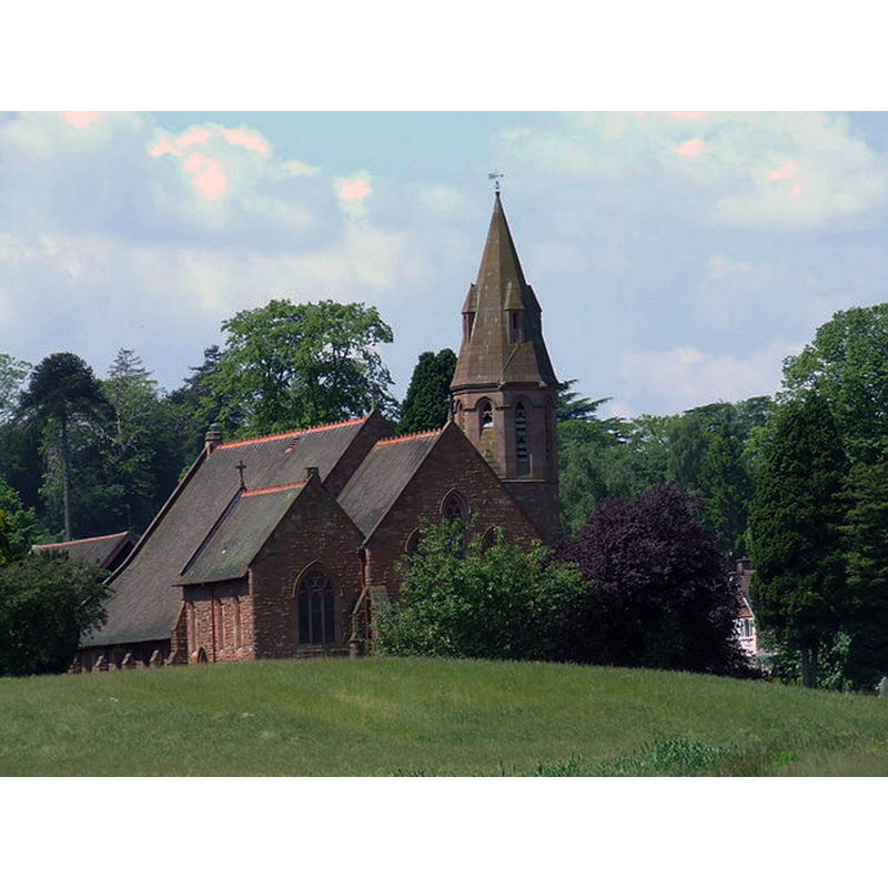
Image copyright © John Shepher, 2005
CC-BY-SA-2.0
Results: 1 records
view of church exterior
Scene Description: the modern church built in 1879 to replace the contended old parish church [cf. ChurchNotes]
Copyright Statement: Image copyright © John Shepher, 2005
Image Source: digital photograph taken 6 June 2005 by John Shepherd [www.geograph.org.uk/photo/199602] [accessed 18 November 2014]
Copyright Instructions: CC-BY-SA-2.0
INFORMATION
Font ID: 19515WRI
Object Type: Baptismal Font1?
Font Date: ca. 1622?
Font Century and Period/Style: 17th century(early?), Restoration
Church / Chapel Name: Christ Church [demolished mid-19thC]
Church Patron Saint(s): Jesus Christ
Church Notes: "All Saints Church replaced Christ Church in 1879. Christ Church was built on land which the then Lord Foley had bought in 1728. In 1750 he and the parishioners argued about who should hold the keys to the church. He accordingly had one door padlocked and another walled up. He claimed he was in his rights since it was private property. However, the Attorney General ruled in favour of the parishioners. Even though the church continued to be used it and its grounds were not consecrated until 1841. Following the dispute the people of Wribbenhall decided to build a new church. The consecration of All Saints' took place on the Eve of All Saints in 1879. The land surrounding the new church had been used as a burial ground for the people of Wribbenhall since 1866. With the building of the new church, Christ Church was demolished." [www.worcesterbmsgh.co.uk/parish/wribbenhall] [accessed 18 November 2014]
Church Address: [the new church of All Saints: Kidderminster Rd., Wribbenhall, Bewdley, Worcestershire DY12 1DQ]
Site Location: Worcestershire, West Midlands, England, United Kingdom
Directions to Site: Located near, and now part of Bewdley
Ecclesiastic Region: Diocese of Worcester
Historical Region: Nundred of Cresslow [in Domesday]
Additional Comments: disappeared font? (the one from the earlier church here)
Font Notes:
Click to view
There is an entry for Wribbenhall [variant spelling] in the Domesday survey [http://domesdaymap.co.uk/place/SO7975/wribbenhall/] [accessed 18 November 2014], but it mentions neither cleric nor church in it. Miller (1890) reports a modern church with a handsome font. The church mentioned in Miller (ibid.) would be the newly built church consecrated in 1879; it replaced an earlier church that was in dispute between the parishioners and the lord of the manor; the old church appears to have dated from the 17th century, since, even though the register for christenings starts in 1723, there are extracts going back to 1622 [source: [www.worcesterbmsgh.co.uk/parish/wribbenhall] [accessed 18 November 2014]]
COORDINATES
UTM: 30U 547274 5803313
Latitude & Longitude (Decimal): 52.378042, -2.305511
Latitude & Longitude (DMS): 52° 22′ 40.95″ N, 2° 18′ 19.84″ W
REFERENCES
- Miller, George [Revd.], The Parishes of the Diocese of Worcester, Birmingham: Hall & English, 1890, vol. 2: 316