Bamberg No. 4 / Babenberg / Bambärch / Castrum Babenberch
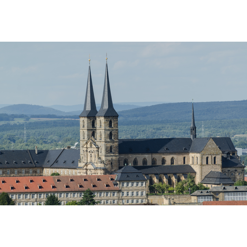
Image copyright © Tilman2007, 2014
CC-BY-SA-3.0
Results: 4 records
view of church exterior in context
Scene Description: the abbey complex seen from Altenburg
Copyright Statement: Image copyright © Tilman2007, 2014
Image Source: digital photograph taken 22 August 2014 by Tilman2007 [http://commons.wikimedia.org/wiki/File:Bamberg,_St._Michael,_von_der_Altenburg_gesehen-001.jpg] [accessed 16 November 2014]
Copyright Instructions: CC-BY-SA-3.0
view of church exterior - west façade
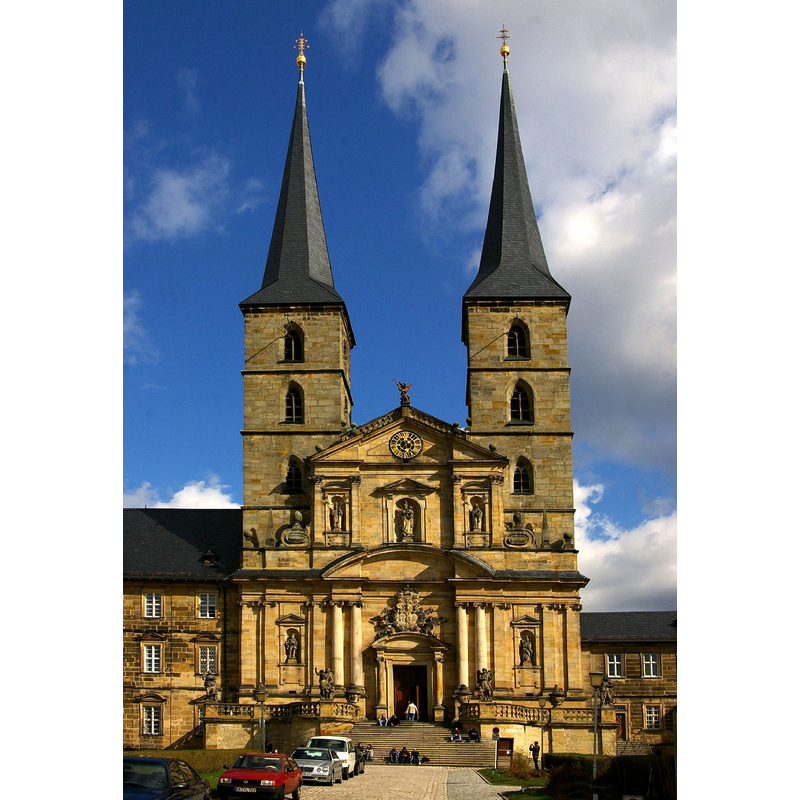
Copyright Statement: Image copyright © Reinhard Kirchner, 2007
Image Source: digital photograph taken May 2007 by Reinhard Kirchner [http://commons.wikimedia.org/wiki/File:Kloster_Michaelsberg_Kirche.JPG] [accessed 16 November 2014]
Copyright Instructions: CC-BY-SA-3.0-migrated
view of church interior - nave - looking west
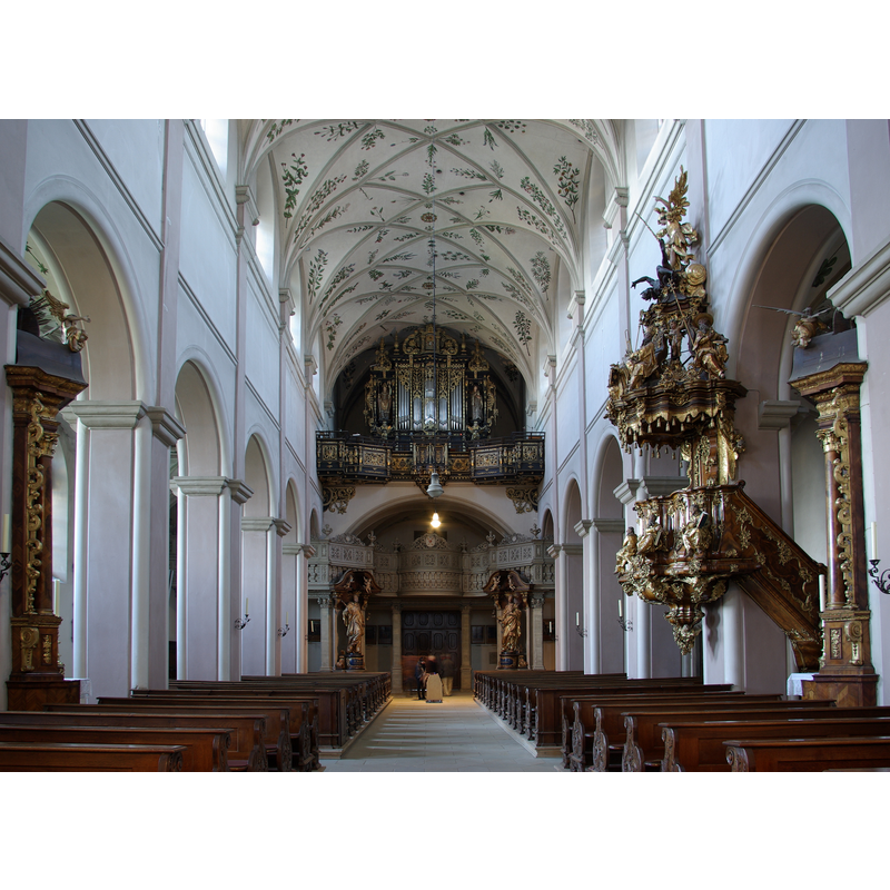
Copyright Statement: Image copyright © [in the public domain]
Image Source: digital photograph taken 18 September 2008 by Berthold Werner [http://commons.wikimedia.org/wiki/File:Bamberg_Sankt_Michael_BW_8.JPG] [accessed 16 November 2014]
Copyright Instructions: PD
view of church interior - nave - looking east
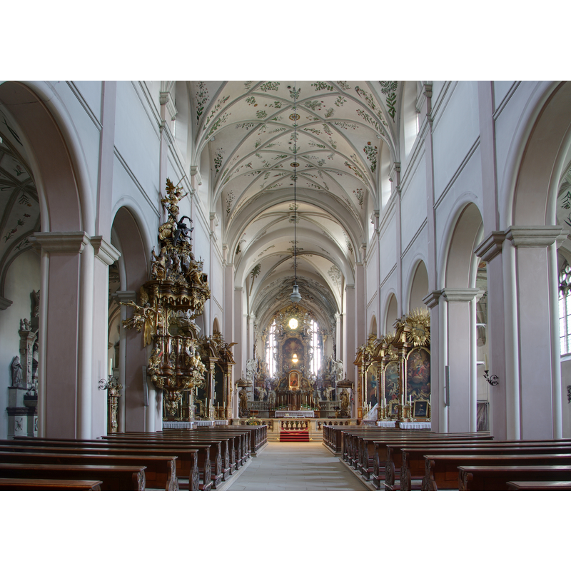
Copyright Statement: Image copyright © [in the public domain]
Image Source: digital photograph taken 18 September 2008 by Berthold Werner [http://commons.wikimedia.org/wiki/File:Bamberg_Sankt_Michael_BW_5.JPG] [accessed 16 November 2014]
Copyright Instructions: PD
INFORMATION
Font ID: 19501BAM
Object Type: Baptismal Font1?
Font Date: ca. 1015?
Font Century and Period/Style: 11th century (early?), Romanesque
Church / Chapel Name: Michaelskirche, Kloster Michelsberg (aka Michaelsberg)
Font Location in Church: [disappeared]
Church Patron Saint(s): St. Michael
Church Notes: originally a Benedictine abbey founded 1015; destroyed in 1117 earthquake; re-built 1121; damaged by fire 1610
Church Address: Michelsberg 10, 96049 Bamberg, Germany -- Tel.: +49 951 872411
Site Location: Oberfranken, Bayern, Germany, Europe
Directions to Site: Located N of road 22, W of Hwy. 73, about 50 km NNW of Nuremberg; the abbey is located in the Altstadt, just NW of the cathedral
Ecclesiastic Region: Erzdiözese Bamberg
Additional Comments: destroyed font? (in the earthquake of 1117)
Font Notes:
Click to view
[NB: we have no information on the font of the early church here]
COORDINATES
UTM: 32U 634822 5528466
Latitude & Longitude (Decimal): 49.893378, 10.877133
Latitude & Longitude (DMS): 49° 53′ 36.16″ N, 10° 52′ 37.68″ E