Stanford-on-Teme / Stanford super Temede / Stanford-upon-Teme / Stanford Washburne / Stanforde
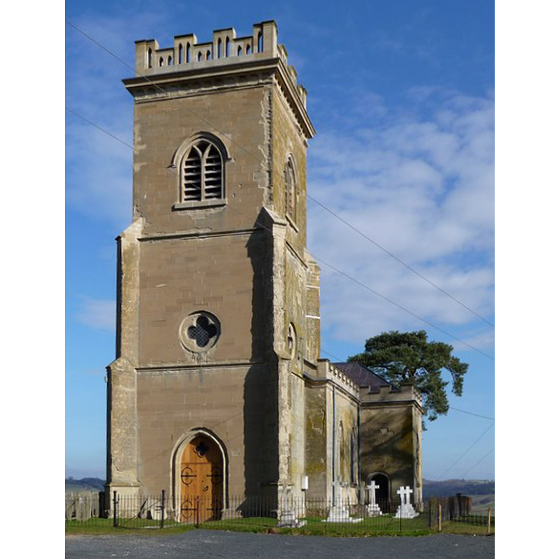
Image copyright © Richard Greenwood, 2009
CC-BY-SA-2.0
Results: 1 records
view of church exterior - southwest view
Scene Description: Source caption: "St Mary's church stands on the western slopes of the Teme valley in a commanding position overlooking Stanford Court." [NB: this is the new church; the foundations of the old church are beneath the lake at Stanford Park].
Copyright Statement: Image copyright © Richard Greenwood, 2009
Image Source: digital photograph taken 21 February 2009 by Richard Greenwood [www.geograph.org.uk/photo/1172238] [accessed 28 October 2014]
Copyright Instructions: CC-BY-SA-2.0
INFORMATION
Font ID: 19478STA
Object Type: Baptismal Font1?
Font Date: ca. 1291?
Font Century and Period/Style: 13th century, Medieval
Church / Chapel Name: Old Parish Church of St. Mary [disappeared]
Church Patron Saint(s): St. Mary the Virgin
Church Address: [New Church: Stanford with Orleton, Worcestershire WR6 6SH]
Site Location: Worcestershire, West Midlands, England, United Kingdom
Directions to Site: Located 8 km SE of Newnham, 22 km NW of Worcester, near the county border with Herefordshire
Ecclesiastic Region: Diocese of Worcester [formerly in the Diocese of Hereford]
Historical Region: Hundred of Doddingtree
Additional Comments: disappeared font? (the one from the pre-1291 church here)
Font Notes:
Click to view
There are two entries for this Stanford in the Domesday survey [http://domesdaymap.co.uk/place/SO7065/stanford-on-teme/] [accessed 28 October 2014], neither of which mentions cleric or church in it. Miller (1890) reports a church "rebuilt 1768 [...] consecrated by the Bishop of Hereford in 1769"; he mentions no font in it. The Victoria County History (Worcester, vol. 4, 1924) notes: "The church of Stanford was returned in 1291 as not worth £4 annually. [...] Of the original church nothing now remains but the foundations which lie beneath the lake in Stanford Park. The present church [...] stands on high ground overlooking Stanford Park, about half a mile east of the original site in the park [...] was consecrated in 1769 [...] The church was restored in 1894 when several alterations were made in the internal fittings. The font and the pulpit are modern."
COORDINATES
UTM: 30U 538372 5793310
Latitude & Longitude (Decimal): 52.288804, -2.43743
Latitude & Longitude (DMS): 52° 17′ 19.69″ N, 2° 26′ 14.75″ W
REFERENCES
- Victoria County History [online], University of London, 1993-. URL: https://www.british-history.ac.uk.
- Miller, George [Revd.], The Parishes of the Diocese of Worcester, Birmingham: Hall & English, 1890, vol. 2: 310