Bewdley
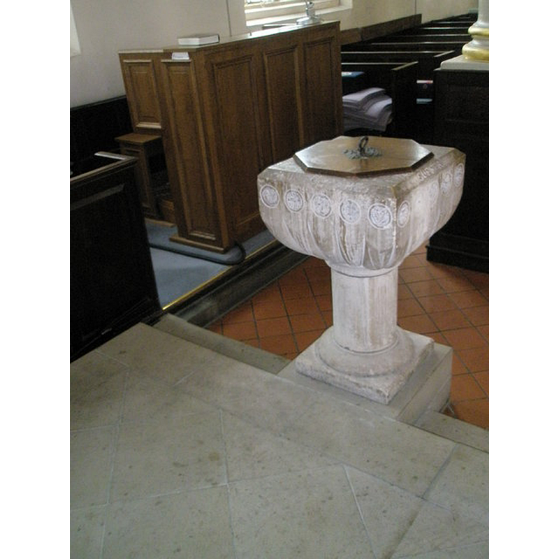
Image copyright © Basher Eyre, 2009
CC-BY-SA-2.0
Results: 3 records
view of font and cover in context
Scene Description: the modern font [cf. FontNotes]
Copyright Statement: Image copyright © Basher Eyre, 2009
Image Source: digital photograph taken 11 August 2009 by Basher Eyre [www.geograph.org.uk/photo/1444989] [accessed 27 October 2014]
Copyright Instructions: CC-BY-SA-2.0
view of church exterior in context - northwest view
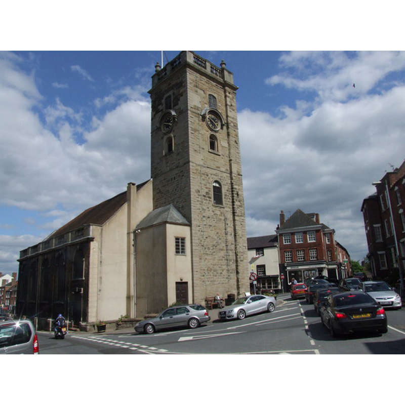
Copyright Statement: Image copyright © Chris Whippet, 2010
Image Source: digital photograph taken 19 June 2010 by Chris Whippet [www.geograph.org.uk/photo/1932560] [accessed 27 October 2014]
Copyright Instructions: CC-BY-SA-2.0
view of church interior - nave - looking east
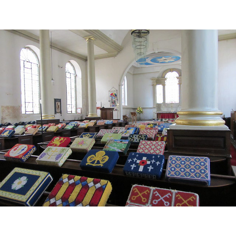
Copyright Statement: Image copyright © Carol Walker Eyre, 2013
Image Source: digital photograph taken 31 May 2013 by Carol Walker Eyre [www.geograph.org.uk/photo/3487240] [accessed 27 October 2014]
Copyright Instructions: CC-BY-SA-2.0
INFORMATION
Font ID: 19477BEW
Object Type: Baptismal Font1?
Font Date: ca. 1472?
Font Century and Period/Style: 15th century, Perpendicular
Church / Chapel Name: Church [former Chapel] of St. Anne
Church Patron Saint(s): St. Anne
Church Address: Load Street, Bewdley, Worcestershire, DY12 2AE -- Tel.: 01299 405385
Site Location: Worcestershire, West Midlands, England, United Kingdom
Ecclesiastic Region: Diocese of Worcester
Historical Region: Hundred of Doddingtree
Font Notes:
Click to view
We found no entry for Bewdley in either the Domesday survey or in Miller (1890). The Victoria County History (Worcester, vol. 4, 1924) entry for Ribbesford with the borough of Bewdley nottes: "The town of Bewdley, probably owing to its origin as a forest settlement, was extra-parochial until by a private Act of Parliament made in the reign of Henry VI [i.e., 1422-1461] it was put within the parish of Ribbesford. [...] The first chapel, which Leland describes as a timber building in the heart of the town, was probably built before 1472. [...] The inhabitants of Bewdley petitioned in 1655 that their chapel might be made parochial, but, as there was no suitable land from which a church-yard could be formed, their petition was not granted. [...] the chapel became a parish church in 1853. [...] The old chapel remained standing till 1745, when it was decided to pull it down and build a new one of stone. [...] At this time the dedication was said to be to St. Andrew, [...] but no evidence of this has been found. The chapel was certainly dedicated to St. Anne in 1520, [...] and probably as early as 1472. [...] The square tower was erected in 1695–6, as recorded by an inscription in the ringing chamber, and the body of the church, which is designed in the Renaissance manner of the period, replaced a somewhat earlier structure in 1748. [...] The font is modern." There is no evidence of an earlier font, though there must have been one, probably replaced after 1748; further, the VCH (ibid.) reports "a flagon of 1637, which has at the bottom the inscription 'Donum Henrici Herberti Ecclesiae de Ribsford Anno Do. 1637 Ante Festum Paschae'".
COORDINATES
UTM: 30U 546559 5802984
Latitude & Longitude (Decimal): 52.375138, -2.316068
Latitude & Longitude (DMS): 52° 22′ 30.5″ N, 2° 18′ 57.85″ W
REFERENCES
- Victoria County History [online], University of London, 1993-. URL: https://www.british-history.ac.uk.