Shipston-on-Stour / Scepwaeisctune / Scepwestun / Scepwestvn / Schipeston / Schipton / Sepestonon-Sture / Sepwestun / Sipestone
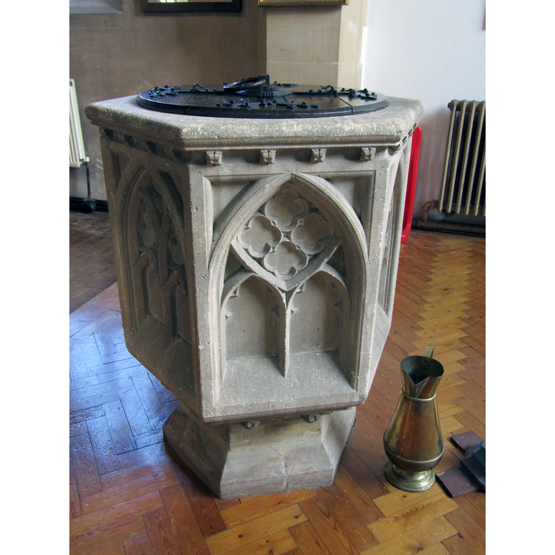
Image copyright © Colin Smith, 2023
Image and permission received from the author (e-mail of 25 February 2024)
Results: 5 records
view of font
Scene Description: the modern font [cf. FontNotes]
Copyright Statement: Image copyright © Colin Smith, 2023
Image Source: digital photograph 29 July 2023 by Colin Smith
Copyright Instructions: Image and permission received from the author (e-mail of 25 February 2024)
view of church exterior in context - southwest end
Copyright Statement: Image copyright © Colin Smith, 2023
Image Source: digital photograph 29 July 2023 by Colin Smith
Copyright Instructions: Image and permission received from the author (e-mail of 25 February 2024)
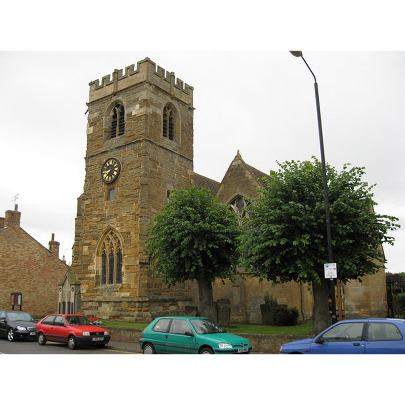
view of church exterior - northwest view

Copyright Statement: Image copyright © P L Chadwick, 2009
Image Source: digital photograph taken 31 August 2009 by P L Chadwick [www.geograph.org.uk/photo/1471616] [accessed 30 October 2014]
Copyright Instructions: CC-BY-SA-2.0
view of church exterior - southwest view
Copyright Statement: Image copyright © Richard Rogerson, 2009
Image Source: digital photograph taken 19 July 2009 by Richard Rogerson [www.geograph.org.uk/photo/1407502] [accessed 30 October 2014]
Copyright Instructions: CC-BY-SA-2.0
view of font and cover in context
![the modern font [cf. FontNotes]](/static-50478a99ec6f36a15d6234548c59f63da52304e5/compressed/1240225012_compressed.png)
Scene Description: the modern font [cf. FontNotes]
Copyright Statement: Image copyright © Colin Smith, 2023
Image Source: digital photograph 29 July 2023 by Colin Smith
Copyright Instructions: Image and permission received from the author (e-mail of 25 February 2024)
INFORMATION
Font ID: 19454SHI
Object Type: Baptismal Font1?
Font Date: ca. 1200?
Font Century and Period/Style: 12th - 13th century, Medieval
Church / Chapel Name: Parish Church of St. Edmund
Church Patron Saint(s): St. Edmund the Martyr [aka Edmund of East Anglia]
Church Address: Church Street, Shipston-on-Stour, Warwickshire CV36 4AP, UK
Site Location: Warwickshire, West Midlands, England, United Kingdom
Directions to Site: Located 16 km S of Stratford-upon-Avon
Historical Region: Hundred of Oswaldslow -- formerly in Worcestershire
Additional Comments: disappeared font? (the one from the pre-1200 chapel/church here)
Font Notes:
Click to view
There is an entry for Shipston [on Stour] [variant spelling] in the Domesday survey [http://domesdaymap.co.uk/place/SP2540/shipston-on-stour/] [accessed 30 September 2014], but it mentions neither cleric nor church in it. Miller (1890) reports a modern font in a church that "was a chapel or chauntry of Treddington [sic]. In 1200 Mangerus, Bishop of Worcester, declared it to be subject to the Rector of Tredington". The Victoria County History (Worcester, vol. 3, 1913) notes: "Shipston was in reality a chapelry of Tredington until 1719 [...] The whole of the church, except the 15th-century tower, was rebuilt in 1855 in the style of the 14th century. Beyond the tower there are now no old remains [...] From notes made by Prattinton in 1812 the former church appears to have been of early date, consisting of a chancel and chapel and a nave separated from a north aisle by a round-arched arcade. The font, however, was of 1707." It is not clear from the records how far back the original chapel went and how full its chapel-of-ease functions were, but the baptismal records start in 1572, which indicate there must have been a font here at least by that date, though probably much earlier. The present font is decribed in Historic England [Listing NGR: SP2592740626] (1966): "hexagonal font with C14-style traceried panels with fleuron cornice", without a date.
COORDINATES
UTM: 30U 594414 5768979
Latitude & Longitude (Decimal): 52.063352, -1.622741
Latitude & Longitude (DMS): 52° 3′ 48.07″ N, 1° 37′ 21.87″ W
REFERENCES
- Victoria County History [online], University of London, 1993-. URL: https://www.british-history.ac.uk.
- Miller, George [Revd.], The Parishes of the Diocese of Worcester, Birmingham: Hall & English, 1890, vol. 2: 252-253