Worcester No. 8 / Uueogorna / Vveogorna / Weogorna / Wigornia / Wirccester / Wirecestre
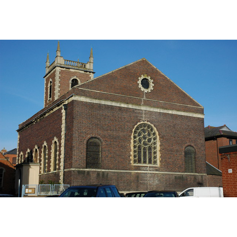
Image copyright © Philip Halling, 2008
CC-BY-SA-2.0
Results: 1 records
view of church exterior - southeast view
Scene Description: the 1771 church re-building
Copyright Statement: Image copyright © Philip Halling, 2008
Image Source: digital photograph taken 5 March 2008 by Philip Halling [www.geograph.org.uk/photo/720185] [accessed 30 September 2014]
Copyright Instructions: CC-BY-SA-2.0
INFORMATION
Font ID: 19453WOR
Object Type: Baptismal Font1?
Font Century and Period/Style: 11th century, Pre-Conquest
Church / Chapel Name: Old St. Martin's in the Cornmarket
Church Patron Saint(s): St. Martin of Tours
Church Address: The Cornmarket, Queen Street, Worcester, Worcestershire, WR1 2PL
Site Location: Worcestershire, West Midlands, England, United Kingdom
Directions to Site: The old church was located where the present building now is, in the Cornmarket, the E of Worcester town centre
Ecclesiastic Region: Diocese of Worcester
Historical Region: Hundred of Oswaldslow
Additional Comments: disappeared font? (the one from the suspected church here [cf. FontNotes]
Font Notes:
Click to view
There are three entries for Worcester [variant spelling] in the Domesday survey [http://domesdaymap.co.uk/place/SO8454/worcester/] [accessed 30 October 2014], neither of which mention cleric or church in it. Miller (1890) notes the re-building of this church in 1772, and has no information on the old church here other that the name and date of the first recorded rector, "Richard Parson ... 1219". The Victoria County History (Worcester, vol. 3, 1913) notes: "It is possible that St. Martin was the church mentioned among the boundaries of Perry in the charter of Bishop Wulfstan" [NB: probably Wulfstan II, the pre-Conquest bishop of Worcester who retained his office under William]; the medieval church, continues the VCH (ibid.): "was rebuilt in red brick with stone dressings in 1771 from the designs of Anthony Keck [...] The fittings are old, but the seats, font and east window are recent." [NB: we have no information on the font of the early church here].
COORDINATES
UTM: 30U 553399 5782746
Latitude & Longitude (Decimal): 52.192586, -2.218804
Latitude & Longitude (DMS): 52° 11′ 33.31″ N, 2° 13′ 7.69″ W
REFERENCES
- Victoria County History [online], University of London, 1993-. URL: https://www.british-history.ac.uk.
- Miller, George [Revd.], The Parishes of the Diocese of Worcester, Birmingham: Hall & English, 1890, vol. 2: 284