Northfield / Nordfeld
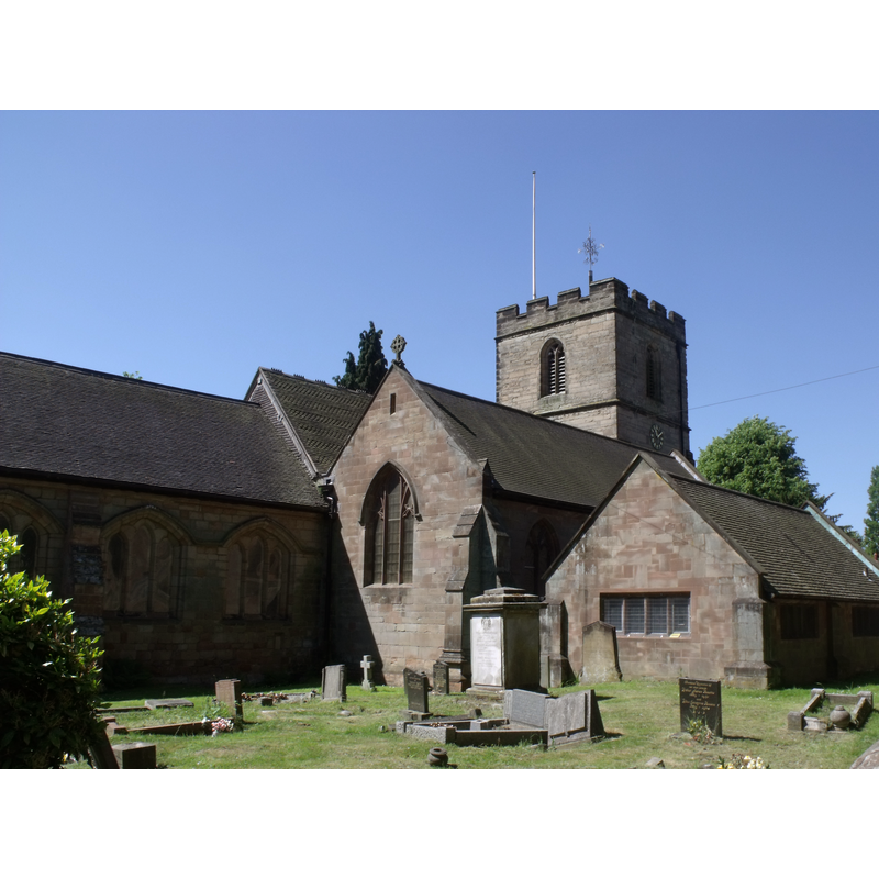
Image copyright © Eliott Brown, 2010
CC-BY-SA-2.0
Results: 2 records
view of church exterior - northeast view
Copyright Statement: Image copyright © Eliott Brown, 2010
Image Source: digital photograph taken 17 June 2010 by Eliott Brown [www.flickr.com/photos/39415781@N06/4711405795] [accessed 22 September 2014]
Copyright Instructions: CC-BY-SA-2.0
view of church exterior - northwest view
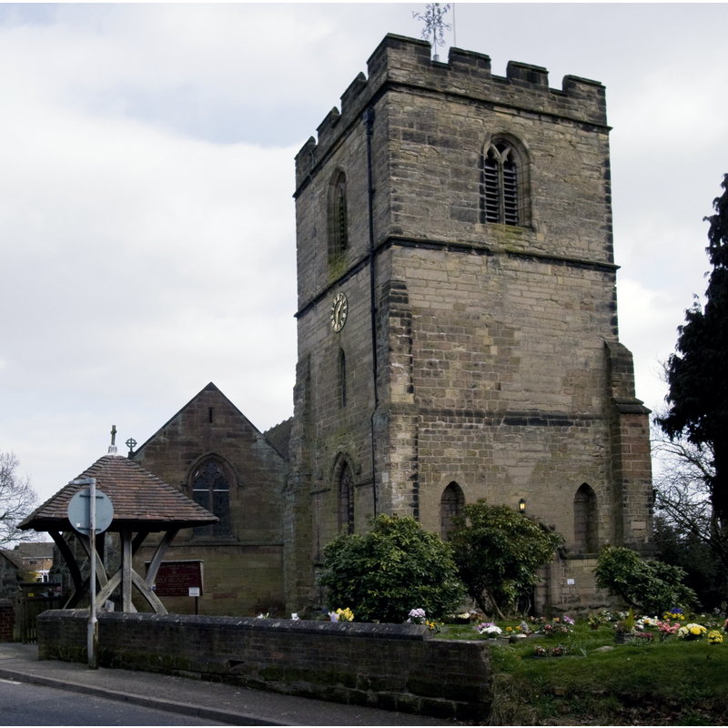
Copyright Statement: Image copyright © Oosoom, 2009
Image Source: digital photograph taken 22 March 2009 by Oosoom [http://commons.wikimedia.org/wiki/File:Northfield_St_Laurence_from_road.jpg] [accessed 22 September 2014]
Copyright Instructions: CC-BY-SA-3.0
INFORMATION
Font ID: 19438NOR
Object Type: Baptismal Font1
Font Date: ca. 1170?
Font Century and Period/Style: 12th century (late?), Late Norman
Church / Chapel Name: Parish Church of St. Laurence [aka St. Lawrence's]
Church Address: 173 Church Road (corner Rectory Road & Church Hill), Northfield, West Midlands, B31 2LX
Site Location: West Midlands, West Midlands, England, United Kingdom
Directions to Site: Northfield was incorporated to Birmingham in 1911
Ecclesiastic Region: Diocese of Birmingham
Historical Region: Hundred of Came -- fomerly Worcestershire/Warwickshire
Additional Comments: disappeared font? (the one from the ca.1170 church here) [NB: there may have been a church here by 1086 [cf. FontNotes]]
Font Notes:
Click to view
There is an entry for Northfield [variant spelling] in the Domesday survey [http://domesdaymap.co.uk/place/SP0279/northfield/] [accessed 2 September 2014]; it reports a priest but there no mention of a church in it, though there probably was one here. Miller (1890) reports "remains of a Norman doorway on the north side" and a modern font in the church here. The Victoria County History (Worcester, vol. 3, 1913) notes: "The church of Northfield was granted to the priory of Dudley by Gervase Paynel when he founded the house about 1160 [...] The earliest part of the existing building is the north doorway, of about 1170, which with two carved heads, inserted in the south face of the tower, formed part of a 12th-century church. [...] The round-headed north door dates from about 1170 and has been reset in the modern aisle wall." The preent font is modern, an octagonal basin with floral motifs in quatrefoils on the sides, on an octagonal stem with niches on the sides, and a graded lower base; probably 19th-century.
COORDINATES
UTM: 30U 570459 5807380
Latitude & Longitude (Decimal): 52.4121, -1.9641
Latitude & Longitude (DMS): 52° 24′ 43.56″ N, 1° 57′ 50.76″ W
REFERENCES
- Victoria County History [online], University of London, 1993-. URL: https://www.british-history.ac.uk.
- Miller, George [Revd.], The Parishes of the Diocese of Worcester, Birmingham: Hall & English, 1890, vol. 2: 76-77