Moseley / Museleie
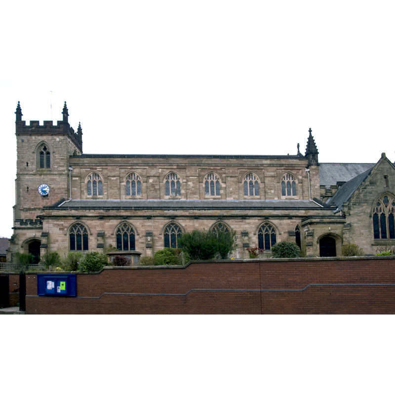
Image copyright © Oosoom, 2009
CC-BY-SA-3.0
Results: 1 records
view of church exterior - south view
Copyright Statement: Image copyright © Oosoom, 2009
Image Source: digital photograph taken 2 April 2009 by Oosoom [http://en.wikipedia.org/wiki/File:Moseley_St_Marys_church.jpg] [accessed 18 September 2014]
Copyright Instructions: CC-BY-SA-3.0
INFORMATION
Font ID: 19434MOS
Object Type: Baptismal Font1?
Font Century and Period/Style: 14th - 15th century, Medieval
Church / Chapel Name: Parish Church of St. Mary [formerly chapel-of-ease to King's Norton]
Church Patron Saint(s): St. Mary the Virgin
Church Address: 31 St. Mary's Row, Moseley, Birmingham, West Midlands, B13 8HW
Site Location: West Midlands, West Midlands, England, United Kingdom
Directions to Site: Located 3 km S of Birmingham, now a suburb
Ecclesiastic Region: Diocese of Birmingham
Historical Region: Hundred of Came -- formerly Worcestershire
Additional Comments: disappeared font? (the one from the late-medieval church here; was there a church ihere in Domesday time? cf. FontNotes])
Font Notes:
Click to view
There is an entry for this Moseley [variant spelling] in the Domesday survey [http://domesdaymap.co.uk/place/SP0783/moseley/] [accessed 18 September 2014]; it reports a priest but does not mention a church in it, though there probably was one there. The entry for the church at Moseley in Miller (1890), however, reports "an old tower, built 5 Henry VIII" [5th year of Henry VIII, i.e., 1514]. The Victoria County History (Worcester, vol. 3, 1913) notes: "The chapel of St. Mary Moseley was built by the parishioners of King's Norton because the parish was 'seven miles broad every way & 40 miles compass,' and many of the inhabitants lived 4 miles from the parish church. [...] In 1405 licence was given to the parishioners of Bromsgrove who lived near King's Norton to attend mass in the chapel of St. Mary, Moseley. [...] The chapel apparently continued to be used [...] and a brief for rebuilding was issued in 1780. [...] Moseley was formed into a separate ecclesiastical parish in 1853". This former chapel has many indications of having been a chapel-of-ease with parochial functions and, therefore, must have had a baptismal font early on. The English Heritage entry for this church [Listing NGR: SP0780883166] (1952) mentions no font in it. Unconfirmed source mentions a new font added in the Thomas Rickman restoration of thr 1820s, a basin made of plaster affixed to the west wall. [NB: we have no information on the font of the original church here].
COORDINATES
UTM: 30U 575672 5811273
Latitude & Longitude (Decimal): 52.4464, -1.8866
Latitude & Longitude (DMS): 52° 26′ 47.04″ N, 1° 53′ 11.76″ W
REFERENCES
- Victoria County History [online], University of London, 1993-. URL: https://www.british-history.ac.uk.
- Miller, George [Revd.], The Parishes of the Diocese of Worcester, Birmingham: Hall & English, 1890, vol. 2: 74