Halesowen No. 2 / Hala / Halam / Hales / Hales Owen / Hales Regis / Halesoweyn / Halysoweyn
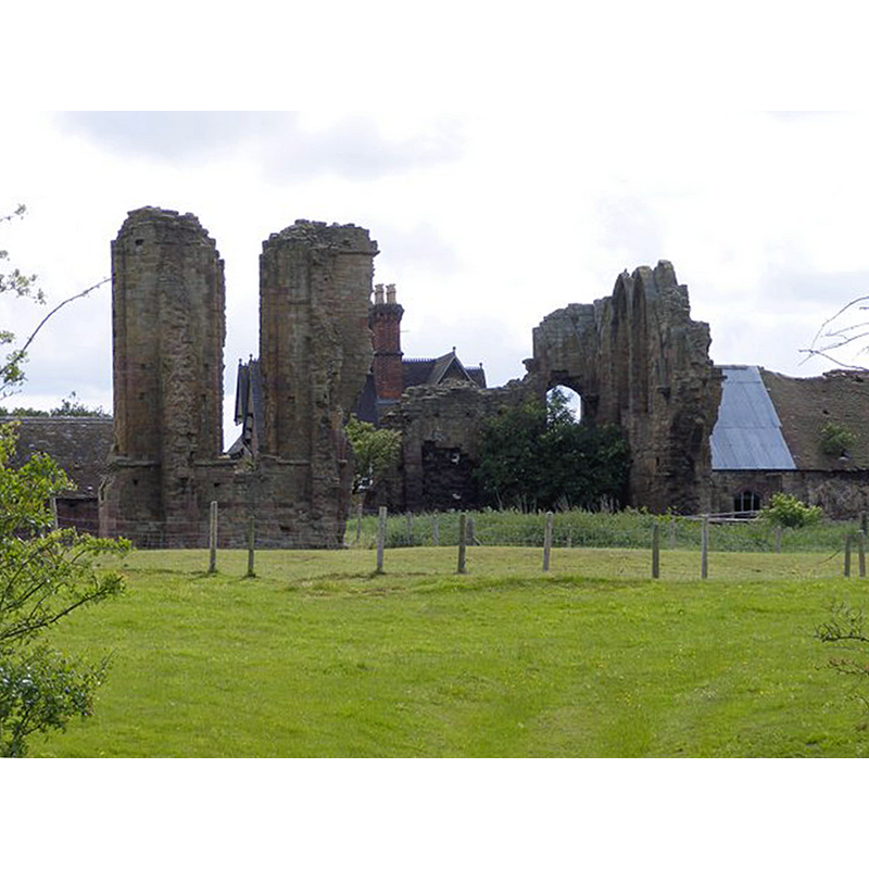
Image copyright © Gordon Griffiths, 2011
CC-BY-SA-2.0
Results: 1 records
view of church exterior
Scene Description: Source caption: "The view from the Monarch's Way of St Mary's Abbey ruins."
Copyright Statement: Image copyright © Gordon Griffiths, 2011
Image Source: digital photograph taken 28 May 2011 by Gordon Griffiths [www.geograph.org.uk/photo/2433248] [accessed 17 September 2014]
Copyright Instructions: CC-BY-SA-2.0
INFORMATION
Font ID: 19432HAL
Object Type: Baptismal Font1?
Font Date: ca. 1215?
Font Century and Period/Style: 13th century (early?), Early English
Church / Chapel Name: Abbey Church [in ruins]
Church Notes: abbey founded 1215 by Premonstratensian canons under a grant from King John
Church Address: Manor Way, Halesowen, West Midlands B62 8RJ, UK -- Tel.: +44 870 333 1181
Site Location: Worcestershire, West Midlands, England, United Kingdom
Directions to Site: Located in the western suburbs of Birmingham, towards Stourbridge
Ecclesiastic Region: [Diocese of Worcester]
Historical Region: Hundred of Clent
Additional Comments: disappeared font? (the one from the early13thC abbey church here)
Font Notes:
Click to view
The Victoria County History (Worcester, vol. 3, 1913) notes: "The scanty remains of the Premonstratensian ABBEY OF HALESOWEN founded in 1215 are situated upon a slight eminence in a secluded valley about half a mile south-east of the village [...] The conventual buildings were demolished shortly after the Dissolution, and from the churchwardens' accounts for 1539 it appears that the parish authorities took part in the spoliation. A modern farm-house stands a little to the south of the monastic remains. [...] The surviving remains include one bay of the north wall of the presbytery, the south-west corner of the south transept, the east end of the south wall of the south aisle and a small piece of walling at the south-west corner of the same aisle; these are all circa 1220.
COORDINATES
UTM: 30U 565561 5810877
Latitude & Longitude (Decimal): 52.44415, -2.035412
Latitude & Longitude (DMS): 52° 26′ 38.94″ N, 2° 2′ 7.48″ W
REFERENCES
- Victoria County History [online], University of London, 1993-. URL: https://www.british-history.ac.uk.