Grafton Manor Chapel [disappeared?]
![Main image for Grafton Manor Chapel [disappeared?]](/static-50478a99ec6f36a15d6234548c59f63da52304e5/compressed/1140917002_compressed.png)
Image copyright © Martin Wilson, 2006
CC-BY-SA-2.0
Results: 2 records
view of church exterior in context
Scene Description: the manor and grounds, now a hotel-restaurant
Copyright Statement: Image copyright © Martin Wilson, 2006
Image Source: digital photograph taken 16 July 2006 by Martin Wilson [www.geograph.org.uk/photo/203966] [accessed 17 September 2014]
Copyright Instructions: CC-BY-SA-2.0
view of church exterior in context
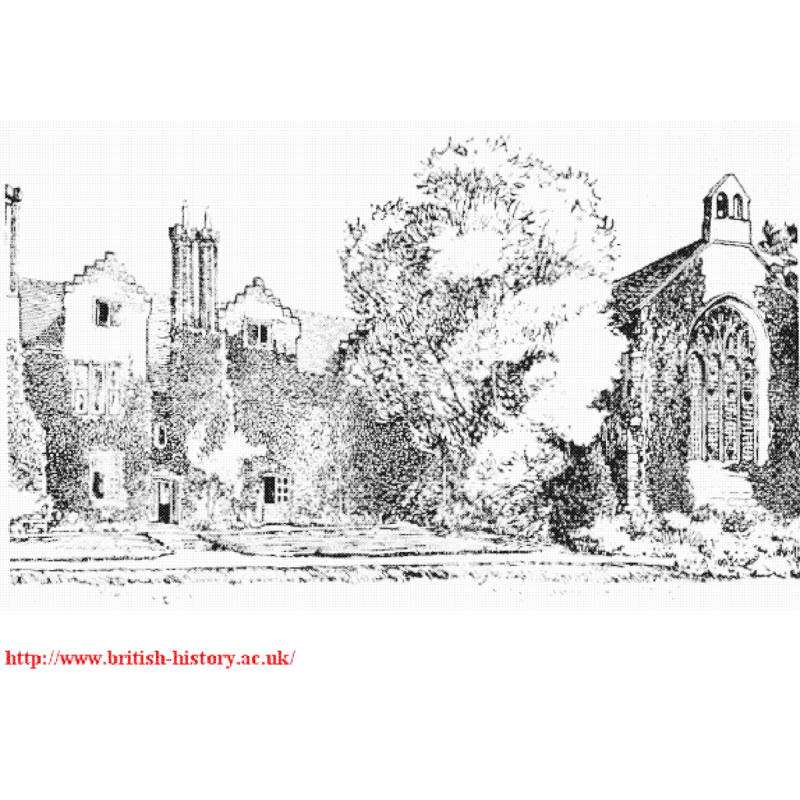
Scene Description: the chapel west facade on the right
Copyright Statement: Image copyright © [in the public domain]
Image Source: illustration in the Victoria County History (Worcester, vol. 3, 1913: 3) [www.british-history.ac.uk/report.aspx?compid=43097] [accessed 17 September 2014]
Copyright Instructions: PD
INFORMATION
Font ID: 19430GRA
Object Type: Baptismal Font1?
Church / Chapel Name: Chapel of St. Michael [originally a chapel-of-easy to Bromsgrove -- in ruins by end of 18thC]
Church Patron Saint(s): St. Michael
Church Address: Grafton Lane, Dodford, Worcestershire B61 7HA
Site Location: Worcestershire, West Midlands, England, United Kingdom
Directions to Site: The Chapel adjoined to the SW of Grafton Manor, itself located 4 km SW of Bromsgrove, 20 km NE of Worcester
Ecclesiastic Region: [Diocese of Worcester]
Historical Region: Hundred of
Additional Comments: disappeared font? (did the chapel of ease have sacramental rights?)
Font Notes:
Click to view
The Victoria County History (Worcester, vol. 3, 1913) entry for the Garfton Manor [civic] parish notes: "The profits of the chapelry of Grafton annexed to the church of Bromsgrove were granted by William of Blois, Bishop of Worcester (1218–36), to the sacrist of St. Mary's, Worcester, who had to provide a taper to burn before the tomb of King John. [...] The chapel, which was dedicated to St. Michael, [...] it was in ruins before the end of the 18th century. [...] The chapel is connected with the west wing by a small brick two-storied building of early 16th-century date, containing the sacristy and a priest's room over it. The chapel itself, measuring about 53 ft. by 17 ft. internally, is entirely of stone and [the present building] dates from the first half of the 15th century."
COORDINATES
UTM: 30U 561973 5797099
Latitude & Longitude (Decimal): 52.320713, -2.090741
Latitude & Longitude (DMS): 52° 19′ 14.57″ N, 2° 5′ 26.67″ W
REFERENCES
- Victoria County History [online], University of London, 1993-. URL: https://www.british-history.ac.uk.