Dudley No. 1 / Duddelœge / Dudelei / Dvdelei
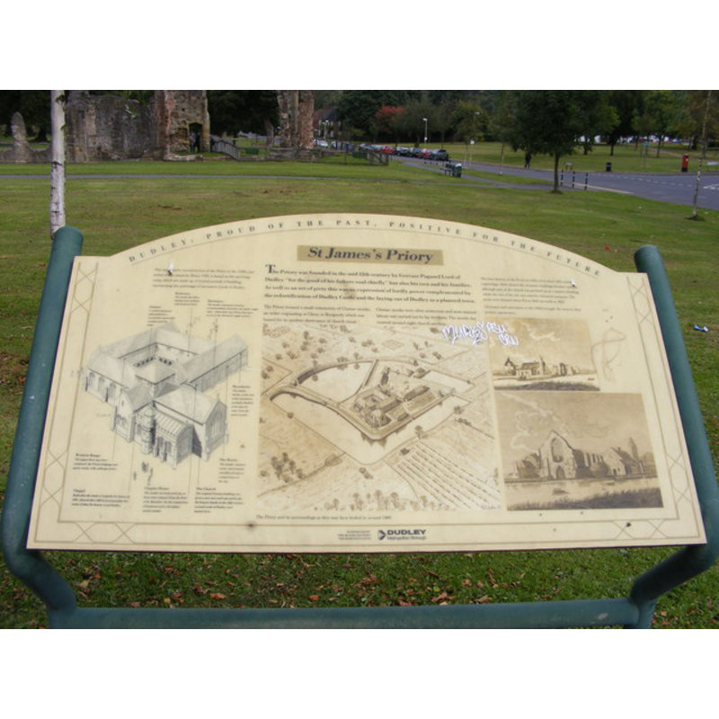
Image copyright © Gordon Griffiths, 2009
CC-BY-SA-2.0
Results: 4 records
view of church exterior - plan
Scene Description: Source caption: "The sign in front of St James' Priory off the Broadway, Dudley"
Copyright Statement: Image copyright © Gordon Griffiths, 2009
Image Source: digital photograph taken 16 September 2009 by Gordon Griffiths [www.geograph.org.uk/photo/1505344] [accessed 17 September 2014]
Copyright Instructions: CC-BY-SA-2.0
view of church exterior - southwest view
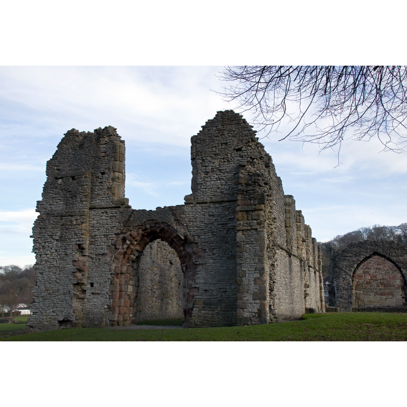
Scene Description: Source caption: "The ruins of Dudley Priory. The priory was founded in 1160 by Gervase Paganel, Lord of Dudley. The priory was closed by King Henry VIII in the 1530s as part of the nationwide Dissolution of the Monasteries."
Copyright Statement: Image copyright © Tony Hisgett, 2010
Image Source: digital photograph taken 26 November 2010 by Tony Hisgett [http://commons.wikimedia.org/wiki/File:Dudley_Priory_5_(5208950601).jpg] [accessed 17 September 2014]
Copyright Instructions: CC-BY-SA-2.0
view of church exterior
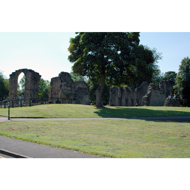
Scene Description: Source caption: "This is the ruins of Dudley Priory in Dudley, West Midlands."
Copyright Statement: Image copyright © Erebus, 2007
Image Source: digital photograph taken 23 August 2007 by Erebus [http://commons.wikimedia.org/wiki/File:Dudley_Priory.JPG] [accessed 17 September 2014]
Copyright Instructions: CC-BY-SA-2.0
view of church interior - nave - looking west
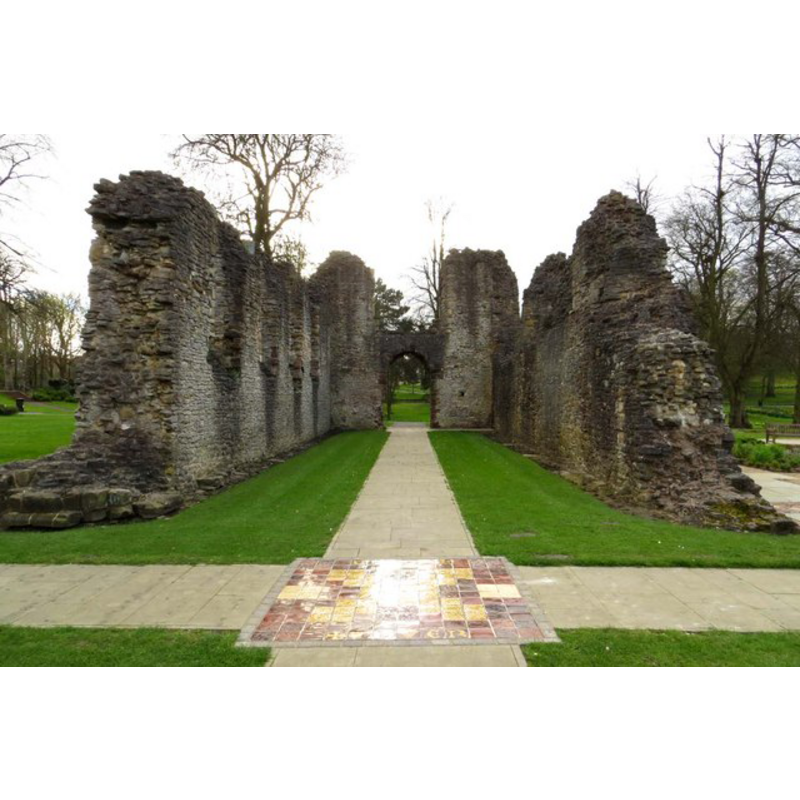
Copyright Statement: Image copyright © Steve Daniels, 2014
Image Source: digital photograph taken 8 April 2014 by Steve Daniels [www.geograph.org.uk/photo/4015111] [accessed 17 September 2014]
Copyright Instructions: CC-BY-SA-2.0
INFORMATION
Font ID: 19427DUD
Object Type: Baptismal Font1
Font Date: ca. 1160?
Font Century and Period/Style: 12th century (mid?), Late Norman
Church / Chapel Name: Priory Church of St. James [in ruins]
Church Patron Saint(s): St. James
Church Address: Paganel Dr, Dudley DY1 4EU
Site Location: Worcestershire, West Midlands, England, United Kingdom
Directions to Site: Located 10 km SE of Wolverhampton, 14 km NW of Birmingham
Ecclesiastic Region: Diocese of Worcester
Historical Region: Hundred of Clent
Additional Comments: disappeared font? ( the one from the mid-12thC church here)
Font Notes:
Click to view
There is an entry for Dudley [variant spelling] in the Domesday survey [http://domesdaymap.co.uk/place/SO9490/dudley/] [accessed 17 September 2014], but it mentions neither cleric nor a church in it. Miller (1890) writes: "There appears to have been formerly two churches in Dudley--St. Edmund and St. Thomas. Bishop Sandy's Survey states that St. Thomas's was a chapel dependent on St. Edmund's. Both these churches are said, in the Bull of Pope Lucius, 1190, to be dependent on the mother church of St. James. This latter church must have been destroyed in early times. The church of St. Edmund was demolished by Colonel Leveson, 1646. Both parishes became then one, and the register book, from thenceforth, became also one. On September 13th, 1648, upon the people's petition, it was ordered that both parishes should repair the church of St. Thomas. The present church was erected 1816." The Victoria County History (Worcester, vol. 3, 1913) notes: "From very early times there were two churches at Dudley. They were granted by Gervase Paynel in the middle of the 12th century to his newly-founded priory of Dudley, [...] and appear afterwards to have become annexed to the priory church of St. James, for when Pope Lucius confirmed the possessions of the priory in 1182 he included the church of St. James of Dudley with the chapels of St. Edmund and St. Thomas. [...] Both the churches were united in one vicarage, [...] and Bishop Sandys's survey states that St. Edmund's was the parish church and St. Thomas's a chapel dependent upon it. [...] In 1844 the four new parishes of St. Edmund, St. James, St. John and St. Andrew, Netherton, were formed out of the old parish of Dudley. [...] Since that date two other parishes have been formed, that of St. Luke in 1876 [...] and that of St. Augustine in 1884. [...] The livings of all these churches are vicarages, and all are in the gift of the vicar of Dudley." All other churches in Dudley date from the 19th-century. [NB: we have no information on the font from the mid-12th century church here].
COORDINATES
UTM: 30U 562084 5818769
Latitude & Longitude (Decimal): 52.5155, -2.0851
Latitude & Longitude (DMS): 52° 30′ 55.8″ N, 2° 5′ 6.36″ W
REFERENCES
- Victoria County History [online], University of London, 1993-. URL: https://www.british-history.ac.uk.
- Miller, George [Revd.], The Parishes of the Diocese of Worcester, Birmingham: Hall & English, 1890, vol. 2: 149-151