Lydiate / Ledeyate / Leiate / Lichet / Liddigate / Lidezate / Lidgate / Lydegate / Lydeyate / Lydyate
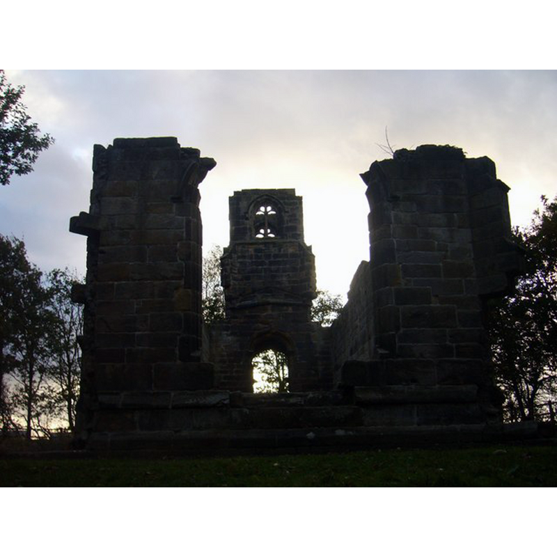
Image copyright © Eddy Lloyd, 2009
CC-BY-SA-2.0
Results: 5 records
view of church exterior - east view
Scene Description: the ruins of St. Catherine's Chapel
Copyright Statement: Image copyright © Eddy Lloyd, 2009
Image Source: digital photograph taken 11 October 2009 by Eddy Llloyd [www.geograph.org.uk/photo/1532053] [accessed 11 September 2014]
Copyright Instructions: CC-BY-SA-2.0
view of church exterior - northwest view
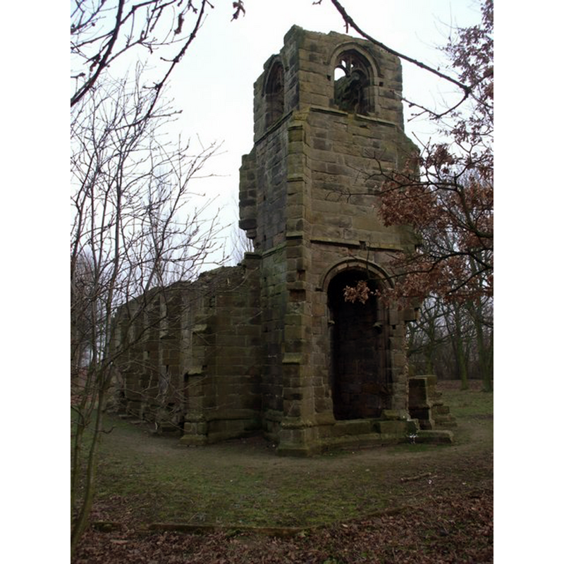
Scene Description: the ruins of St. Catherine's Chapel
Copyright Statement: Image copyright © John Lord, 2009
Image Source: digital photograph taken 1 January 2009 by John Lord [www.geograph.org.uk/photo/1102934] [accessed 11 September 2014]
Copyright Instructions: CC-BY-SA-2.0
view of church exterior - southeast view
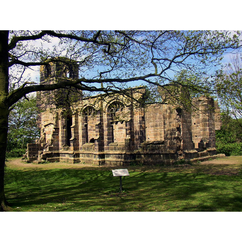
Scene Description: the ruins of St. Catherine's Chapel
Copyright Statement: Image copyright © Jon Clark, 2005
Image Source: digital photograph taken 2 May 2005 by Jon Clark [www.geograph.org.uk/photo/56298] [accessed 11 September 2014]
Copyright Instructions: CC-BY-SA-2.0
view of church exterior - northeast view
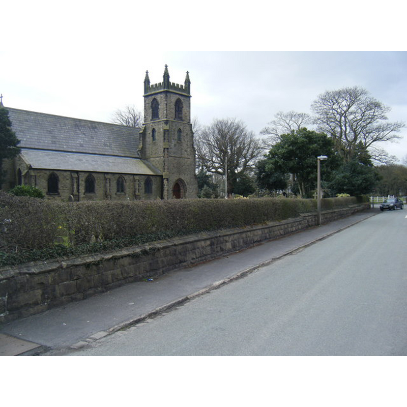
Scene Description: the 19th-century Roman Catholic parish church of St. Mary
Copyright Statement: Image copyright © Colin Pyle, 2013
Image Source: digital photograph taken 17 April 2013 by Colin Pyle [ww.geograph.org.uk/photo/3418736] [accessed 11 September 2014]
Copyright Instructions: CC-BY-SA-2.0
view of church interior - nave - looking west
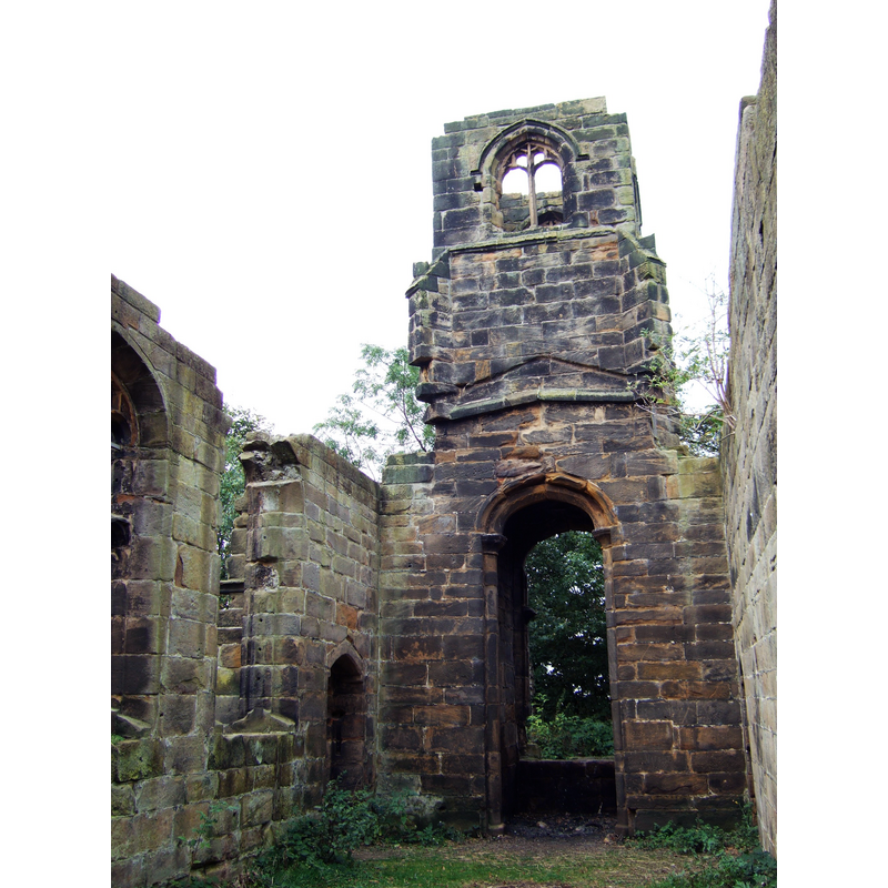
Scene Description: the ruins of St. Catherine's Chapel
Copyright Statement: Image copyright © [in the public domain]
Image Source: digital photograph taken 2 October 2007 by Small-town hero [http://commons.wikimedia.org/wiki/File:St_Catherine%27s_Chapel,_Lydiate_7.JPG] [accessed 11 September 2014]
Copyright Instructions: Released by its author into the public domain
INFORMATION
Font ID: 19419LYD
Object Type: Baptismal Font1?
Font Date: ca. 1486?
Font Century and Period/Style: 15th century (late?), Perpendicular
Church / Chapel Name: St. Catherine's Chapel [aka St. Katherine's Chapel / Lydiate Abbey] [in ruins]
Church Patron Saint(s): St. Catherine of Alexandria [aka Katherine, Katharine]
Church Notes: present church was built between 1839 and 1841 as a chapel-of-ease to Halsall's St. Cuthbert;
Church Address: Southport Road, Lydiate, Sefton L31 4HD
Site Location: Merseyside, North West, England, United Kingdom
Directions to Site: Located N of Maghull, in the Metropolitan Borough of Sefton
Ecclesiastic Region: Archdiocese of Liverpool (R.C.)
Historical Region: Hundred of West Derby -- formerly Cheshire, South Lancashire
Additional Comments: disappeared font? (the one from the late-15thC chapel here)
Font Notes:
Click to view
There is an entry for Lydiate [variant spelling] in the Domesday survey [http://domesdaymap.co.uk/place/SD3604/lydiate/] [accessed 11 September 2014], nut it reports neither cleric not church in it. English Heritage entry for the 19thC church [Listing NGR: SD3632605728] (1968) does not mention a font in it. The Victoria County History (Lancaster, vol. 3, 1907) notes: "To the south of the hall in an open field stands the ruined chapel called 'Lydiate Abbey.' It was dedicated in honour of St. Catherine. [...] Weather and the arch-enemy of ancient buildings, ivy, are slowly destroying its ruins. [...] Parts of a broken altar-slab lie in the church, enough remaining to show that the altar was 3 ft. 4 in. high by 8 ft. 6 in. long and 2 ft. 6 in. wide. [...] The date of the building is probably fixed by the initials on the porch of Lawrence Ireland, ob. before 1486, and Catherine (Blundell) his wife, though the details would suggest a later date, especially the absence of cusps in the window tracery. [...] The chapel was no doubt dismantled when the worship for which it was erected was prohibited by law. [...] Gregson in 1816 records that 'the neighbourhood still abounds with Catholic families, and mass is regularly performed in the old hall.' (fn. 112) This domestic chapel has been superseded by the church of St. Mary (commonly called 'Our Lady's'), built in 1854 by the late Thomas Weld Blundell, and consecrated in 1892." St. Thomas, the Anglican church, dates from the 19th century.
COORDINATES
UTM: 30U 502580 5931898
Latitude & Longitude (Decimal): 53.535982, -2.961074
Latitude & Longitude (DMS): 53° 32′ 9.53″ N, 2° 57′ 39.86″ W
REFERENCES
- Victoria County History [online], University of London, 1993-. URL: https://www.british-history.ac.uk.