Mardale
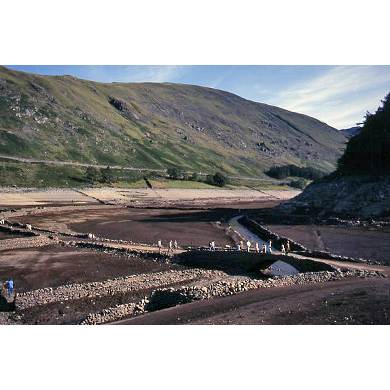
Image copyright © Ian Taylor, 1984
CC-BY-SA-2.0
Results: 3 records
view of context
Scene Description: Source caption: "Tourists visiting the remains of Mardale during the summer of 1984. The bridge over Mardale Beck still stands." -- Parish Church here was dismantled in the 1930s, the materials re-used in the water take-off tower -- last service held in 1935
Copyright Statement: Image copyright © Ian Taylor, 1984
Image Source: photograph taken in 1984 by Ian Taylor [ww.geograph.org.uk/photo/1149036] [accessed 10 September 2014]
Copyright Instructions: CC-BY-SA-2.0
view of church exterior - northwest view
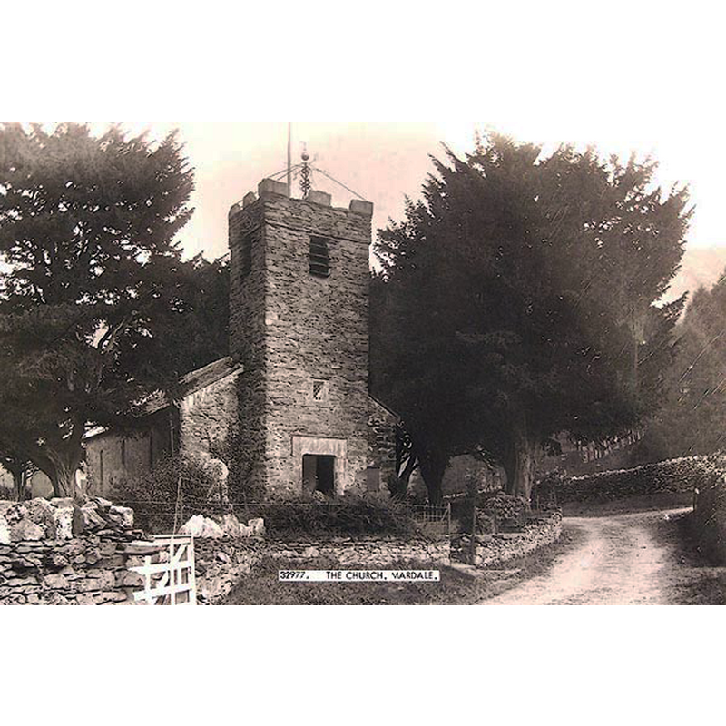
Scene Description: Parish Church here was dismantled in the 1930s, the materials re-used in the water take-off tower -- last service held in 1935
Copyright Statement: Image copyright © [in the public domain]
Image Source: B&W photograph in Penrith Museum [BNO47] reproduced www.geog.port.ac.uk/webmap/thelakes/photos/bno47.jpg [accessed 10 September 2014]
Copyright Instructions: PD
view of church interior - nave - looking east
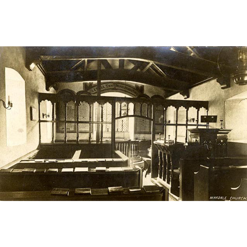
Scene Description: Parish Church here was dismantled in the 1930s, the materials re-used in the water take-off tower -- last service held in 1935
Copyright Statement: Image copyright © [in the public domain]
Image Source: B&W photograph in Penrith Museum [BNV58] reproduced www.geog.port.ac.uk/webmap/thelakes/photos/bno58.jpg [accessed 10 September 2014]
Copyright Instructions: PD
INFORMATION
Font ID: 19417MAR
Object Type: Baptismal Font1?
Font Century and Period/Style: 16th - 17th century
Church / Chapel Name: Parish Church [former chapel-of-ease -- disappeared]
Church Patron Saint(s): [Holy Trinity?]
Church Notes: Parish Church here was dismantled in the 1930s, the materials re-used in the water take-off tower -- last service held in 1935
Site Location: Cumbria, North West, England, United Kingdom
Directions to Site: Village was submerged in the Haweswater Reservoir in the 1930s
Ecclesiastic Region: Diocese of Carlisle
Historical Region: formerly Westmorland
Additional Comments: disappeared font? [cf. FontNotes]
Font Notes:
Click to view
Curwen (1932) notes the former church building -it was dismantled and submerged in the 1930s- as: "a post-Reformation chapel of Shap, and without any special dedication. The earliest date that we have is contained in a note of the death of Randall Brockbank in 1596", later made parochial. [NB: we have no information on the font of the disappeared church]. [NB: there is no indication of parochial use of either of the two other chapels of Shap, those at Keld and Swindale].
COORDINATES
UTM: 30U 512338 6038959
REFERENCES
- Curwen, John F., The Later Records relating to North Westmorland: or the Barony of Appleby, Kendal: T. Wilson, 1932, p. 358-376 / [www.british-history.ac.uk/report.aspx?compid=43525] [accessed 10 September 2014]