Asby / Great Asby
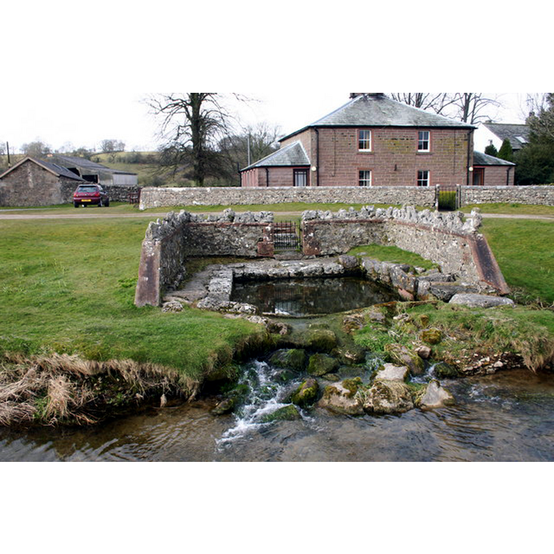
Image copyright © Bob Jenkins, 2006
CC-BY-SA-2.0
Results: 2 records
view of church exterior - well
Scene Description: known as St. Helen's Well -- Photo caption: "This is not really a well - it's a rising for waters which fall on the surrounding limestone hills. There is a direct dye-traced link with the water found in the far reaches of Pate Hole, a cave 1.5km to the south. Only in very wet weather does water flow out of Pate Hole and down the usually dry valley which leads to this well. It is rumoured never to have run dry."
Copyright Statement: Image copyright © Bob Jenkins, 2006
Image Source: digital photograph taken 25 March 2006 by Bob Jenkins [www.geograph.org.uk/photo/142147] [accessed 28 July 2014]
Copyright Instructions: CC-BY-SA-2.0
view of church exterior - southwest view
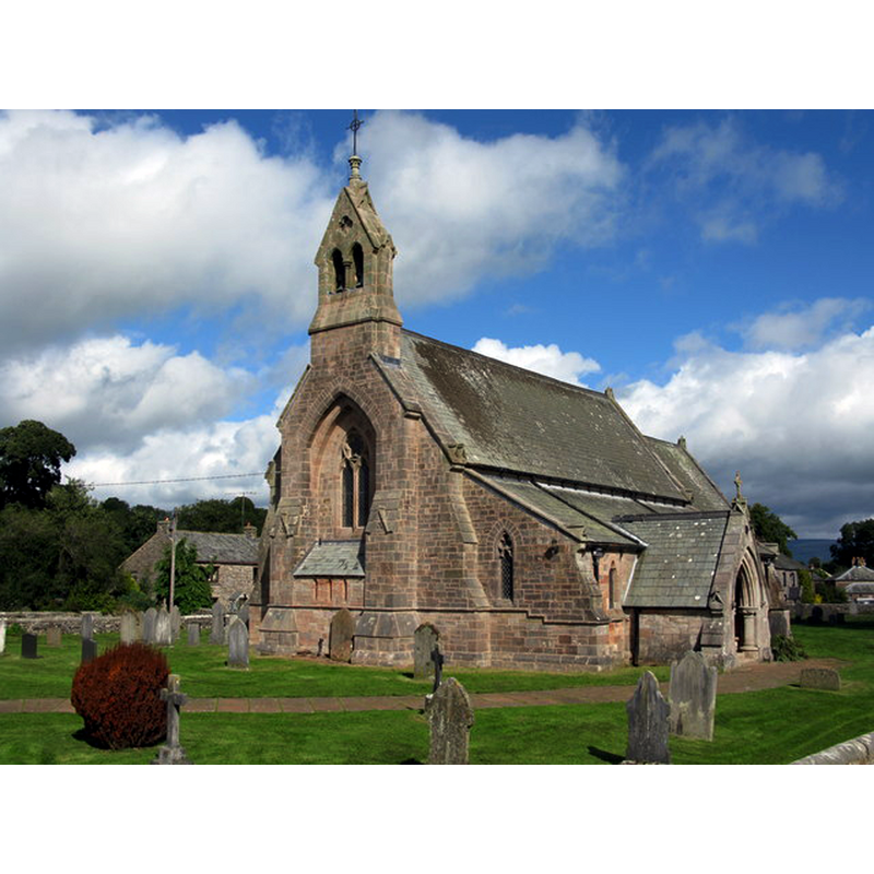
Scene Description: Photo caption: "As a place of worship, St Peter’s dates back at least to Norman times, with some evidence of a Saxon precursor. The earlier church was in a poor state of repair by 1861. The church was almost completely rebuilt in 1864/65 and was consecrated in 1866."
Copyright Statement: Image copyright © G Laird, 2013
Image Source: digital photograph taken 18 September 2013 by G Laird [www.geograph.org.uk/photo/3664014] [accessed 28 July 2014]
Copyright Instructions: CC-BY-SA-2.0
INFORMATION
Font ID: 19387ASB
Object Type: Baptismal Font1?
Font Century and Period/Style: 12th - 13th century, Medieval
Church / Chapel Name: Parish Church of St. Peter
Church Patron Saint(s): St. Peter
Church Address: Great Asby, Cumbria, CA16 6HD
Site Location: Cumbria, North West, England, United Kingdom
Directions to Site: Located 8 km S of Appleby-in-Westmorland, 25 km SE of Penrith
Ecclesiastic Region: Diocese of Carlisle
Historical Region: North Westmorland
Additional Comments: disappeared font? (the one from the medieval church here)
Font Notes:
Click to view
Curwen (1932) notes a church valued in the ""Antique Taxatio Ecclesiastica" of Pope Nicholas IV made in 1291". and in the "Novo Taxatio" of 1318. The present church is 19th-century. [NB: we have no information on the font of the original church here]
COORDINATES
UTM: 30U 532763 6040799
Latitude & Longitude (Decimal): 54.513722, -2.493931
Latitude & Longitude (DMS): 54° 30′ 49.4″ N, 2° 29′ 38.15″ W
REFERENCES
- Curwen, John F., The Later Records relating to North Westmorland: or the Barony of Appleby, Kendal: T. Wilson, 1932, p. 85-93 / [www.british-history.ac.uk/report.aspx?compid=43503] [accessed 28 July 2014]