Lewes No. 4
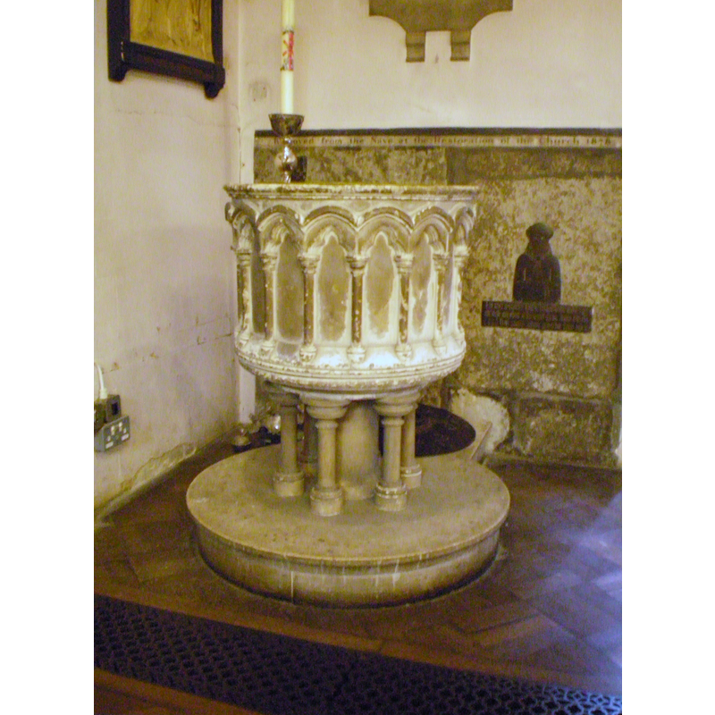
Image copyright © [in the public domain]
Released by its author into the public domain
Results: 3 records
view of font
Scene Description: the 19thC font
Copyright Statement: Image copyright © [in the public domain]
Image Source: digital photograph taken 19 September 2009 by Charlesdrakew [http://commons.wikimedia.org/wiki/File:Lewes_St._Michael's_Church_10.JPG] [accessed 26 July 2014]
Copyright Instructions: Released by its author into the public domain
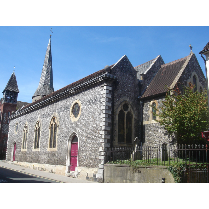
view of church exterior - southeast view
Copyright Statement: Image copyright © [in the public domain]
Image Source: digital photograph taken 19 August 2009 by The Voice of Hassocks
Copyright Instructions: Released by its author into the public domain
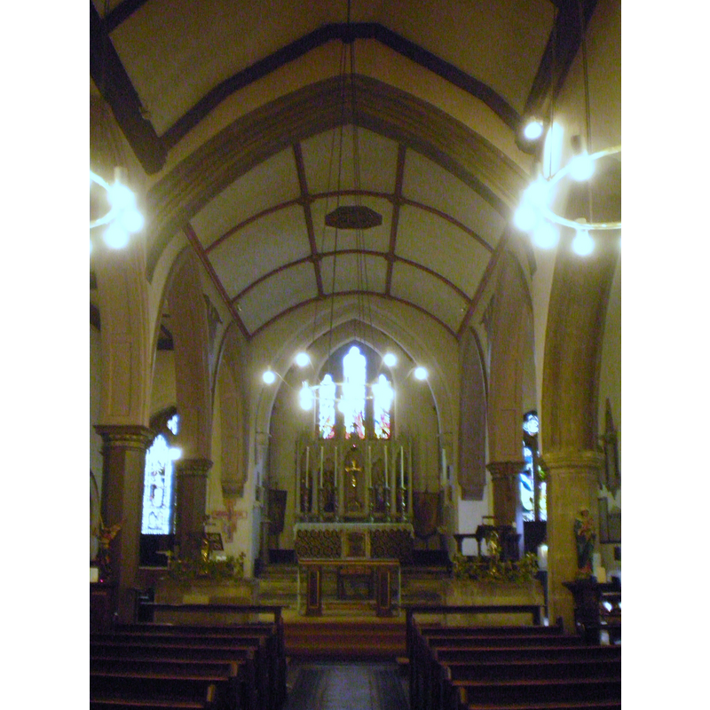
view of church interior - nave - looking east
Copyright Statement: Image copyright © [in the public domain]
Image Source: digital photograph taken 19 September 2009 by Charlesdrakew [http://commons.wikimedia.org/wiki/File:Lewes_St._Michael's_Church_11.JPG] [accessed 26 July 2014]
Copyright Instructions: Released by its author into the public domain
INFORMATION
Font ID: 19384LEW
Object Type: Baptismal Font1?
Font Century and Period/Style: 12th century, Late Norman
Church / Chapel Name: Parish Church of St. Michael / St. Michael-in-Lewes
Church Patron Saint(s): St. Michael
Church Notes: round-tower church -- original church probably 12thC; nave and aisles 13th-14thC
Church Address: Church Lane, Lewes, East Sussex BN7 2JA
Site Location: East Sussex, South East, England, United Kingdom
Ecclesiastic Region: Diocese of Chichester
Historical Region: Rape of Lewes -- Sussex
Additional Comments: disappeared font? (the one from the 12thC church here)
Font Notes:
Click to view
There are two entries for Lewes in the Domesday survey [http://domesdaymap.co.uk/place/TQ4110/lewes/] [accessed 26 September 2014], but neither mentions a church or cleric in it. The present font is modern; round basin with blind arcade of round arches; on central shaft and eight outer colonnettes. [NB: we have no information on the font of the original church here].
COORDINATES
UTM: 30U 710567 5639892
Latitude & Longitude (Decimal): 50.8723, -0.0071
Latitude & Longitude (DMS): 50° 52′ 20.28″ N, 0° 0′ 25.56″ W