Ellenbrook / Ellen Brook
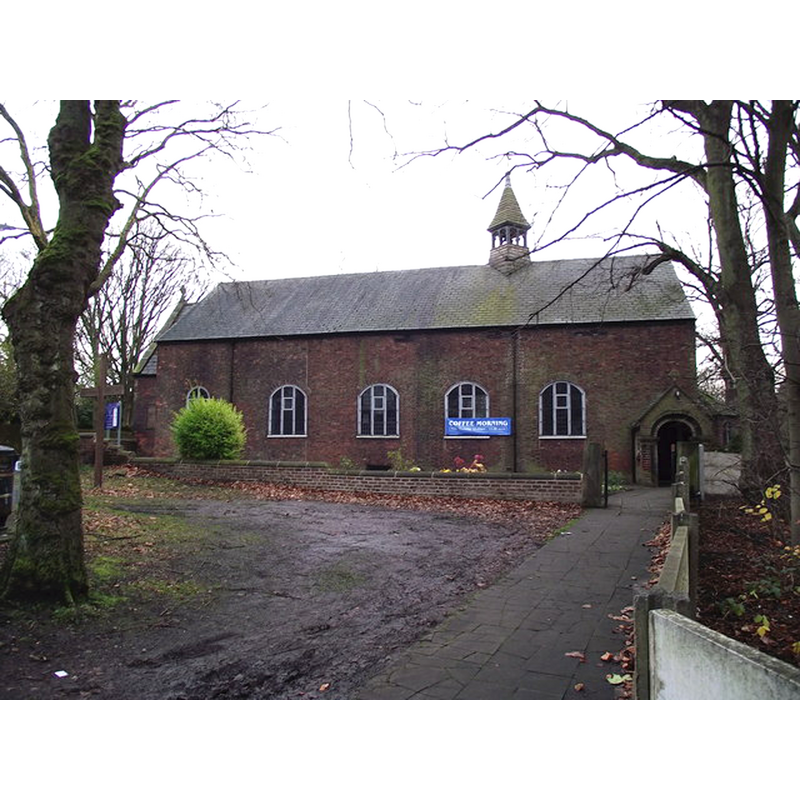
Image copyright © Phil Platt, 2011
CC-BY-SA-2.0
Results: 1 records
view of church exterior - north view
Copyright Statement: Image copyright © Phil Platt, 2011
Image Source: digital photograph taken 1 December 2011 by Phil Platt [www.geograph.org.uk/photo/2715820] [accessed 23 July 2014]
Copyright Instructions: CC-BY-SA-2.0
INFORMATION
Font ID: 19378ELL
Object Type: Baptismal Font1?
Font Century and Period/Style: 13th - 14th century, Medieval
Church / Chapel Name: Chapel of Ellen Brock [demolished; replaced by St. Mary's Chapel in 1725]
Church Patron Saint(s): St. Mary
Church Address: Ellenbrook Rd, Boothstown, Worsley, Greater Manchester, M28 1FR
Site Location: Greater Manchester, North West, England, United Kingdom
Directions to Site: Located SE of Tildesley, NW of Worsley
Ecclesiastic Region: Diocese of Manchester
Historical Region: Hundred of Salford
Additional Comments: coordinates given are for the present Chapel of St. Mary -- disappeared font? (was there ever a font here before 1700?)
Font Notes:
Click to view
No individual entry found for
The Victoria County History (Lancaster, vol. 4, 1911) notes: "The Abbot of Stanlaw, as rector of Eccles, between 1272 and 1295, granted his licence to Richard de Worsley to have a free chantry in his chapel of Worsley, provided that no loss was caused to the mother church [...] There is no continuous record of the chapel's existence [...] The fate of the chapel in the Reformation period is uncertain, but as the lords of Worsley appear to have conformed to the Elizabethan system without difficulty, service was probably continued in it with but little interruption [...] Since 1854 this chapel has been held with St. Mark's, Worsley, which was built by the first Earl of Ellesmere and opened in 1846". Not clear whether or not a font existed in the original chapel, or one of its later iterations before 1725.
The Victoria County History (Lancaster, vol. 4, 1911) notes: "The Abbot of Stanlaw, as rector of Eccles, between 1272 and 1295, granted his licence to Richard de Worsley to have a free chantry in his chapel of Worsley, provided that no loss was caused to the mother church [...] There is no continuous record of the chapel's existence [...] The fate of the chapel in the Reformation period is uncertain, but as the lords of Worsley appear to have conformed to the Elizabethan system without difficulty, service was probably continued in it with but little interruption [...] Since 1854 this chapel has been held with St. Mark's, Worsley, which was built by the first Earl of Ellesmere and opened in 1846". Not clear whether or not a font existed in the original chapel, or one of its later iterations before 1725.
COORDINATES
UTM: 30U 538721 5929105
Latitude & Longitude (Decimal): 53.50946, -2.41613
Latitude & Longitude (DMS): 53° 30′ 34.06″ N, 2° 24′ 58.07″ W