Chorlton-with-Hardy / Barlowe / Chollerton / Chollirton / Chorlton cum Hardy / Chourton
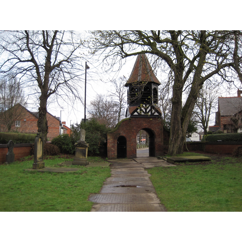
Image copyright © Paddy Griffin, 2010
CC-BY-SA-2.0
Results: 3 records
view of church exterior in context - churchyard, cemetery - detail
Scene Description: Source caption: "Lychgate. Looking towards Chorlton Green. The old churchyard".
Copyright Statement: Image copyright © Paddy Griffin, 2010
Image Source: digital photograph taken 2 April 2010 by Paddy Griffin [www.geograph.org.uk/photo/1813250] [accessed 6 March 2019]
Copyright Instructions: CC-BY-SA-2.0
view of church exterior - churchyard, cemetery
![Source caption: "St. Clement's Churchyard, Chorlton Cum Hardy. There isn't anything left of St. Clements other than an arch leading into the old churchyard and the flat gravestones. At the end of the churchyard you can see the Bowling Green pub". [coordinates for the old church site: DMS: 53° 26′ 16.8″ N, 2° 16′ 48″ W -- Decimal: 53.438, -2.28 -- UTM 30U 547829 5921238]](/static-50478a99ec6f36a15d6234548c59f63da52304e5/compressed/1190308015_compressed.png)
Scene Description: Source caption: "St. Clement's Churchyard, Chorlton Cum Hardy. There isn't anything left of St. Clements other than an arch leading into the old churchyard and the flat gravestones. At the end of the churchyard you can see the Bowling Green pub". [coordinates for the old church site: DMS: 53° 26′ 16.8″ N, 2° 16′ 48″ W -- Decimal: 53.438, -2.28 -- UTM 30U 547829 5921238]
Copyright Statement: Image copyright © D Johnston, 2003
Image Source: digital photograph taken 11 April 2003 by D Johnston [www.geograph.org.uk/photo/3699] [accessed 6 March 2019]
Copyright Instructions: CC-BY-SA-2.0
view of church exterior - northeast view
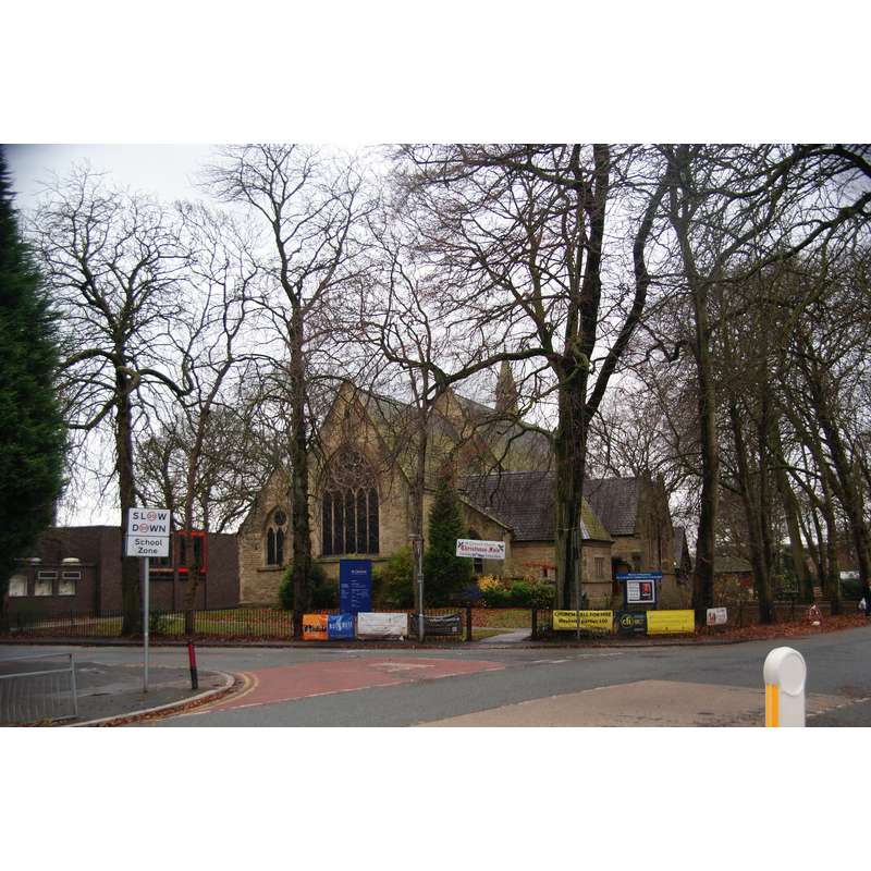
Scene Description: the new church on Edge Lane
Copyright Statement: Image copyright © Bill Boaden, 2013
Image Source: digital photograph taken 7 December 2013 by Bill Boaden [www.geograph.org.uk/photo/3775336] [accessed 22 July 2014]
Copyright Instructions: CC-BY-SA-2.0
INFORMATION
Font ID: 19375CHO
Object Type: Baptismal Font1?
Font Century and Period/Style: 16th century, Tudor
Church / Chapel Name: Parish Church of St. Clement
Church Patron Saint(s): St. Clement
Church Notes: original chapel dedicated to St Clement probably ca. 1512; re-built 1779; new larger church built on Edge Lane consecrated 1896; old church demolished 1949
Church Address: [new church address and coordinates]: Edge Lane, Chorlton-cum-Hardy, Greater Manchester, M21 9AE
Site Location: Greater Manchester, North West, England, United Kingdom
Directions to Site: Now a suburb of Manchester
Ecclesiastic Region: Diocese of Manchester
Historical Region: Hundred of Salford
Additional Comments: disappeared font? (the one from the early-16thC church here)
Font Notes:
Click to view
No individual entry found for Chorlton in the Domesday survey. The Victoria County History (Lancaster, vol. 4, 1911) notes: "The old chapel of Chorlton is believed to have been built about the beginning of the reign of Henry VIII [i.e., 1509- ] [...] it was taken down in 1779 and another erected, called St. Clement's. [...] A second church of St. Clement was consecrated in 1896, technically as a chapel of ease to the old one, which is still used." [NB: we have no information on the font of the original church here].
COORDINATES
UTM: 30U 547637 5921559
Latitude & Longitude (Decimal): 53.440908, -2.28283
Latitude & Longitude (DMS): 53° 26′ 27.27″ N, 2° 16′ 58.19″ W
REFERENCES
- Victoria County History [online], University of London, 1993-. URL: https://www.british-history.ac.uk.