Manchester No. 1 / Mametestre
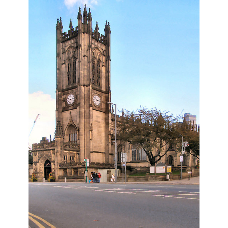
Image copyright © David Dixon, 2010
CC-BY-SA-2.0
Results: 5 records
view of church exterior - southwest view
Copyright Statement: Image copyright © David Dixon, 2010
Image Source: digital photograph taken 16 October 2010 by David Dixon [www.geograph.org.uk/photo/2114953] [accessed 22 July 2014]
Copyright Instructions: CC-BY-SA-2.0
view of church exterior in context - southwest view
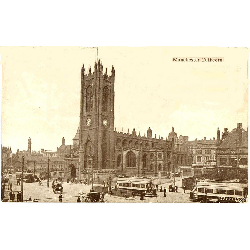
Scene Description: Photo caption: "With electric trams. Showing the "Old Curisoity Shop" in the right foreground registered 1903 "
Copyright Statement: Image copyright © [in the public domain]
Image Source: B&W photograph of 1903 [author unknown] reproduced by sean.cuill [http://commons.wikimedia.org/wiki/File:Manchester_Cathedral,_1903.jpg] [accessed 22 July 2014]
Copyright Instructions: PD
view of font and cover in context
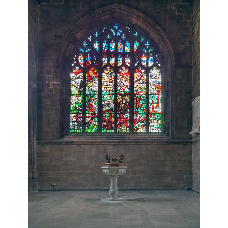
Scene Description: the modern font
Copyright Statement: Image copyright © David Dixon, 2014
Image Source: digital photograph taken 25 February 2014 by David Dixon [www.geograph.org.uk/photo/3869938] [accessed 22 July 2014]
Copyright Instructions: CC-BY-SA-2.0
view of font cover
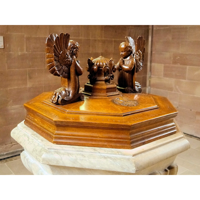
Scene Description: like the font, modern
Copyright Statement: Image copyright © David Dixon, 2014
Image Source: digital photograph taken 25 February 2014 by David Dixon [www.geograph.org.uk/photo/3869942] [accessed 22 July 2014]
Copyright Instructions: CC-BY-SA-2.0
view of font and cover

Scene Description: the modern font
Copyright Statement: Image copyright © Budby, 2011
Image Source: digital photograph taken 9 August 2011 by Budby [www.flickr.com/photos/30120216@N07/6029299069/] [accessed 22 July 2014]
Copyright Instructions: PERMISSION NOT AVAILABLE -- IMAGE NOT FOR PUBLIC USE
INFORMATION
Font ID: 19369MAN
Object Type: Baptismal Font1
Font Century and Period/Style: 10th - 11th century, Pre-Conquest? / Norman?
Church / Chapel Name: Cathedral Church of Our Lady, St. George and St. Denys [former collegiate church]
Church Patron Saint(s): St. Mary, St. George & St. Denis
Church Notes: orig. church here reported in 1086, but may have replaced a much earlier church;
Church Address: Victoria St, Manchester M3 1SX, United Kingdom -- Tel.: +44 161 833 2220
Site Location: Greater Manchester, North West, England, United Kingdom
Directions to Site: Located on Victoria Street, on the N side of Manchester city centre
Ecclesiastic Region: Diocese of Manchester
Historical Region: Hundred of Salford -- formerly Lancashire
Additional Comments: disappeared font? (the one from the Domesday-time church here, or an earlier church)
Font Notes:
Click to view
There is an entry for Manchester [variant spelling] in the Domesday survey [http://domesdaymap.co.uk/place/SJ8398/manchester/] [accessed 22 July 2014], and it reports two churches and churchlands in it. The Victoria County History (Lancashire, vol. 4, 1911) notes on this church; "The endowment of St. Mary's Church at Manchester is recorded in Domesday Book. [...] The church was made collegiate in 1421–2 by Thomas, Lord La Warre, the rector and patron, in honour of St. Mary, St. Denis, and St. George. [...] From the time of its becoming a collegiate church in 1421 its history can be set forth with some completeness, and of work older than this date enough remains, or can be shown to have existed [...] The oldest work still standing is to be found in the west arch and lower parts of the walls of the Lady chapel and in the eastern responds of the quire arcades. It dates from c. 1330, and implies a lengthening, or rebuilding, of the chancel of the old parish church at this date [...] The oldest worked stone yet found on the site is the relief of an angel holding a scroll with an inscription, perhaps 10th-century work; but with this exception no details earlier than the 13th century have come to light. The traditions of the occupation of this or a neighbouring site in Saxon times by a wooden building, though embellished by a good deal of circumstantial evidence, seem to have no more solid foundation than the similar stories told of so many ancient sites in England. [...] A fine 13th-century church certainly existed here, and was perhaps not the first stone building on the site. [...] The registers begin in 1573." The present font is modern. [NB: we have no information on the font of the original church here.
COORDINATES
UTM: 30U 550116 5926521
Latitude & Longitude (Decimal): 53.485278, -2.244722
Latitude & Longitude (DMS): 53° 29′ 7″ N, 2° 14′ 41″ W
REFERENCES
- Victoria County History [online], University of London, 1993-. URL: https://www.british-history.ac.uk.
- Victoria County History [online], University of London, 1993-. URL: https://www.british-history.ac.uk.