Atherton / Aderton / Chowbent
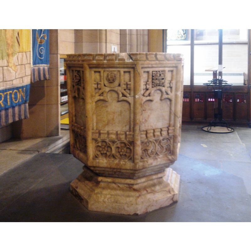
Image copyright © Martinevans123, 2014
CC-BY-SA-3.0
Results: 2 records
view of font
Scene Description: the modern font -- damaged; the pieces camented together
Copyright Statement: Image copyright © Martinevans123, 2014
Image Source: digital photograph taken 23 March 2014 by Martinevans123 [http://commons.wikimedia.org/wiki/File:Atherton_003.jpg] [accessed 15 July 2014]
Copyright Instructions: CC-BY-SA-3.0
view of church exterior - southeast view
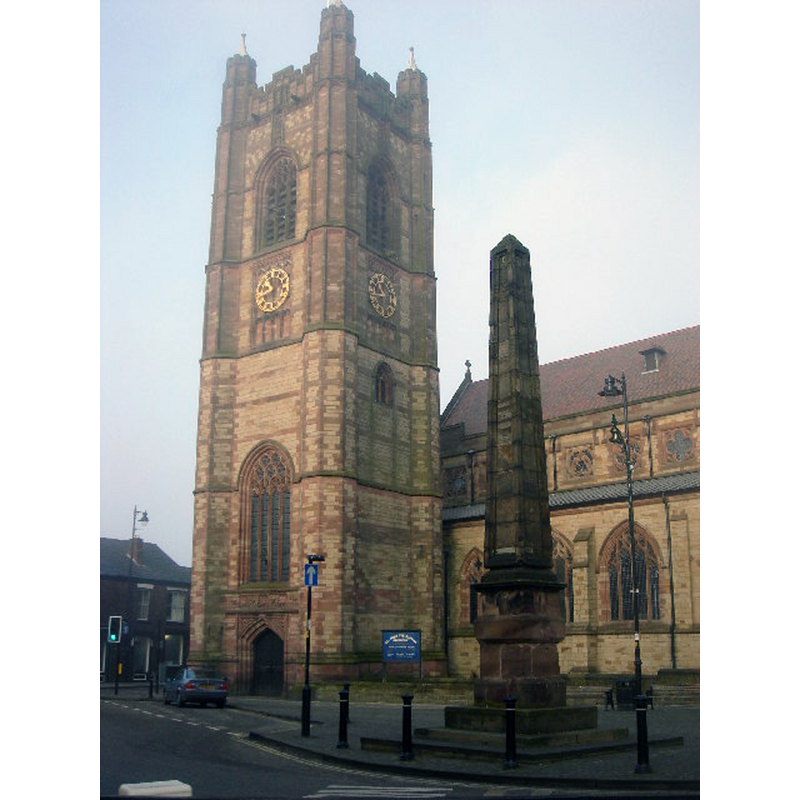
Scene Description: Photo caption: "St. Johns built 1879 at a cost of £24,000."
Copyright Statement: Image copyright © Margaret Clough, 2005
Image Source: digital photograph taken 13 December 2005 by Margaret Clough [www.geograph.org.uk/photo/90629] [accessed 15 July 2014]
Copyright Instructions: CC-BY-SA-3.0
INFORMATION
Font ID: 19355ATH
Object Type: Baptismal Font1?
Font Date: ca. 1645?
Font Century and Period/Style: 17th century(mid?)
Church / Chapel Name: Parish Church of St, John the Baptist
Church Patron Saint(s): St. John the Baptist
Church Address: Market Place, Atherton, Greater Manchester
Site Location: Greater Manchester, North West, England, United Kingdom
Directions to Site: Located 3 km NNE od Leigh, 21 km WNW of Manchester
Ecclesiastic Region: Diocese of Manchester
Historical Region: Hundred of West Derby
Additional Comments: disappeared font? (the one from the mid-17thC parochial chapel here)
Font Notes:
Click to view
The Victoria County History (Lancaster, vol. 3, 1907) notes; "The parochial chapel of St. John the Baptist at Chowbent was a small brick edifice erected in 1645 by John Atherton, esq., and his tenants, the one erecting the chancel, the others the body of the chapel. [...] The present church, the third to be erected upon the site, was consecrated in 1879, and is now described as the parish church of St. John the Baptist in Atherton." The VCH (ibid.) names James Smith as the incumbent ca, 1648. The present font is modern, perhaps of the date of the late-19th century building here; a polygonal basin with a confusing array of traditional decorations on it (Tudor roses, square flowers, trefoiled windows, crenellation, Ogee motifs, etc.) [NB: we have no information on the font of the mid-17th century parochial chapel here].
COORDINATES
UTM: 30U 533693 5931034
Latitude & Longitude (Decimal): 53.52715, -2.49173
Latitude & Longitude (DMS): 53° 31′ 37.74″ N, 2° 29′ 30.23″ W