Burscough / Borchestuoe / Borescou / Boureghe stide / Burcho / Buresco / Burgaschou / Burgastud / Burrestude / Burschehou / Burscho / Burschogh / Burschou / Burscogh
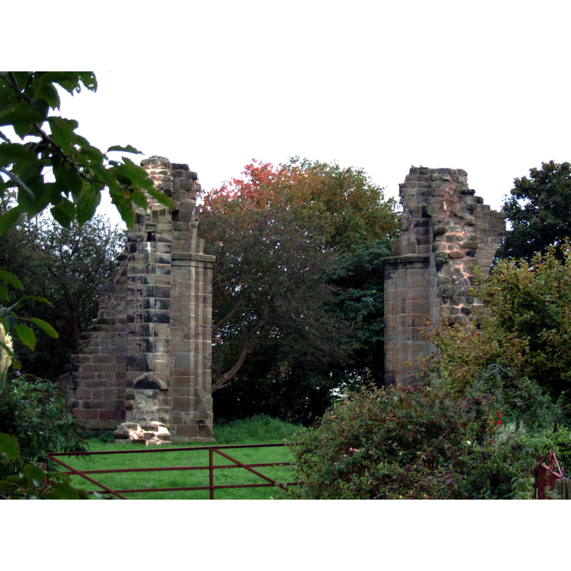
Image copyright © [in the public domain]
Released by its author into the public domain
Results: 2 records
view of church exterior
Scene Description: ruins of the old priory church
Copyright Statement: Image copyright © [in the public domain]
Image Source: digital photograph taken 30 September 2007 by Small-town hero [http://commons.wikimedia.org/wiki/File:Ruins_of_Burscough_Priory.JPG] [accessed 14 Juky 2014]
Copyright Instructions: Released by its author into the public domain
view of church exterior
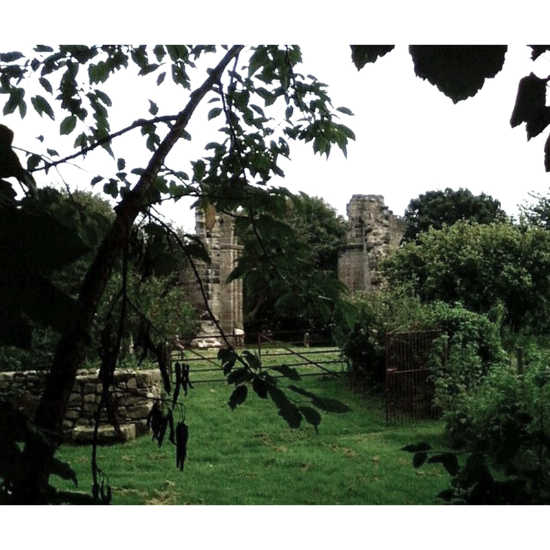
Scene Description: ruins of the old priory church
Copyright Statement: Image copyright © Dave Hamnett, 2008
Image Source: digital photograph taken 30 August 2008 by Dave Hamnett [http://commons.wikimedia.org/wiki/File:Burscough_Priory.jpg] [accessed 14 July 2014]
Copyright Instructions: CC-BY-SA-3.0
INFORMATION
Font ID: 19352BUR
Object Type: Baptismal Font1
Font Date: ca. 1190?
Font Century and Period/Style: 12th century (late?), Late Norman? / Transitional?
Church / Chapel Name: Priory Church [in ruins since late-16thC]
Font Location in Church: [cf. FontNotes]
Church Notes: Burscough Priory dates from ca. 1190; dissolved 1536;
Site Location: Lancashire, North West, England, United Kingdom
Directions to Site: Located 7 km N of Ormskirk
Historical Region: Hundred of West Derby
Additional Comments: moved font (originally from Burscough Priory Church moved to Lathom)
Font Notes:
Click to view
There is no entry for Burscough in the Domesday survey. The VCH (Lancaster, vol. 3, 1907) mentions "The foundation charter of the priory granted by the lord of Lathom in or about 1189 [...] Immediately after the surrender it was ordered that the buildings of the priory should be demolished. The earl of Derby was very reluctant to destroy the church, his ancestors having been buried there, and offered to maintain a priest if permission were granted. (fn. 13) This must have been denied as the buildings have been demolished, the only conspicuous fragments now remaining being the northern piers of the central tower; portions of old walls remain just below the surface of the ground. In 1886 a systematic exploration of the ground on which the church stood was carried out, and many interesting details and remains of the building were found. [...] The church was cruciform [...] The work is plain but good in design and workmanship, its date being c. 1280, and both transepts and the presbytery appear to have been of the same date. Whether any part of the older church was discovered is not stated, but the gap between the east wall of the cloisters and the south transept suggests that the former is on the site of the twelfth-century cloister, and preserved the old arrangement after the eastward enlargement of the church c. 1280. The plan of the nave also may represent that of the twelfth-century church. A careful and complete excavation of the site is much to be desired." [for the old baptismal font of the Priory church here cf. Index entry for Lathom]
COORDINATES
UTM: 30U 509525 5937215
Latitude & Longitude (Decimal): 53.5837, -2.856116
Latitude & Longitude (DMS): 53° 35′ 1.32″ N, 2° 51′ 22.02″ W
REFERENCES
- Victoria County History [online], University of London, 1993-. URL: https://www.british-history.ac.uk.
- Victoria County History [online], University of London, 1993-. URL: https://www.british-history.ac.uk.