Buttforde / Butaforda / Buteferde / Butefode / Butefoerde / Buthfoerde / Wittmund-Buttforde
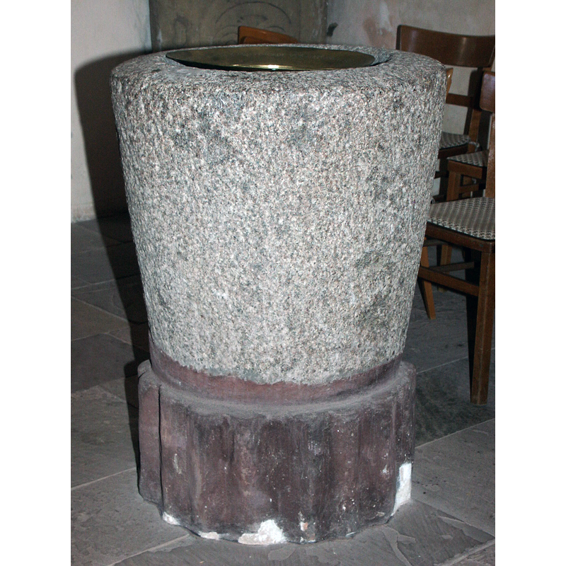
Image copyright © Evangelische-Lutherische Kirchenkreis Harlingerland, 2022
No lnown copyright restriction / Fair Dealing
Results: 5 records
view of font
Scene Description: Source caption: "Der Taufstein aus Granit stammt aus dem späten 12. Jahrhundert."
Copyright Statement: Image copyright © Evangelische-Lutherische Kirchenkreis Harlingerland, 2022
Image Source: digital photograph in the Evangelische-Lutherische Kirchenkreis Harlingerland [https://www.kirchenkreis-harlingerland.de/gemeinden/buttforde] [accessed 23 February 2022]
Copyright Instructions: No lnown copyright restriction / Fair Dealing
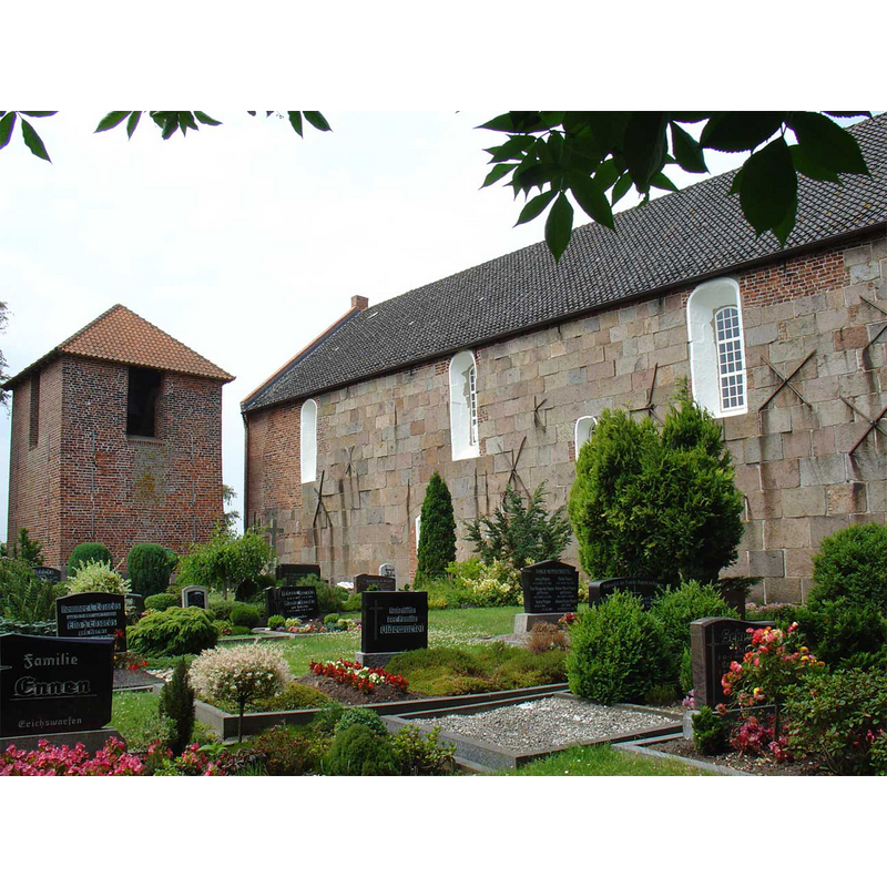
view of church exterior - southeast view
Copyright Statement: Image copyright © [in the public domain]
Image Source: digital photograph taken 3 July 2008 by Gouwenaar [http://commons.wikimedia.org/wiki/File:Mariakerk_Buttforde.jpg] [accessed 13 July 2014]
Copyright Instructions: Released by its author into the public domain
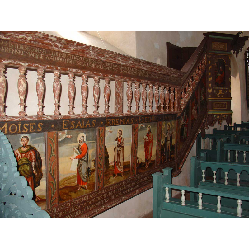
view of church interior - pulpit - detail
Copyright Statement: Image copyright © [in the public domain]
Image Source: digital photograph taken 3 July 2008 by Gouwenaar [http://commons.wikimedia.org/wiki/File:Preekstoel_Mariakerk_Buttforde.jpg] [accessed 13 July 2014]
Copyright Instructions: Released by its author into the public domain
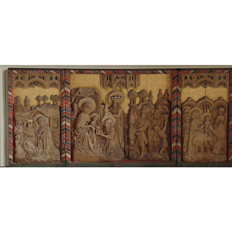
view of church interior - retable
Copyright Statement: Image copyright © [in the public domain]
Image Source: digital photograph taken 3 July 2008 by Gouwenaar [http://commons.wikimedia.org/wiki/File:Retabel_Mariakerk_Buttforde.jpg] [accessed 13 July 2014]
Copyright Instructions: Released by its author into the public domain
view of church interior - nave - looking east
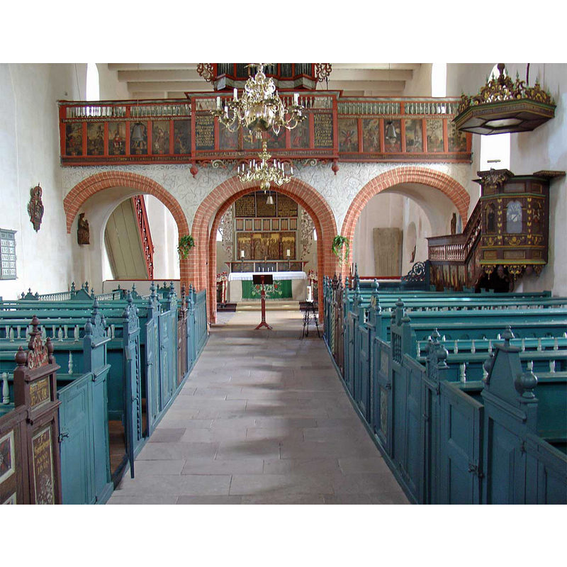
Copyright Statement: Image copyright © [in the public domain]
Image Source: digital photograph taken 3 July 2008 by Gouwenaar [http://commons.wikimedia.org/wiki/File:Interieur_Mariakerk_Buttforde.jpg] [accessed 13 July 2014]
Copyright Instructions: Released by its author into the public domain
INFORMATION
Font ID: 19350BUT
Object Type: Baptismal Font1
Font Century and Period/Style: 12th century (late?), Romanesque
Church / Chapel Name: Evangelisch-Lutherische Dorfkirche St.-Marien
Font Location in Church: Inside the church
Church Patron Saint(s): St. Mary the Virgin
Church Notes: possible wooden church here previous to the stone church of the early-13thC [ca. 1230?];
Church Address: Neudorfer Weg 1, Buttforde, 26409 Wittmund, Germany
Site Location: Ostfriesland, Niedersachsen, Germany, Europe
Directions to Site: Located off the B210, near Harlebucht, in the municipality of Wittmund
Ecclesiastic Region: Bistum Bremen
Font Notes:
Click to view
Noted in Kiesow (2010) as a plain granite baptismal font of the late-12th century. The entry for Buttforde in the Evangelische-Lutherische Kirchenkreis Harlingerland [https://www.kirchenkreis-harlingerland.de/gemeinden/buttforde] [accessed 23 February 2022] notes and illustrates a granite tub vessel dated late-12th century ["Der Taufstein aus Granit stammt aus dem späten 12. Jahrhundert"]. An old holy-water stoup believed to be originally from this church was reported found in a local garden in the 1950s [NB: we have no information on its present whereabouts].
Credit and Acknowledgements: We are grateful to Pol Herman for his help in documenting this font
COORDINATES
UTM: 32U 415688 5942157
Latitude & Longitude (Decimal): 53.621417, 7.725278
Latitude & Longitude (DMS): 53° 37′ 17.1″ N, 7° 43′ 31″ E
MEDIUM AND MEASUREMENTS
Material: stone, granite
Font Shape: tub-shaped
Basin Interior Shape: round
Basin Exterior Shape: round
REFERENCES
- Kiesow, Gottfried, Architekturführer Ostfriesland, Bonn: Deutsche Stiftung Denkmalschutz, 2010, p. 346