Ribnitz / Ribnitz-Damgarten
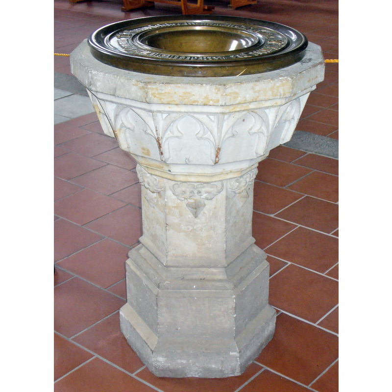
Image copyright © Colin Smith, 2014
Image and permission received (e-mail of 7 July 2014)
Results: 6 records
view of font and baptismal dish
Scene Description: the modern font
Copyright Statement: Image copyright © Colin Smith, 2014
Image Source: digital photograph taken 3 June 2014 by Colin Smith
Copyright Instructions: Image and permission received (e-mail of 7 July 2014)
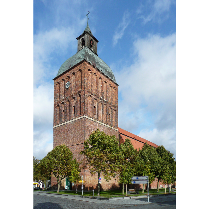
view of church exterior - northeast view
Copyright Statement: Image copyright © Darkone, 2004
Image Source: digital photograph taken 3 August 2004 by Darkone [http://commons.wikimedia.org/wiki/File:Ribnitz_Marienkirche_1.jpg] [accessed 7 July 2014
Copyright Instructions: CC-BY-SA-2.0
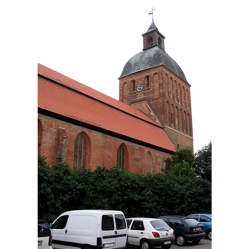
view of church exterior in context - southeast view
![Photo caption: "Market place in Ribnitz-Damgarten [...] view from the fountain to St Mary's church."](/static-50478a99ec6f36a15d6234548c59f63da52304e5/compressed/1140707008_compressed.png)
Scene Description: Photo caption: "Market place in Ribnitz-Damgarten [...] view from the fountain to St Mary's church."
Copyright Statement: Image copyright © Rimshot, 2007
Image Source: digital photograph taken 7 October 2007 by Rimshot [http://commons.wikimedia.org/wiki/File:Fountain_and_St_Mary's_church_in_RDG_1.jpg] [accessed 7 July 2014]
Copyright Instructions: CC-BY-SA-2.5
view of church exterior - southwest view
Copyright Statement: Image copyright © Norbert Kaiser, 2008
Image Source: digital photograph taken 1 October 2008 by Norbert Kaiser [http://commons.wikimedia.org/wiki/File:Ribnitz-Damgarten_Marienkirche_(01).jpg] [accessed 7 July 2014]
Copyright Instructions: CC-BY-SA-3.0
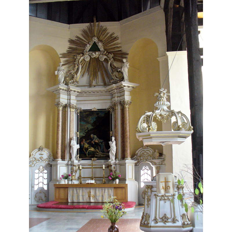
view of church interior - chancel
Copyright Statement: Image copyright © Colin Smith, 2014
Image Source: digital photograph taken 3 June 2014 by Colin Smith
Copyright Instructions: Image and permission received (e-mail of 7 July 2014)
view of baptismal dish
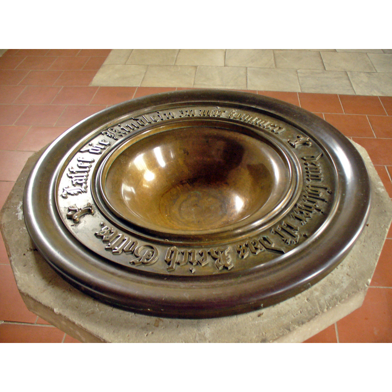
Copyright Statement: Image copyright © Colin Smith, 2014
Image Source: digital photograph taken 3 June 2014 by Colin Smith
Copyright Instructions: Image and permission received (e-mail of 7 July 2014)
INFORMATION
Font ID: 19336RIB
Object Type: Baptismal Font1
Font Century and Period/Style: 13th century, Late Romanesque / Early Gothic?
Church / Chapel Name: Evangelisch-Lutherische Stadtkirche St. Marien / Marienkirche Ribnitz
Font Location in Church: Inside the church, at the E end of the nave, N side
Church Patron Saint(s): St. Mary the Virgin
Church Notes: church here first documented 1233; soon expanded; many additions and restorations through times; fire in 1759; re-built
Church Address: Neue Klosterstr. 17, 18311 Ribnitz-Damgarten, Germany -- Tel.: (03821) 6090003
Site Location: Vorpommern-Rügen, Mecklenburg-Vorpommern, Germany, Europe
Directions to Site: Located right on the old border between the historical regions of Mecklenburg and Pomerania; Ribnitz in on the Mecklenburg side
Additional Comments: disappeared font? (the one from the original 13thC church here)
Font Notes:
Click to view
The present baptismal font consists of a dodecagonal (?) basin decorated with as many trefoiled arch-heads; raised on a hexagonal pedestal base of two volumes, the upper one ornamented with foliage motifs. Baptismal dish with inscription; also modern. [NB: we have no information on the font of the 13th-century church here].
COORDINATES
UTM: 33U 332582 6013657
Latitude & Longitude (Decimal): 54.243464, 12.430639
Latitude & Longitude (DMS): 54° 14′ 36.47″ N, 12° 25′ 50.3″ E