Hamburg No. 1 / Hammaburg
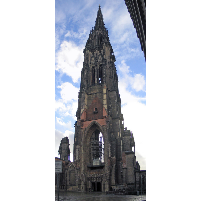
Image copyright © AlterVista, 2004
CC-BY-SA-3.0-migrated
Results: 2 records
view of church exterior - west tower
Scene Description: in ruins
Copyright Statement: Image copyright © AlterVista, 2004
Image Source: digital photograph taken September 2004 by AlterVista [http://commons.wikimedia.org/wiki/File:Hamburg_StNikolai_Panorama.jpg] [accessed 5 July 2014]
Copyright Instructions: CC-BY-SA-3.0-migrated
view of church exterior - northeast view
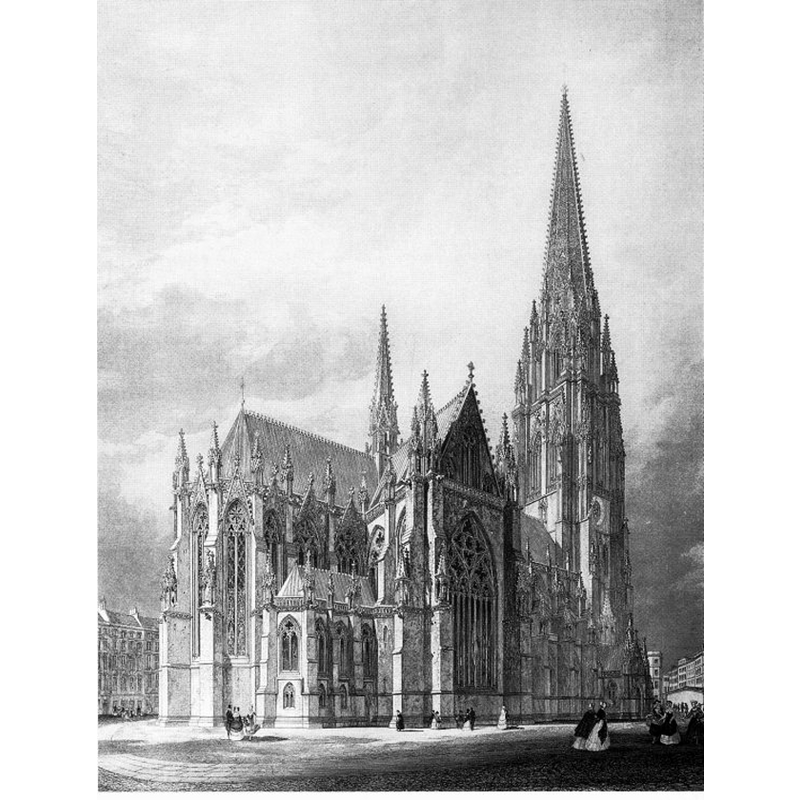
Scene Description: re-building plan after the destruction by fire in 1842
Copyright Statement: Image copyright © [in the public domain]
Image Source: 1846 steel engraving with Sir Gilbert Scott's final draft for the reconstruction of this church; reproduced in Eberhard Petzold, Sylvester M. Robert: Mahnmal St. Nikolai. (Hamburg: Historika Photoverlag,1995 [http://commons.wikimedia.org/wiki/File:Nikolaikirche_Hamburg_Entwurf.jpg] [accessed 5 July 2014]
Copyright Instructions: PD
INFORMATION
Font ID: 19327HAM
Object Type: Baptismal Font1
Font Century and Period/Style: 12th century (late?), Romanesque
Church / Chapel Name: Evangelisch-lutherische St.-Nikolai-Kirche / Haputkirche St. Nikolai [in ruins]
Font Location in Church: [disappeared]
Church Patron Saint(s): St. Nicholas of Myra
Church Notes: original wooden church started here 1189; three-nave brick church built in 14thC; burned down in 1842; re-built a/p Sir GG Scott's design; damaged in WWI Allied bombings; nave demolished in 1951; no reconstruction planned -- the crypt houses a museum
Church Address: Willy-Brandt-Straße 60, 20457 Hamburg, Germany
Site Location: Hamburg, Hamburg, Germany, Europe
Directions to Site: Located in the city's Harvestehude district
Ecclesiastic Region: Bistum Hamburg-Bremen
Additional Comments: disappeared font? (the one of the original late-12thC church here)
Font Notes:
Click to view
[NB: we have no information on the font of the original church here].
COORDINATES
UTM: 32U 565632 5933635
Latitude & Longitude (Decimal): 53.5475, 9.990556
Latitude & Longitude (DMS): 53° 32′ 51″ N, 9° 59′ 26″ E