Ormesby No. 1 / Ormesbei / Ormesbej / Ormesbi / Ormesbie / Ormesbye / Ormsby / Ormysby / Ormysbye
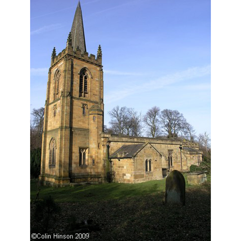
Image copyright © Colin Hinson, 2009
Standing permission
Results: 3 records
view of church exterior - southwest view
Copyright Statement: Image copyright © Colin Hinson, 2009
Image Source: digital photograph taken 17 March 2009 by Colin Hinson
Copyright Instructions: Standing permission
view of church exterior - southeast view
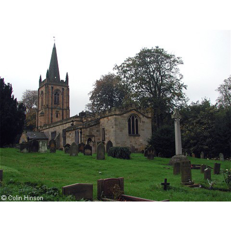
Copyright Statement: Image copyright © Colin Hinson, 2009
Image Source: digital photograph taken 17 March 2009 by Colin Hinson
Copyright Instructions: Standing permission
view of church exterior - northeast view
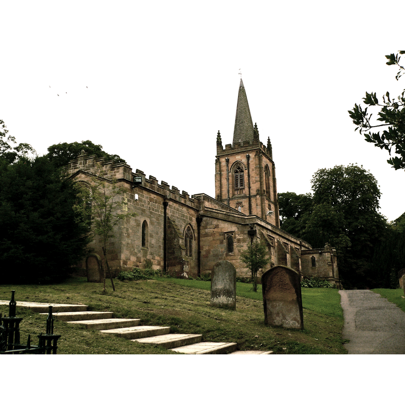
Copyright Statement: Image copyright © Francis Hannaway, 2010
Image Source: digital photograph taken 17 August 2010 by Francis Hannaway [http://en.wikipedia.org/wiki/File:Ormesby_St_Cuthberts_Church_1.jpg] [accessed 29 May 2014]
Copyright Instructions: CC-BY-SA-3.0
INFORMATION
Font ID: 19235ORM
Object Type: Baptismal Font1, basin only
Font Century and Period/Style: 12th century, Late Norman
Church / Chapel Name: Parish Church of St. Cuthbert
Font Location in Church: [cf. FontNotes]
Church Patron Saint(s): St. Cuthbert [aka Cubertus]
Church Notes: church of the 12thC said to have Anglo-Saxon foundations; re-built in the late-19thC
Church Address: 50 Church Ln, Ormesby, Middlesbrough TS7 9AU, UK -- Tel.: +44 1642 314445
Site Location: North Yorkshire, Yorkshire and the Humber, England, United Kingdom
Directions to Site: Located off (NW) the A171-A174 crossroads, 4 km SE the centre of Middlesbrough, 10 km W of Guisborough
Ecclesiastic Region: Diocese of York
Historical Region: Hundred of Lanbaurgh / Wapentake and liberty of Langbargh
Additional Comments: disappeared font? (the one from the pre-Conquest church here [cf. FontNotes])
Font Notes:
Click to view
There is an entry for Ormesby [variant spelling] in the Domesday survey [http://domesdaymap.co.uk/place/NZ5316/ormesby/] [accessed 29 May 2014], and it reports a church and a priest in it. The entry for this parish in the Victoria County History (York North Riding, vol. 2, 1923) notes: "There was a church with a priest at Ormesby in 1086 ([...] the church was granted to Guisborough by Arnald de Percy at the foundation of that house, [...] the gift being confirmed by Robert de Brus, [...] by succeeding generations of Percys, [...] and by Henry II. [...] It was appropriated to the priory and a vicarage was ordained. [...] At the Dissolution it came to the Crown, and the rectory and advowson were in 1545 granted to the Archbishop of York [...] The church, dedicated to St. Cuthbert, stands amidst trees to the west of the village, in a position of much beauty. [...] [It] was almost entirely rebuilt in 1875, and the structure has therefore little or no antiquarian interest. A number of old stones, however, and other fragments of the ancient building are incorporated with the walls or are preserved inside the church. Three of these are of pre-Conquest date, one a small fragment with flat strap ornament, outside the east wall of the organ chamber, and another with plait and cheveron pattern in the south wall of the nave, perhaps portions of grave slabs. The ocher is part of a hog-back with tegulated ornament. [...] The old church is described by Graves, about 1808, as consisting of chancel, nave and strong square tower, the chancel and tower being more modern than the nave, with a circular chancel arch and a south doorway with zigzag moulding partly built up. [...] From this it would appear that the nave was substantially of 12th-century date, and among the fragments now preserved in the church are a Norman impost stone and capital carved with spiral pattern, and the bowl of a large circular font, without ornament, but apparently belonging to the same period. [...] Amongst the fragments already mentioned, now preserved at the east end of the aisle, are a stoup, a female effigy and the feet of a male figure resting on a lion. Built into the south wall of the vestry outside are two mediaeval grave slabs, one with a floreated cross and sword and the other with a cross head within a circle. In the south wall of the nave and the east wall of the organ chamber are built eight other grave slabs, or fragments of such, with crosses and the customary symbols, one a chalice." [NB: we have found no confirmation that the old font and stoup are still in the church at present].
COORDINATES
UTM: 30U 617735 6045484
Latitude & Longitude (Decimal): 54.5432, -1.18
Latitude & Longitude (DMS): 54° 32′ 35.52″ N, 1° 10′ 48″ W
MEDIUM AND MEASUREMENTS
Material: stone
Font Shape: round
Basin Exterior Shape: round
REFERENCES
- Victoria County History [online], University of London, 1993-. URL: https://www.british-history.ac.uk.