Tunstall nr. Newcastle / Tunestal
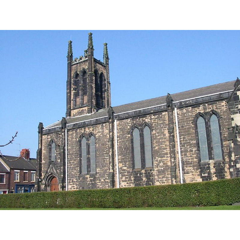
Image copyright © Clive Woolliscroft, 2007
CC-BY-SA-2.0
Results: 1 records
view of church exterior - south view
Copyright Statement: Image copyright © Clive Woolliscroft, 2007
Image Source: digital photograph taken 26 March, 2007 by Clive Woolliscroft [www.geograph.org.uk/photo/489845] [accessed 3 May 2015]
Copyright Instructions: CC-BY-SA-2.0
INFORMATION
Font ID: 19210TUN
Object Type: Baptismal Font1
Church / Chapel Name: Christ Church
Church Patron Saint(s): Jesus Christ
Church Notes: "Tunstall Christ Church was created in 1837 from Wolstanton, Staffordshire Ancient Parish. Subsequent mission churches of Tunstall St Aidan and Tunstall St Chad were formed from the parish" [source: https://familysearch.org/learn/wiki/en/Tunstall_Christ_Church,_Staffordshire [accessed 14 May 2014]]
Church Address: High Street/Furlong Road, Tunstall, Tunstall, Staffordshire, ST6 5EJ -- Tel.: +44 1782 838288
Site Location: Staffordshire, West Midlands, England, United Kingdom
Directions to Site: Located in the parish of Wolstanton, E of Adbaston, 7 km NNE of Newcastle, in the borough of Stoke-on-Trent
Ecclesiastic Region: Diocese of Lichfield
Historical Region: Hundred of Pirehill [in Domesday]
Font Notes:
Click to view
There is an entry for Tunstall [variant spelling] in the Domesday surbey [http://domesdaymap.co.uk/place/SJ7727/tunstall/] [accessed 14 May 2014], but it mentions neither church nor cleric in it. The Victoria County History (Stafford, vol. 8, 1963) describes Tunstall as: "the most northerly of the six towns incorporated in the new borough of Stoke-on-Trent in 1910 [...] Tunstall manor, also called Tunstall Court from the 16th century, [...] covered an area which extended to the Cheshire border and included the following townships: Tunstall, Chell, Oldcott, and Ravenscliffe; Burslem and Sneyd; and Chatterley, Brieryhurst, Stadmorslow, Thursfield, Wedgwood, and Bemersley. [...] In 1086 Tunstall may have formed part of Thursfield (in Wolstanton), [...] Between 1212 and 1273 Tunstall, Bemersley, Burslem, Chatterley, Chell, Oldcott, and Thursfield, as well as Whitfield within the Bemersley portion of Tunstall manor, were mentioned as distinct manors or vills, [...] but all, except for Chell, had been merged within the manor of Tunstall by the end of the 13th century. [...] Tunstall, Oldcott, Ravenscliffe, and Chell originally formed part of the chapelry of Newchapel within the ancient parish of Wolstanton. (fn. 350) In the 12th century there was evidently a holy well and hermitage at Tunstall, the property of Trentham Priory, and this presumably lay in the district now known as Holy Wall. [...] By 1366 the lord of Tunstall manor had a chapel in his house at Holy Wall. (fn. 352) A graveyard at Chell was mentioned in 1569. [...] There does not, however, appear to have been a church in Tunstall before the 19th century. [...] C[hrist] C[hurch], Tunstall, was built in 1831–2 [...] The only possible evidence to the contrary is the former open field called Church Field, which evidently lay to the W. of the town, and the discovery at various times of human bones in that area". The VCH (ibid.) gives later dates for the other churches in the area. [NB: we have no information
COORDINATES
UTM: 30U 552895 5879569
Latitude & Longitude (Decimal): 53.062988, -2.21066
Latitude & Longitude (DMS): 53° 3′ 46.76″ N, 2° 12′ 38.38″ W
REFERENCES
- Victoria County History [online], University of London, 1993-. URL: https://www.british-history.ac.uk.