Hainford / Hamford / Hamforda / Hayneford / Haynford
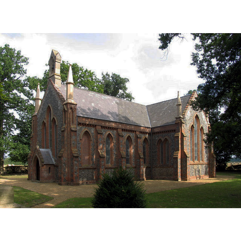
Image copyright © John Salmon, 2005
CC-BY-SA-3.0
Results: 3 records
view of church exterior
Scene Description: the new church
Copyright Statement: Image copyright © John Salmon, 2005
Image Source: digital photograph taken 1 September 2005 by John Salmon [www.geograph.org.uk/photo/319025] [accessed 15 April 2014]
Copyright Instructions: CC-BY-SA-3.0
view of church exterior - west tower
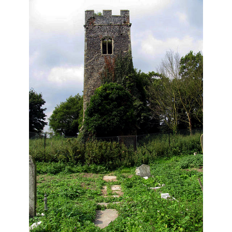
Scene Description: ruins of the old church in 2005
Copyright Statement: Image copyright © John Salmon, 2005
Image Source: digital photograph taken 1 September 2005 by John Salmon [www.geograph.org.uk/photo/319030] [accessed 15 April 2014]
Copyright Instructions: CC-BY-SA-3.0
view of church exterior - west tower
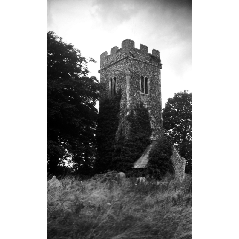
Scene Description: Photo caption: "Serving as a mortuary chapel only, the remainder ruinated when a new church built nearer the village in 1840"
Copyright Statement: Image copyright © George Plunkett, 2014
Image Source: B&W photograph taken 18 September 1965 by George Plunkett [www.georgeplunkett.co.uk/Norfolk/H/Hainford All Saints church tower ruin [5028] 1965-09-18.jpg] [accessed 15 April 2014]
Copyright Instructions: Standing permission by Jonathan Plunkett
INFORMATION
Font ID: 19152HAI
Object Type: Baptismal Font1?
Font Century and Period/Style: 13th century (late?), Medieval
Church / Chapel Name: Old Parish Church of All Saints [in ruins]
Church Patron Saint(s): All Saints
Church Address: Old Church Road, Hainford, Norfolk NR10 3BG
Site Location: Norfolk, East Anglia, England, United Kingdom
Directions to Site: Located off the A140, S of Hevingham, 10 km N of Norwich
Ecclesiastic Region: Diocese of Norwich
Historical Region: Hundred of Taverham
Additional Comments: disappeared font? (the one from the the 13thC church here)
Font Notes:
Click to view
There is an entry for Hainford [variant spelling] in the Domesday book [http://domesdaymap.co.uk/place/TG2218/hainford/] [accessed 15 April 2014], but it mentions neither church or cleric in it. Blomefield (1805-1810) writes: "The Church is a rectory, dedicated to All-Saints [...] Rectors. In the 25th of Edward I [i.e., 1297] Mr. Thomas de Kerdeston, conveyed his right of patronage, to William Roselyn." Knott (2009) informs: "After the old church was abandoned, its graveyard remained in use, and does so to this day. What we were looking at was obviously a Victorian mortuary chapel, a place where the coffin could rest and the funeral be celebrated on site, without need for the deceased to be brought from the new church for burial. Today, the chapel is also in ruins, and the entire structure is surrounded by high chain link fencing to keep people out".
Credit and Acknowledgements: We are grateful to Jonathan Plunkett for the photograph of this church, taken by his father, George Plunkett, in September 1965
COORDINATES
UTM: 31U 385219 5843396
Latitude & Longitude (Decimal): 52.728244, 1.300249
Latitude & Longitude (DMS): 52° 43′ 41.68″ N, 1° 18′ 0.89″ E
REFERENCES
- Blomefield, Francis, An essay towards a topographical history of Norfolk, 1805-1810, vol. 10: 422-424 / [www.british-history.ac.uk/report.aspx?compid=78709] [accessed 15 April 2014]