Little Ringstead / Barret Ringstead / Rincteda / Ringstead Barrett / Ringstead Parva / Ringsted Barrett / Ringsted Parva / Little Ringstead / Little Ringsted
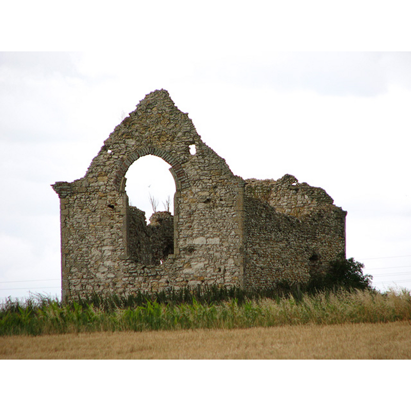
Image copyright © Evelyn Simak, 2010
CC-BY-SA-3.0
Results: 2 records
view of church exterior - northeast view
Scene Description: the ruins of the abandoned church
Copyright Statement: Image copyright © Evelyn Simak, 2010
Image Source: digital photograph taken 18 August 2010 by Evelyn Simak [www.geograph.org.uk/photo/2019771] [accessed 7 April 2014]
Copyright Instructions: CC-BY-SA-3.0
view of church exterior in context
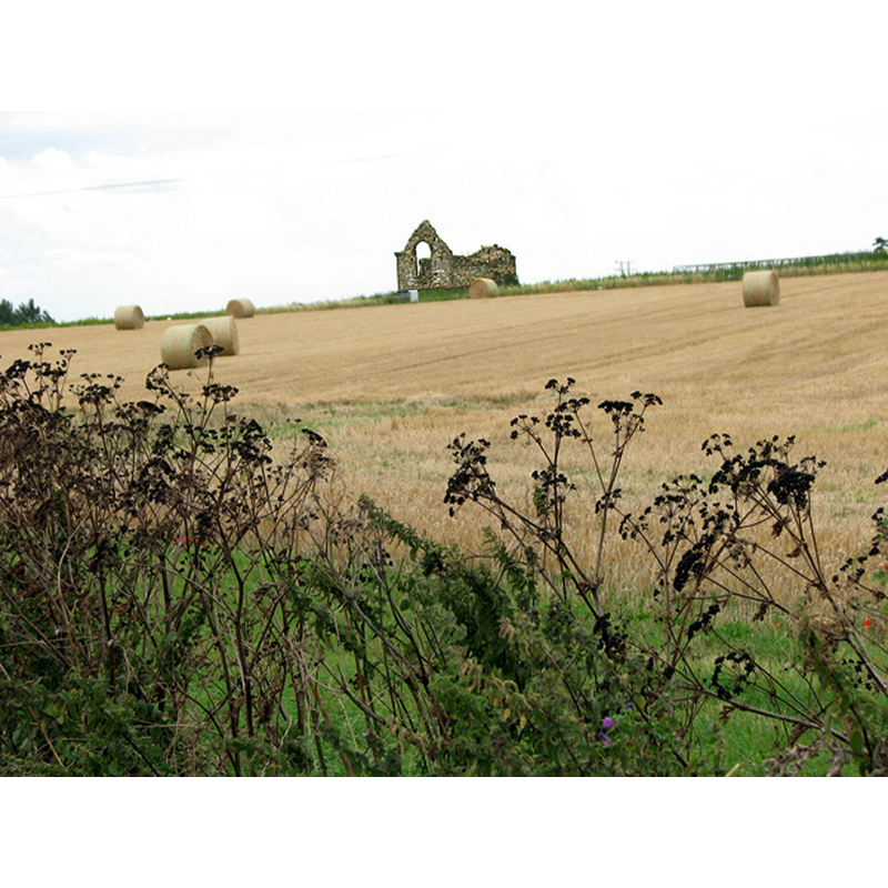
Scene Description: the ruins of the old church in the fields where the hamlet once stood
Copyright Statement: Image copyright © Evelyn Simak, 2010
Image Source: digital photograph taken 18 August 2010 by Evelyn Simak [www.geograph.org.uk/photo/2019772] [accessed 7 April 2014]
Copyright Instructions: CC-BY-SA-3.0
INFORMATION
Font ID: 19136RIN
Object Type: Baptismal Font1?
Font Century and Period/Style: 13th century, Early English
Church / Chapel Name: Parish Church of St. Andrew [in ruins]
Church Patron Saint(s): St. Andrew
Church Notes: "Evelyn Simak [www.geograph.org.uk/photo/2019771] [accessed 7 April 2014] writes: "The village of Little Ringstead was depopulated by the plague in 1349 and by the 18th century only one farm remained. The ruin stands in the middle of a large cultivated field on private farmland. The nearest buildings today are at Downs Farm".
Site Location: Norfolk, East Anglia, England, United Kingdom
Directions to Site: Village abandoned in the 14thC. Nearest location is the Downs Farm
Additional Comments: disappeared font? (the one from the 13thC church here)
Font Notes:
Click to view
[NB: there appears to be some confusion in reading some early sources on the two Ringsteads, Magna and Parva. Chambers (1829) writes of two parishes (St. Andrew and St. Peter) in Magna, but "nothing worhty of observation" in Parva, aka Barret Ringstead -- other sources identify St. Andrew's with Magna and St. Peter's with Parva]
There are five entries for Ringstead in the Domesday survey [http://domesdaymap.co.uk/place/TF7040/ringstead/] [accessed 7 April 2014], neither of which mention a church or cleric in it. Blomefield (1805-1810) writes: "The Church of Ringstead Parva (called also Barret Ringstead) had anciently two medieties or portions; Richard de Boylound was patron of one, of which Nicholas was rector in Edward the First's time, and the heirs of Hamon Byrlingham were patrons of the other, the rector of which served the cure, and had no manse or land belonging to the church [...] the church was dedicated to St. Andrew. [...] 1526 [...] About this time it is called the church or free chapel of Ringstead Parva, valued at 66s. 8d. and has been dilapidated many years."
There are five entries for Ringstead in the Domesday survey [http://domesdaymap.co.uk/place/TF7040/ringstead/] [accessed 7 April 2014], neither of which mention a church or cleric in it. Blomefield (1805-1810) writes: "The Church of Ringstead Parva (called also Barret Ringstead) had anciently two medieties or portions; Richard de Boylound was patron of one, of which Nicholas was rector in Edward the First's time, and the heirs of Hamon Byrlingham were patrons of the other, the rector of which served the cure, and had no manse or land belonging to the church [...] the church was dedicated to St. Andrew. [...] 1526 [...] About this time it is called the church or free chapel of Ringstead Parva, valued at 66s. 8d. and has been dilapidated many years."
COORDINATES
UTM: 31U 332416 5867438
Latitude & Longitude (Decimal): 52.930397, 0.506648
Latitude & Longitude (DMS): 52° 55′ 49.43″ N, 0° 30′ 23.93″ E
REFERENCES
- Blomefield, Francis, An essay towards a topographical history of Norfolk, 1805-1810, vol. 10: 345-348 / [www.british-history.ac.uk/report.aspx?compid=78690] [accessed 7 April 2014]