Bircham Tofts / Stofstan / Stony Tofts / Storstan
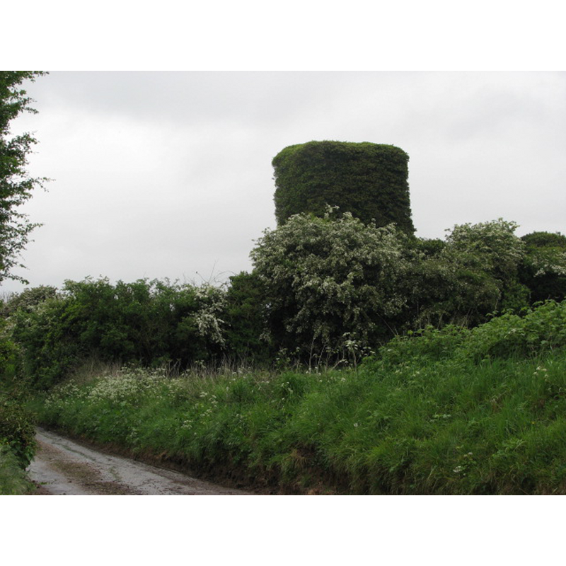
Image copyright © Evelyn Simak, 2007
CC-BY-SA-3.0
Results: 2 records
view of church exterior - west tower
Scene Description: Photo caption: "The ruin of St Andrew's church, Bircham Tofts. View of tower from Church Lane."
Copyright Statement: Image copyright © Evelyn Simak, 2007
Image Source: digital photograph taken 15 May 2007 by Evelyn Simak [www.geograph.org.uk/photo/519941] [accessed 31 March 2014]
Copyright Instructions: CC-BY-SA-3.0
view of church exterior - northeast view
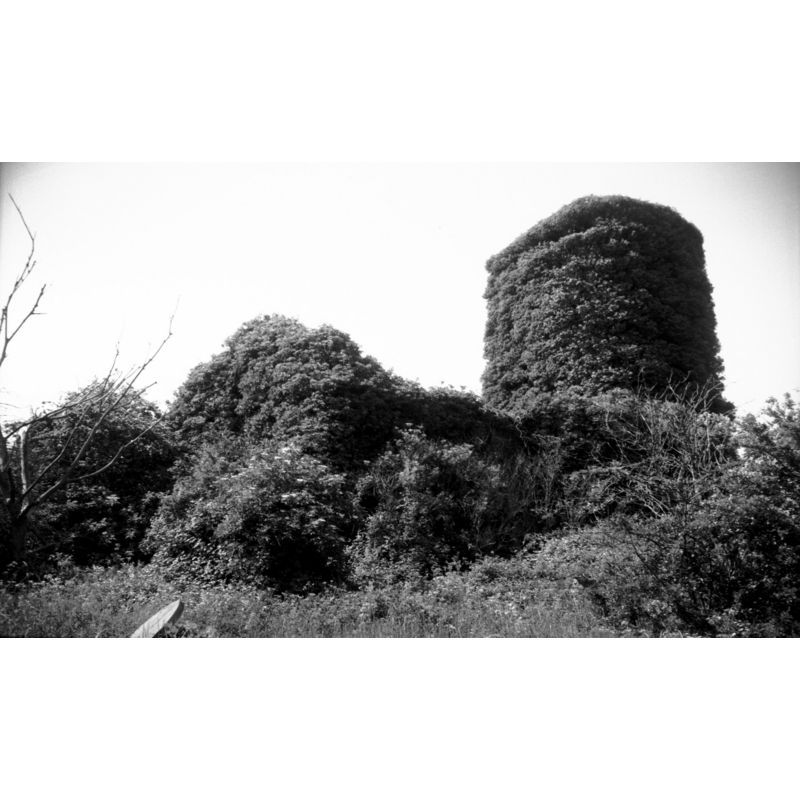
Scene Description: The ruins of St. Andrew's church in 1996-- Photo caption: "Nave and tower 15c. Abandoned in late 1940s"
Copyright Statement: Image copyright © George Plunkett, 2013
Image Source: B&W photograph taken 16 June 1996 by George Plunkett [www.georgeplunkett.co.uk/Norfolk/B/Bircham Tofts St Andrew's church ruin NE [7329] 1996-06-16.jpg] [accessed 31 March 2014]
Copyright Instructions: Standing permission from Jonathan Plunkett
INFORMATION
Font ID: 19129BIR
Object Type: Baptismal Font1?
Font Century and Period/Style: 13th century, Medieval
Church / Chapel Name: Parish Church of St. Andrew [abandoned in 1940s; in ruins]
Church Patron Saint(s): St. Andrew
Church Address: Bircham Tofts, Bircham, Norfolk PE31 6QT
Site Location: Norfolk, East Anglia, England, United Kingdom
Directions to Site: Ruins located E of Great Bircham, SE of Bircham Newton, 20 km NE of King's Lynn
Ecclesiastic Region: [Diocese of Norwich]
Historical Region: Hundred of Smethdon [Hundred of Docking?]
Additional Comments: disappeared font? (the one from the 13thC (?) church here)
Font Notes:
Click to view
There is an entry for Bircham [Tofts] in the Domesday survey [http://domesdaymap.co.uk/place/TF7732/bircham-tofts/] [accessed 31 March 2014], but it mentions neither church nor cleric in it. Blomefield (1805-1810) writes: "The Church is dedicated to St. Andrew. The rector had in the reign of Edward I. a mansion, with 14 acres of land [...] John occurs rector in the 14th of Edward I" [1272-1307]. White's Directory of 1883 describes the church: "(St. Andrew) is a small plain structure, consisting only of a nave and a square tower containing one bell, and surmounted by a small wooden spire. The entrance is now at the west end, through the tower, the old north and south doorways being walled up. There was originally a chancel, the site of which may be distinctly traced. The only window in the body of the church is an ugly round-headed one, inserted in the east wall of the nave." [NB: we have no information on its font].
Credit and Acknowledgements: We are grateful to Jonathan Plunkett for the photograph of the ruins of this church taken by his father, George Plunkett, in 1996
COORDINATES
UTM: 31U 341078 5859417
Latitude & Longitude (Decimal): 52.860983, 0.639326
Latitude & Longitude (DMS): 52° 51′ 39.54″ N, 0° 38′ 21.58″ E
REFERENCES
- Blomefield, Francis, An essay towards a topographical history of Norfolk, 1805-1810, vol. 10: 286-288 / [www.british-history.ac.uk/report.aspx?compid=78678] [accessed 31 March 2014]