Veurdre / Le Veurdre
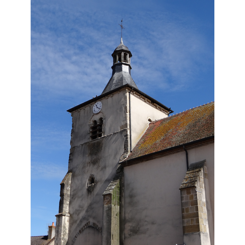
Image copyright © Wayne77, 2013
CC-BY-SA-3.0
Results: 2 records
view of church exterior - west tower
Copyright Statement: Image copyright © Wayne77, 2013
Image Source: digital photograph taken 19 April 2013 by Wayne77 [http://commons.wikimedia.org/wiki/File:Le_Veurdre_Allier-Église_Saint-Hippolyte.JPG] [accessed 9 February 2014]
Copyright Instructions: CC-BY-SA-3.0
view of church interior - nave - looking northeast
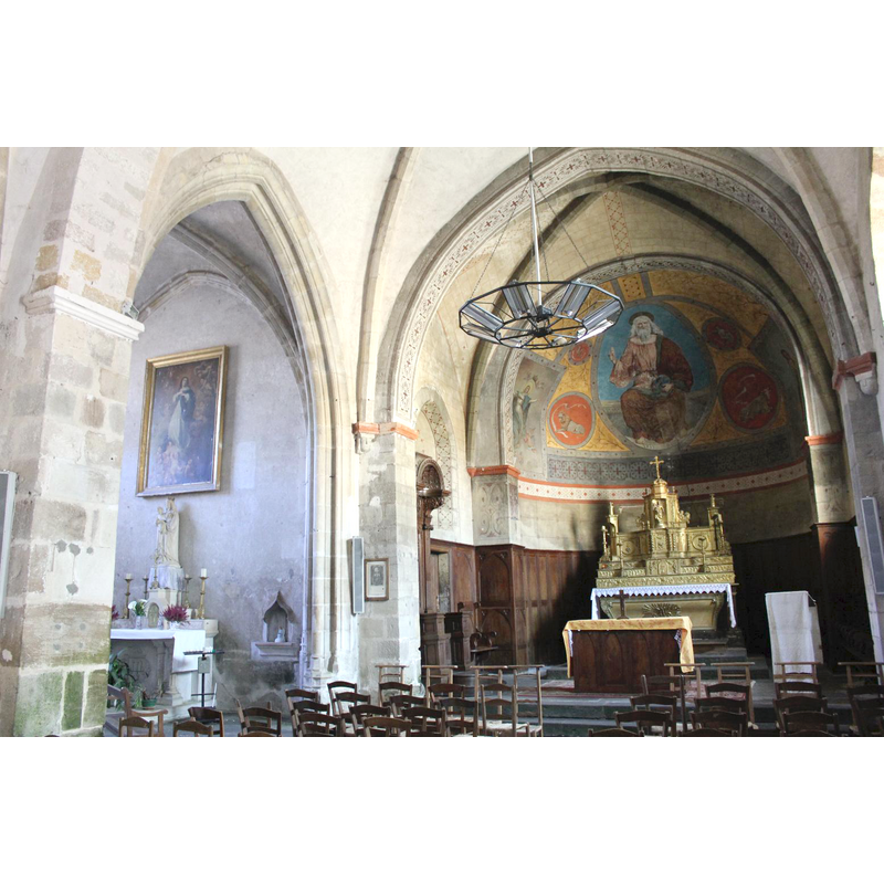
Scene Description: the end of the north aisle is visible on the left
Copyright Statement: Image copyright © Modillons58, 2011
Image Source: digital photograph taken 29 October 2011 by Modillons58 [http://commons.wikimedia.org/wiki/File:Le_Veurdre_Eglise_(3).jpg] [accessed 9 February 2014]
Copyright Instructions: CC-BY-SA-3.0
INFORMATION
Font ID: 19079VEU
Object Type: Stoup
Font Century and Period/Style: 11th - 12th century, Romanesque
Church / Chapel Name: Église paroissiale Saint-Hippolyte
Font Location in Church: [cf. FontNotes]
Church Patron Saint(s): St. Hippolytus of Rome
Church Notes: church originally 11thC
Church Address: 03320 Le Veurdre, France
Site Location: Allier, Auvergne-Rhône-Alpes, France, Europe
Directions to Site: Located at the D13-D101 crossroads, 2 km SE of Chateau-sur-Allier, 14 km ENE of Lurcy-Lévis
Ecclesiastic Region: Diocèse de Moulins
Historical Region: Pays de Lévis en bocage bourbonnais
Font Notes:
Click to view
Stoup reported in an oral presentation by Georges de Soultrait to the 21st session of the 1854 Congrès archéologique de France, as Romanesque, overall "informe" [=shapeless].
COORDINATES
UTM: 31T 503041 5178071
Latitude & Longitude (Decimal): 46.756183, 3.039815
Latitude & Longitude (DMS): 46° 45′ 22.26″ N, 3° 2′ 23.33″ E
MEDIUM AND MEASUREMENTS
Material: stone
REFERENCES
- Société française d'archéologie, Congrès archéologique de France (XXIe session, Moulins, France, 1854), Paris: Derache, 1855, p. 121