Lurcy-Levis / Lurcy-Lévis / Lurcy-le-Sauvage
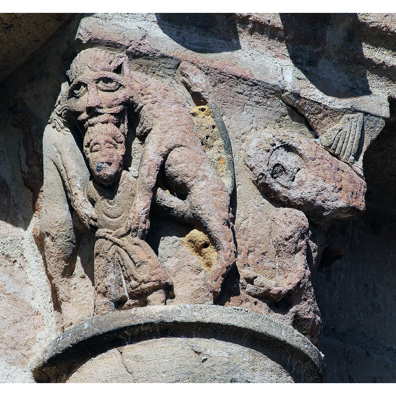
Image copyright © Modillons58, 2011
CC-BY-SA-3.0
Results: 2 records
view of church exterior - capital
Copyright Statement: Image copyright © Modillons58, 2011
Image Source: digital photograph taken 29 October 2011 by Modillons58 [http://commons.wikimedia.org/wiki/File:Lurcy_Levis_Eglise_(2).jpg] [accessed 8 February 2014]
Copyright Instructions: CC-BY-SA-3.0
view of church exterior - east view
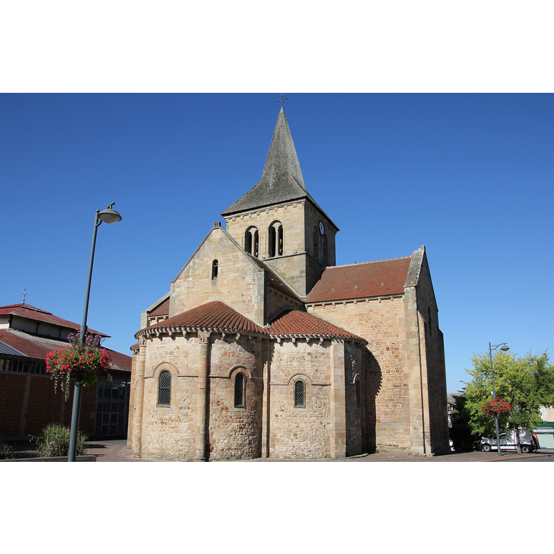
Copyright Statement: Image copyright © Modillons58, 2011
Image Source: digital photograph taken 29 October 2011 by Modillons58 [http://commons.wikimedia.org/wiki/File:Lurcy_Levis_Eglise_(1).jpg] [accessed 8 February 2014]
Copyright Instructions: CC-BY-SA-3.0
INFORMATION
Font ID: 19073LUR
Object Type: Baptismal Font1
Font Century and Period/Style: 15th - 16th century, Late Gothic
Church / Chapel Name: Église paroissiale Saint-Martin de Lurcy-Lévis
Font Location in Church: [cf. FontNotes]
Church Patron Saint(s): St. Martin of Tours
Church Notes: church originally 12thC. Listed in Mérimée [ref.: PA00093143]: "Eglise du 12e siècle, remaniée à diverses époques".
Church Address: 03320 Lurcy-Lévis, France
Site Location: Allier, Auvergne-Rhône-Alpes, France, Europe
Directions to Site: Located off the D1-D978A crossroads, NW of Moulins, near the departmental border with Cher
Ecclesiastic Region: Diocèse de Moulins
Historical Region: Pays de Lévis en bocage bourbonnais
Additional Comments: disappeared font? (the one from the 12thC church here)
Font Notes:
Click to view
Reported in an oral presentation by Georges de Soultrait to the 21st session of the 1854 Congrès archéologique de France, as one of several stone fonts of the late-15th or early-16th century in the Allier.
COORDINATES
UTM: 31T 495283 5175193
Latitude & Longitude (Decimal): 46.730276, 2.938263
Latitude & Longitude (DMS): 46° 43′ 49″ N, 2° 56′ 17.75″ E
MEDIUM AND MEASUREMENTS
Material: stone
REFERENCES
- Société française d'archéologie, Congrès archéologique de France (XXIe session, Moulins, France, 1854), Paris: Derache, 1855, p. 120