Souvigny No. 1
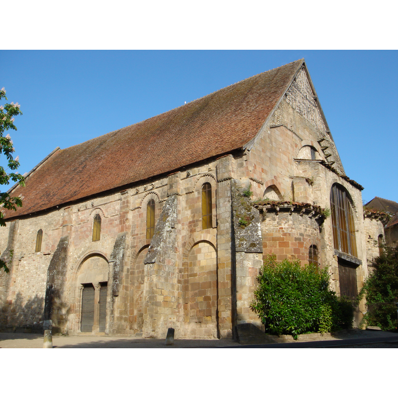
Image copyright © AccueilSouvigny, 2008
CC-BY-SA-3.0
Results: 1 records
view of church exterior - southeast view
Copyright Statement: Image copyright © AccueilSouvigny, 2008
Image Source: digital photograph taken 14 May 2008 by AccueilSouvigny [http://commons.wikimedia.org/wiki/File:Souvigny_Eglise_St_Marc.jpg] [accessed 2 February 2014]
Copyright Instructions: CC-BY-SA-3.0
INFORMATION
Font ID: 19055SOU
Object Type: Baptismal Font1
Font Century and Period/Style: 12th century, Romanesque
Church / Chapel Name: Ancienne église Saint-Marc de Souvigny
Font Location in Church: [disappeared]
Church Patron Saint(s): St. Mark
Church Notes: original church 12thC; altered in the 16thC. Listed in Mérimée [ref.: PA00093303]: "Petite église à trois nefs du 12e siècle. Au 16e siècle, la voûte en maçonnerie avec ses arcs doubleaux a été remplacée par un berceau en bois. Son abside a été détruite lors de l'élargissement de la voie publique. Pilastres cannelés et chapiteaux sculptés. Après avoir servi de lieu de culte paroissial, l'église a été utilisée comme grange ou magasin."
Church Address: 1 Cr Jean Jaurès, 03210 Souvigny, France
Site Location: Allier, Auvergne-Rhône-Alpes, France, Europe
Directions to Site: Located at the confluence of roads D73-D233-D253-D945, 12 km WSW of Moulins, 60 km S of Nevers
Ecclesiastic Region: Diocèse de Saint-Flour
Historical Region: Le Bourbonnais -- Auvergne
Additional Comments: disappeared font? (the one from the original 12thC church here)
Font Notes:
Click to view
[NB: we have no information on the font of the original 12th-century church here].
COORDINATES
UTM: 31T 514780 5153560
Latitude & Longitude (Decimal): 46.535444, 3.19275
Latitude & Longitude (DMS): 46° 32′ 7.6″ N, 3° 11′ 33.9″ E