Mont-Saint-Jean / Mont-Serein (Côte-d'Or) [disppeared?]
![Main image for Mont-Saint-Jean / Mont-Serein (Côte-d'Or) [disppeared?]](/static-50478a99ec6f36a15d6234548c59f63da52304e5/compressed/1140111008_compressed.png)
Image copyright © Christophe Finot, 2007
Reproduced under the Creative Commons Attribution-Share Alike 2.5 Generic license
Results: 3 records
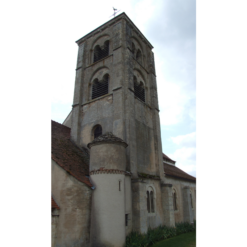
view of church exterior - tower - detail
Copyright Statement: Image copyright © Christophe Finot, 2007
Image Source: digital photograph taken 20 August 2007 by Christophe Finot [http://commons.wikimedia.org/wiki/File:Mont_Saint_Jean_-_Eglise_3.jpg] [accessed 11 January 2014]
Copyright Instructions: Reproduced under the Creative Commons Attribution-Share Alike 2.5 Generic license
view of church exterior - tower
Copyright Statement: Image copyright © Christophe Finot, 2007
Image Source: digital photograph taken 20 August 2007 by Christophe Finot [http://commons.wikimedia.org/wiki/File:Mont_Saint_Jean_-_Eglise_1.jpg] [accessed 11 January 2014]
Copyright Instructions: CC-BY-SA-3.0
view of church exterior - southwest view
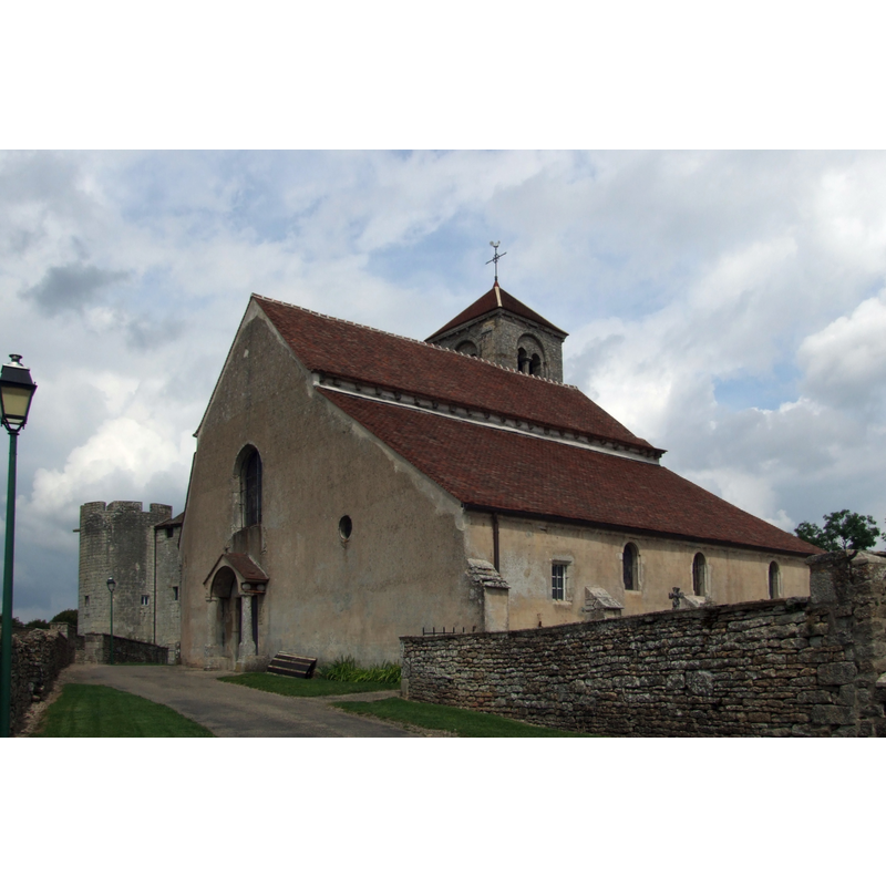
Copyright Statement: Image copyright © Christophe Finot, 2007
Image Source: digital photograph taken 20 August 2007 by Christophe Finot [http://commons.wikimedia.org/wiki/File:Mont_Saint_Jean_-_Eglise_2.jpg] [accessed 11 January 2014]
Copyright Instructions: CC-BY-SA-3.0
INFORMATION
Font ID: 18990JEA
Object Type: Baptismal Font1
Font Century and Period/Style: 12th century, Romanesque
Church / Chapel Name: Église paroissiale Saint-Jean-Baptiste
Font Location in Church: [disappeared]
Church Patron Saint(s): St. John the Baptist
Church Notes: 12thC castle chapel (chancel) and 13thC (tower); became parochial in mid-15thC; actually two consecrated chapels (Saint-Jean and Sainte-Pélagie) under one roof; became one church in 1873 under the advocation of St. John the Baptist; 12thC crypt beneath the apse -- listed in Mérimée [ref.: PA00112561]
Church Address: 21320 Mont-Saint-Jean, France -- Tel.: +03 80 84 31 22
Site Location: Côte-d'Or, Bourgogne-Franche-Comté, France, Europe
Directions to Site: Located between Montangy (N) amd Marcilly-Ogny (S)in the canton of Pouilly-en-Auxois
Ecclesiastic Region: Diocèses de Dijon et du Mans
Additional Comments: disappeared font? (the one from the original 12thC church here?)
Font Notes:
Click to view
[NB: we have no information on the font of the 12th-century church here]
COORDINATES
UTM: 31T 605812 5238352
Latitude & Longitude (Decimal): 47.2901, 4.3994
Latitude & Longitude (DMS): 47° 17′ 24.36″ N, 4° 23′ 57.84″ E