Autreppes / Altripia / Eutreppes
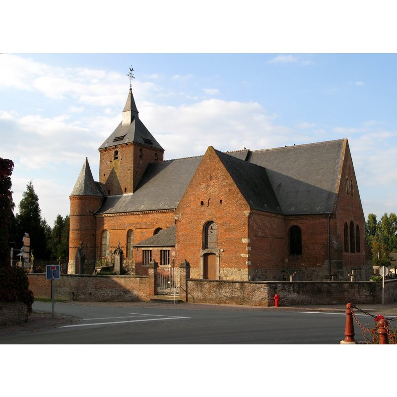
Image copyright © Markus3 (Marc Roussel), 2007
CC-BY-SA-3.0
Results: 2 records
view of church exterior - southeast view
Copyright Statement: Image copyright © Markus3 (Marc Roussel), 2007
Image Source: digital photograph taken 23 September 2007 by Markus3 (Marc Roussel) [http://commons.wikimedia.org/wiki/File:Autreppes_église_fortifiée_2.jpg] [accessed 7 January 2013]
Copyright Instructions: CC-BY-SA-3.0
view of church exterior - southwest view
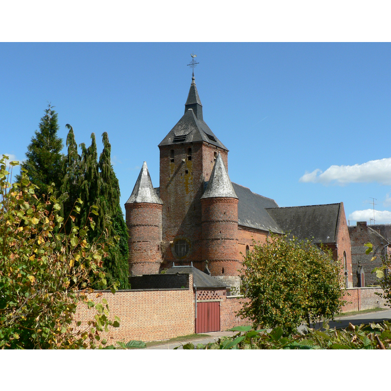
Copyright Statement: Image copyright © Patrick Clenet, 2009
Image Source: digital photograph taken 22 August 2009 by Patrick Clenet [http://commons.wikimedia.org/wiki/File:P1040115WK_Eglise_Fortifiée_d'Autreppes.JPG] [accessed 7 January 2013]
Copyright Instructions: GFDL / CC-BY-SA-3.0,2.5,2.0,1.0
INFORMATION
Font ID: 18972AUT
Object Type: Baptismal Font1
Font Century and Period/Style: 17th century
Church / Chapel Name: Église paroissiale Saint-Hilaire
Font Location in Church: Inside the church, in an alcove used as baptistery
Church Patron Saint(s): St. Hilary of Poitiers
Church Notes: church originally 15thC (?) -- listed in Mérimée [ref.: PA00115514]: "Eglise construite en 1632, ayant subi des modifications au 19e siècle."
Church Address: 02580 Autreppes, France
Site Location: Aisne, Hauts-de-France, France, Europe
Directions to Site: Located S of Erloy, N of Laigny, in the NE of the canton of Vervins
Ecclesiastic Region: Diocèse de Soissons, Laon et Saint-Quentin
Historical Region: Thiérache du centre
Font Notes:
Click to view
Stone baptismal font consisting of an octagonal basin with rounded underbowl, decorated with a moulding around it, raised on an octagonal pedestal base and an octagonal lower base. Low-dome font cove; appears modern.
COORDINATES
UTM: 31U 561407 5528408
Latitude & Longitude (Decimal): 49.904904, 3.85516
Latitude & Longitude (DMS): 49° 54′ 17.65″ N, 3° 51′ 18.58″ E
MEDIUM AND MEASUREMENTS
Material: stone
Font Shape: octagonal, mounted
Basin Interior Shape: round
Basin Exterior Shape: octagonal
LID INFORMATION
Apparatus: no
Notes: [cf. FontNotes]