Taillefontaine
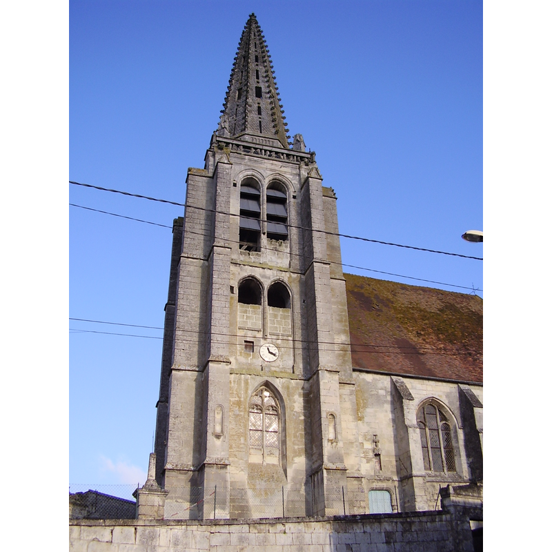
Image copyright © Emmanuel Dervaux, 2005
CC-BY-SA-3.0
Results: 2 records
view of church exterior - southwest end
Copyright Statement: Image copyright © Emmanuel Dervaux, 2005
Image Source: digital photograph taken 23 January 2005 by Emmanuel Dervaux [http://commons.wikimedia.org/wiki/File:Eglise-Taillefontaine.JPG] [accessed 4 January 2014]
Copyright Instructions: CC-BY-SA-3.0
view of font and cover
![the 18th-century font [cf. FontNotes]](/static-50478a99ec6f36a15d6234548c59f63da52304e5/others/permission_not_available.jpg)
Scene Description: the 18th-century font [cf. FontNotes]
Copyright Statement: Image copyright © Ministère de la Culture (France), Médiathèque de l'architecture et du patrimoine (objets mobiliers), 2013
Image Source: tirage photographique no. 02W00492, in Mémoire [ref.: AP02W00492]
Copyright Instructions: CC-BY-SA-NC-ND 4.0 = Licence Ouverte / CC-BY-SA-4.0
INFORMATION
Font ID: 18954TAL
Object Type: Baptismal Font1?
Font Century and Period/Style: 11th - 12th century, Romanesque
Church / Chapel Name: Église paroissiale Notre-Dame [aka Église paroissiale de L'Assomption]
Font Location in Church: [disappeared]
Church Patron Saint(s): St. Mary the Virgin [The Assumption of St. Mary]
Church Notes: early-12thC church with traces of an earlier one here -- listed in Mérimée [ref.: PA00115955]: "Eglise du début du 12e siècle, reconstruite au cours du 16e siècle en conservant le porche et quelques supports de l'église primitive. [...] 11e siècle ; 12e siècle ; 16e siècle".
Church Address: route de Compiègne, 02600 Taillefontaine, France
Site Location: Aisne, Hauts-de-France, France, Europe
Directions to Site: Located off the D973, 3-4 km SE of Retheuil, 8-9 km NNW of Villers-Cotterêts, about 22 km WSW of Soissons
Ecclesiastic Region: Diocèse de Soissons, Laon et Saint-Quentin
Additional Comments: disappeared font? (the one from the 11th-12thC church here)
Font Notes:
Click to view
The present baptismal font in this church is of 18th-century date. Listed and illustrated in Palissy [ref.: PM02001267]. [NB: we have no information on the font of the original church here].
COORDINATES
UTM: 31U 503058 5462218
Latitude & Longitude (Decimal): 49.312694, 3.042078
Latitude & Longitude (DMS): 49° 18′ 45.7″ N, 3° 2′ 31.48″ E