Clermont-Ferrand
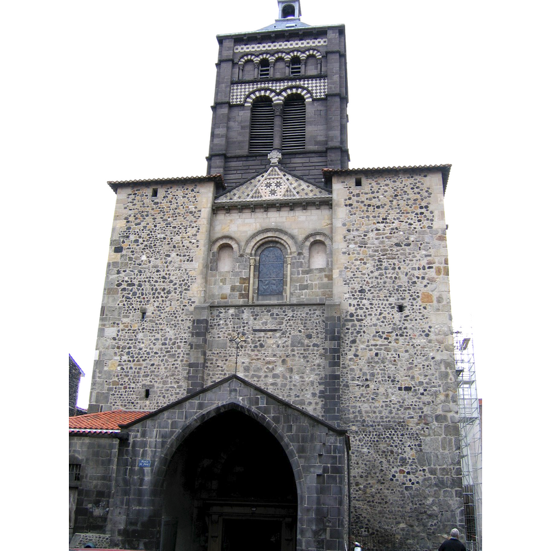
Image copyright © Mussklprozz, 2005
CC-BY-SA-3.0
Results: 3 records
view of church exterior - west façade
Copyright Statement: Image copyright © Mussklprozz, 2005
Image Source: digital photograph taken 17 September 2005 by Mussklprozz [http://commons.wikimedia.org/wiki/File:ClermontNotreDameDuPort.jpg] [accessed 29 December 2013]
Copyright Instructions: CC-BY-SA-3.0
view of church exterior - southeast end
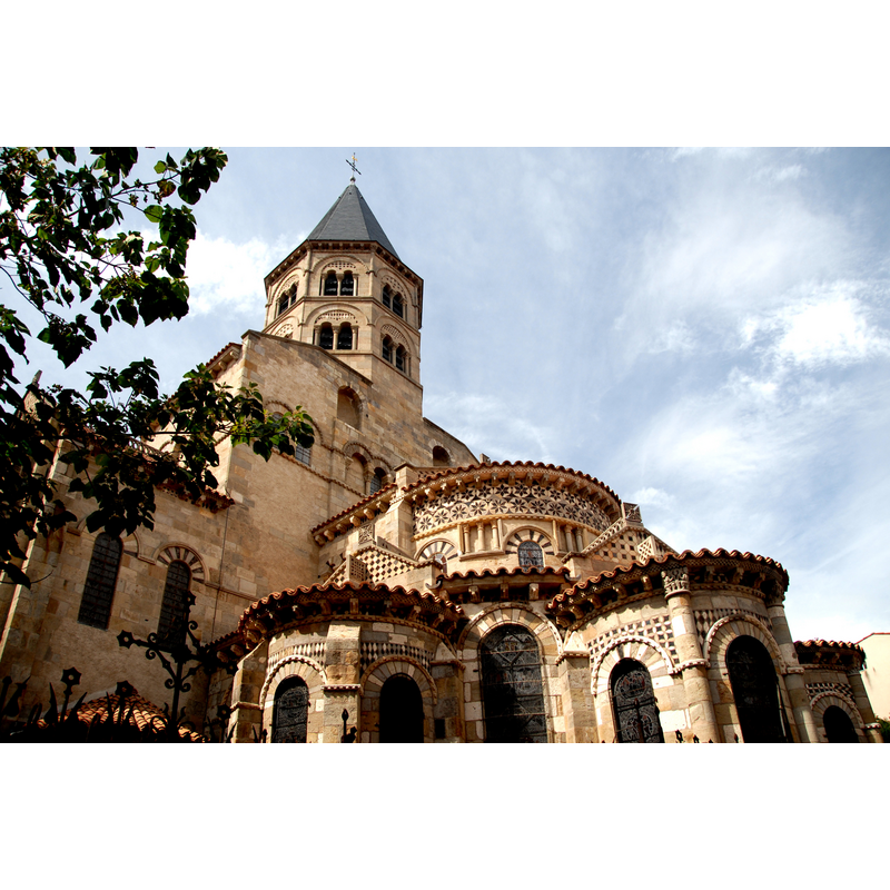
Copyright Statement: Image copyright © Jochen Jahnke, 2008
Image Source: digital photograph taken 5 September 2008 by Jochen Jahnke [http://commons.wikimedia.org/wiki/File:F08.N.-D._du_Port.0050.jpg] [accessed 29 December 2013]
Copyright Instructions: CC-BY-SA-3.0
view of church interior - crypt - wellhead

Scene Description: the 16th-century carved well-head and its metal cover, much like a font
Copyright Statement: Image copyright © Lieux Sacrés, 2013
Image Source: digital photograph in Lieux Sacrés [http://lieuxsacres.canalblog.com/archives/2011/10/19/22408002.html] [accessed 29 December 2013]
Copyright Instructions: PERMISSION NOT AVAILABLE -- IMAGE NOT FOR PUBLIC USE
INFORMATION
Font ID: 18922CLE
Object Type: Baptismal Font1?
Font Century and Period/Style: 11th - 12th century, Romanesque
Church / Chapel Name: Basilique Notre-Dame du Port [formerly Église collégiale Sainte-Marie-Principale]
Font Location in Church: [disappeared]
Church Patron Saint(s): St. Mary the Virgin
Church Notes: original church here said to have been founded in the 6thC; burnt by the Normans; re-built in the 11th-12thC
Church Address: Rue Notre Dame du Port, 63000 Clermont-Ferrand, France -- Tel.: +33 4 73 29 29 73
Site Location: Puy-de-Dôme, Auvergne-Rhône-Alpes, France, Europe
Directions to Site: Located in the Port quarter of Clermont-Ferrand, between Place Delille and the cathedral
Ecclesiastic Region: Diocèse de Clermont-Ferrand
Additional Comments: disappeared font? (we have no information on the baptismal font of the Romanesque church here)
Font Notes:
Click to view
[NB: we have no information on the baptismal font of the Romanesque church here]. The baptismal chapel altar and retable are 17th-century and listed.
COORDINATES
UTM: 31T 506953 5069686
Latitude & Longitude (Decimal): 45.780694, 3.089444
Latitude & Longitude (DMS): 45° 46′ 50.5″ N, 3° 5′ 22″ E