Saint-Romain-d'Albon / Albon
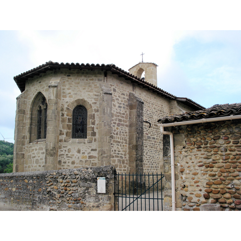
Image copyright © Gachepi, 2008
CC-BY-SA-3.0
Results: 2 records
view of church exterior - northeast end
Copyright Statement: Image copyright © Gachepi, 2008
Image Source: digital photograph taken 19 May 2008 by Gachepi [http://commons.wikimedia.org/wiki/File:St_Philibert_d'Albon_chapelle.JPG] [accessed 28 December 2013]
Copyright Instructions: CC-BY-SA-3.0
view of church exterior - southwest end
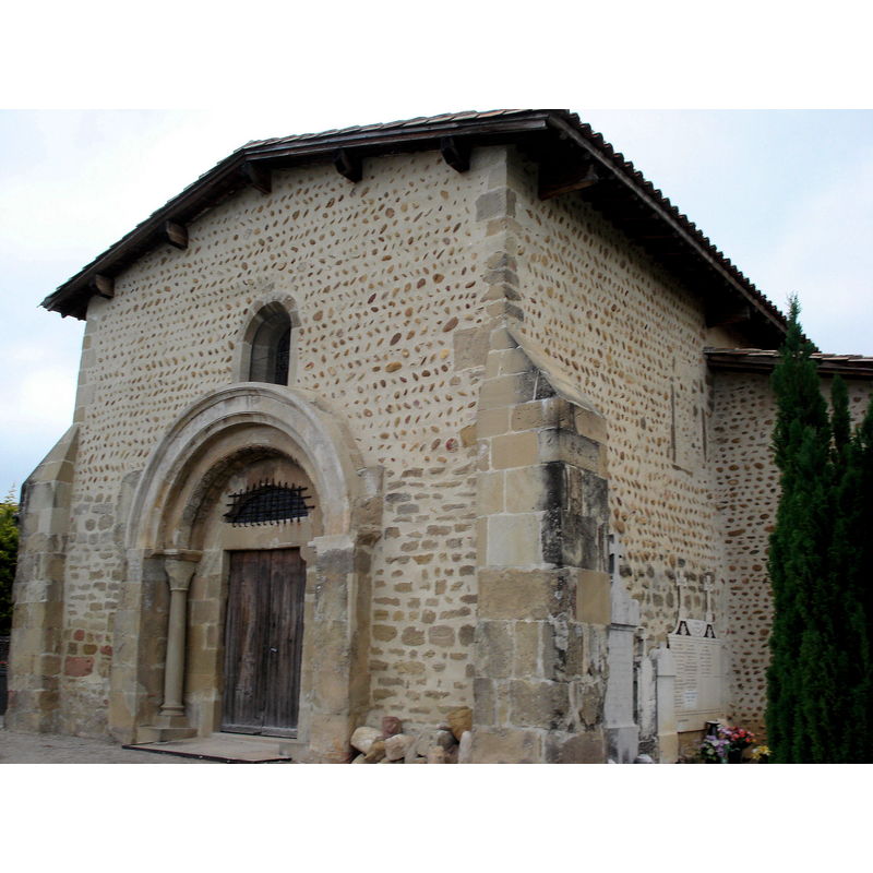
Copyright Statement: Image copyright © Gachepi, 2008
Image Source: digital photograph taken 19 May 2008 by Gachepi http://commons.wikimedia.org/wiki/File:St_Philibert_d'Albon_2.JPg] [accessed 28 December 2013]
Copyright Instructions: CC-BY-SA-3.0
INFORMATION
Font ID: 18920ALB
Object Type: Baptismal Font1?
Font Century and Period/Style: 11th - 12th century, Romanesque
Church / Chapel Name: Église Saint-Philibert d'Albon
Font Location in Church: [disappeared]
Church Patron Saint(s): St. Philibert
Church Notes: church and priory of St. Philibert built here in the 11thC by monks from the Abbaye de Tournus; enlarged in 1230; taken over by secular clergy in the 13thC; re-built in the 17thC
Church Address: rue du Dauphiné [RN7], 26140 Albon, France
Site Location: Drôme, Auvergne-Rhône-Alpes, France, Europe
Directions to Site: Located off the A7/E15, in the municipality and 4-5 km S of Albon, 40 km S of Vienne, about 55 N of Valence
Ecclesiastic Region: Diocèse de Vienne
Historical Region: Rhône-Valloire -- Dauphiné
Additional Comments: disappeared font? (the one from the 11thC church here)
Font Notes:
Click to view
[NB: we have no information on the font of the original 11th-century church here].
COORDINATES
UTM: 31T 646015 5009179
Latitude & Longitude (Decimal): 45.220957, 4.859783
Latitude & Longitude (DMS): 45° 13' 15.22", 4° 51' 35.35" E