Romans-sur-Isere No. 1 / Romans-sur-Isère / Rumans d'Isèra
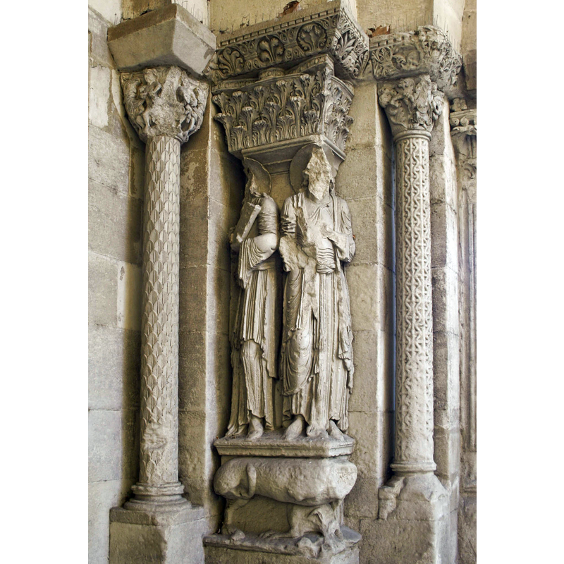
Image copyright © Morburre, 2009
CC-BY-SA-3.0
Results: 5 records
view of church exterior - west portal - detail
Copyright Statement: Image copyright © Morburre, 2009
Image Source: digital photograph taken 29 August 2009 by Morburre [http://commons.wikimedia.org/wiki/File:PortailStBarnard-Romans.jpg] [accessed 27 December 2013]
Copyright Instructions: CC-BY-SA-3.0
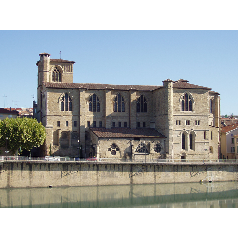
view of church exterior - south view
Copyright Statement: Image copyright © Fifistorien, 2006
Image Source: digital photograph taken 4 September 2006 by Fifistorien [http://commons.wikimedia.org/wiki/File:La_collégiale_Saint-Barnard_de_Romans-sur-Isère_(Drôme).JPG] [accessed 27 December 2013]
Copyright Instructions: CC-BY-SA-3.0
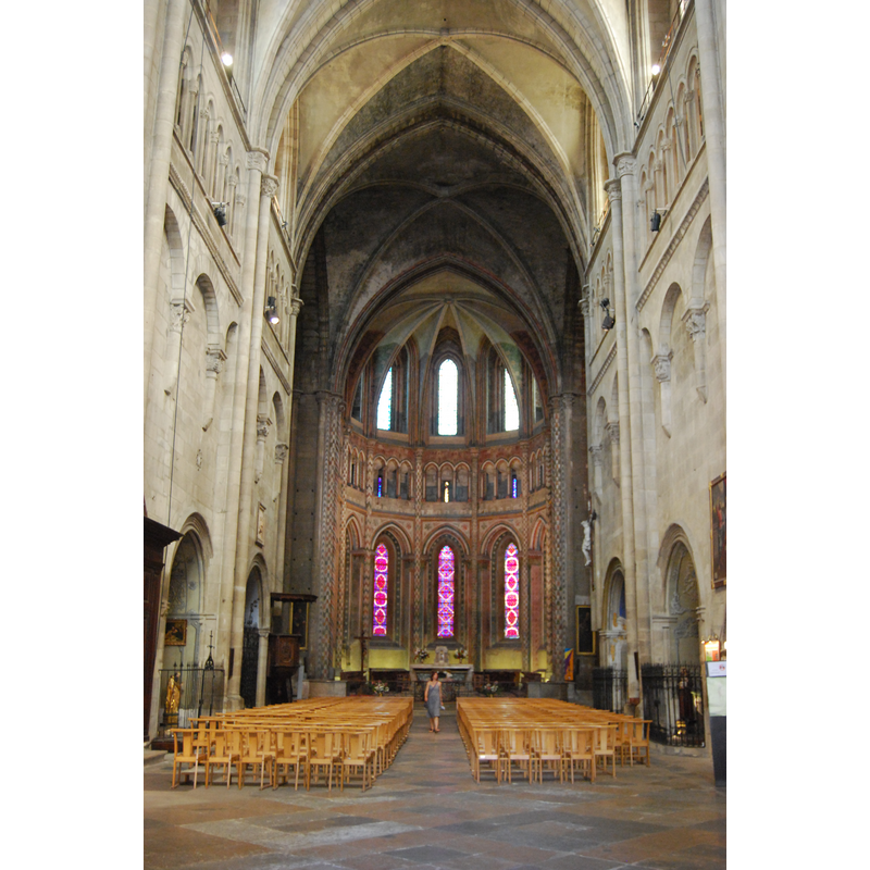
view of church interior - nave - looking east
Copyright Statement: Image copyright © Kvardek du, 2011
Image Source: digital photograph taken 8 August 2011 by Kvardek du [http://commons.wikimedia.org/wiki/File:Intérieur_église_Romans.jpg] [accessed 27 December 2013]
Copyright Instructions: CC-BY-SA-3.0
view of church interior - nave - northwest corner
Scene Description: some of the 12th-century remains below the triforium
Copyright Statement: Image copyright © Morburre, 2009
Image Source: digital photograph taken 29 August 2009 by Morburre [http://commons.wikimedia.org/wiki/File:StBarnard-Romans-nef.jpg] [accessed 27 December 2013]
Copyright Instructions: CC-BY-SA-3.0
view of font

Copyright Statement: Image copyright © [in the public domain]
Image Source: Tirage photographique no. 26W00753 in Mémoire [AP38W00753] [accessed 27 December 2013]
Copyright Instructions: PERMISSION NOT AVAILABLE -- IMAGE NOT FOR PUBLIC USE
INFORMATION
Font ID: 18915ROM
Object Type: Baptismal Font1
Font Century and Period/Style: 12th century [composite font], Medieval / composite
Church / Chapel Name: Église Saint-Barnard / Ancienne collégiale Saint-Barnard de Romans-sur-Isère
Font Location in Church: Inside the church
Church Patron Saint(s): St. Barnard de Romans [aka Barnard de Vienne] [dedicated to St. Peter & St. Paul until the 13thC]
Church Notes: Benedictine abbey dedicated to St. Peter and St. Paul founded by Barnard de Romans [aka Barnard de Vienne] in 838 -- Listed in Mérimée [ref.: PA00117029]: " En 838, fondation d'un monastère par l'archevêque de Vienne. L'église, édifiée en mémoire de martyrs viennois, est placée sous le vocable de Saint-Paul et Saint-Pierre. Entre 932 et 939, des chanoines s'y installent et développent le culte des reliques de Saint-Barnard qui donne lieu à un pèlerinage. En 1049, un cloître est adossé à l'église (détruit en 1857). En 1134, l'église est rebâtie suite à un incendie. De cette reconstruction datent les parties romanes. La deuxième grande phase de construction débute en 1238. L'église est couverte de voûtes sur croisées d'ogives et le triforium est surmonté d'une coursière. Le sac que connaît l'église en 1280 entraîne la destruction d'un clocher-porche situé sur la façade occidentale. La construction du clocher rectangulaire actuel daterait de cette disparition. Une salle capitulaire est édifiée au 14ème siècle puis aggrandie avant 1440 par deux chapelles (détruite en 1870). L'église est endommagée au cours des guerres de Religion. Des restaurations sont entreprises entre 1574 et 1718."
Church Address: 3 Pl. Maurice Faure / Imp. Saint-Barnard, 26100 Romans-sur-Isère, France -- Tel.: +33 4 75 02 23 84
Site Location: Drôme, Auvergne-Rhône-Alpes, France, Europe
Directions to Site: Located off the D2532N, on the N bank of the Isère river, 20 km NE of Valence
Ecclesiastic Region: Diocèse de Valence
Historical Region: Pays de Romans -- Dauphiné
Additional Comments: composite font [cf. FontNotes]
Font Notes:
Click to view
The font here is clearly a composite object put together with pieces originally not intended to form a font: the basin proper has a polygonal (12 sides? 16?) with a round tapering lower half; inserted into its inner well is a much later basin with a lip moulding; the base is probably a former capital of the old church here, carved with what appear to be squatting figures all around. Listed and illustrated in Palissy [ref.: PM26000239]: "Cuve polygonale et socle de chapiteau. [...] 12e siècle".
COORDINATES
UTM: 31T 661417 4989715
Latitude & Longitude (Decimal): 45.0425, 5.049167
Latitude & Longitude (DMS): 45° 2′ 33″ N, 5° 2′ 57″ E