Bochum No. 3 / Baukem / Cofbuokheim
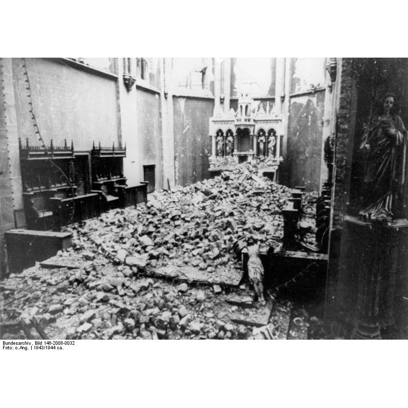
Image copyright © Bundesarchiv, 2013
CC-BY-SA-3.0
Results: 1 records
view of church interior - nave - looking east
Scene Description: 1943. The ruins of St. Marien church in Bochum. The interior of St. Marien church, destroyed by bombing
Copyright Statement: Image copyright © Bundesarchiv, 2013
Image Source: from an original B&W negative at the Bundesarchiv Bild 146-2008-0032, Bochum, Zerstörte St. Marien Kirche.jpg] [accessed 18 December 2013]
Copyright Instructions: CC-BY-SA-3.0
INFORMATION
Font ID: 18878BOC
Object Type: Baptismal Font1?
Font Century and Period/Style: 19th century (late?), Modern
Church / Chapel Name: St. Marien Kirche [church closed and deconsecrated in 2002; scheduled for demolition]
Font Location in Church: [destroyed]
Church Patron Saint(s): St. Mary the Virgin
Church Notes: church closed and deconsecrated in 2002; scheduled for demolition but was instead incorporated in the building of the Anneliese Brost Music Forum Ruhr on Marienplatz next to the church, as a venue for the Bochum Symphony Orchestra , among others . [ 3 ] In the design by the Stuttgart-based firm Bez+Kock Architekten, the deconsecrated St. Mary's Church was incorporated as a foyer between the two halls (concert hall and small hall) of the music center, which opened in October 2016. [ 4 ] The main entrance to the Music Forum is via the south and north sides of the choir on Viktoriastraße [source: Wikipedia [https://de.wikipedia.org/wiki/St.-Marien-Kirche_(Bochum)] [accessed 20 September 2025]]
Church Address: Marienplatz, 44787 Bochum, Germany
Site Location: Arnsberg, Nordhein-Westfalen, Germany, Europe
Directions to Site: Located just outeside the ringroad 226, in Bochum-Mitte, SW off the city centre -- the church is located off Marienplatz, at Humboldtstrasse
Ecclesiastic Region: Bistum Essen
Historical Region: Ruhrhöhen -- Ruhrgebiet -- Preußen
Additional Comments: destroyed font? (in the 1943 WWII bombing)
Font Notes:
Click to view
[NB: we have no information on this font; probably destroyed in 1944]
COORDINATES
UTM: 32U 376036 5704434
Latitude & Longitude (Decimal): 51.477461, 7.214917
Latitude & Longitude (DMS): 51° 28′ 38.86″ N, 7° 12′ 53.7″ E